
Articles | Volume 13, issue 6
https://doi.org/10.5194/gmd-13-2611-2020
© Author(s) 2020. This work is distributed under
the Creative Commons Attribution 4.0 License.
the Creative Commons Attribution 4.0 License.
https://doi.org/10.5194/gmd-13-2611-2020
© Author(s) 2020. This work is distributed under
the Creative Commons Attribution 4.0 License.
the Creative Commons Attribution 4.0 License.
Model description paper
| 
08 Jun 2020
Model description paper |
| 08 Jun 2020
| 08 Jun 2020
QuickSampling v1.0: a robust and simplified pixel-based multiple-point simulation approach
University of Lausanne, Faculty of Geosciences and Environment,
Institute of Earth Surface Dynamics, Lausanne, Switzerland
Grégoire Mariethoz
University of Lausanne, Faculty of Geosciences and Environment,
Institute of Earth Surface Dynamics, Lausanne, Switzerland
Related authors
Mathieu Gravey and Grégoire Mariethoz
Geosci. Model Dev., 16, 5265–5279, https://doi.org/10.5194/gmd-16-5265-2023, https://doi.org/10.5194/gmd-16-5265-2023, 2023
Short summary
Short summary
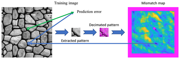
Multiple‐point geostatistics are widely used to simulate complex spatial structures based on a training image. The use of these methods relies on the possibility of finding optimal training images and parametrization of the simulation algorithms. Here, we propose finding an optimal set of parameters using only the training image as input. The main advantage of our approach is to remove the risk of overfitting an objective function.
Fatemeh Zakeri, Gregoire Mariethoz, and Manuela Girotto
Hydrol. Earth Syst. Sci., 29, 6935–6958, https://doi.org/10.5194/hess-29-6935-2025, https://doi.org/10.5194/hess-29-6935-2025, 2025
Short summary
Short summary
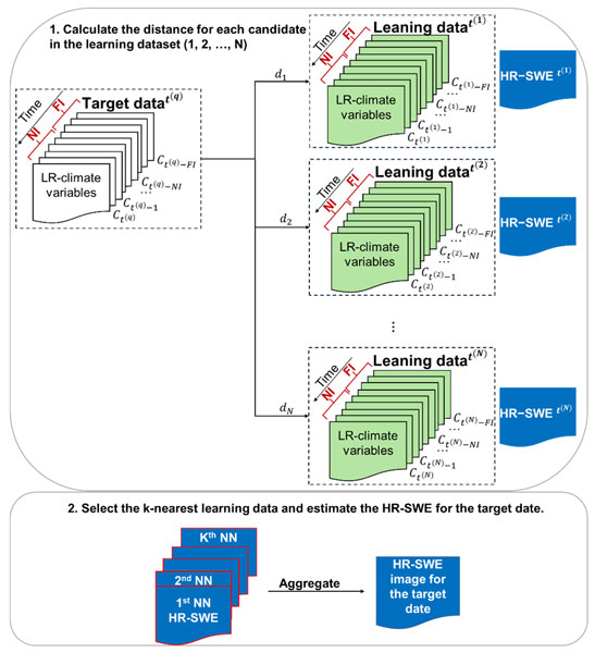
Our study presents a method to estimate high-resolution snow water equivalent (HR-SWE) using low-resolution climate data (LR-CD). By using a data-driven approach, we analyze historical weather patterns from LR-CD to generate HR-SWE maps. Machine learning and statistical relationships between LR-CD and HR-SWE enable estimation for dates without HR-SWE data. This method enhances water resource management and climate impact assessments, especially in data-scarce regions.
Pau Wiersma, Jan Magnusson, Nadav Peleg, Bettina Schaefli, and Grégoire Mariéthoz
EGUsphere, https://doi.org/10.5194/egusphere-2025-3610, https://doi.org/10.5194/egusphere-2025-3610, 2025
Short summary
Short summary
Using a newly introduced inverse hydrological modeling framework, we demonstrate that streamflow observations have the potential to improve snow mass reconstructions, but that non-uniqueness in the snow-streamflow relationship and uncertainties in the inverse modeling chain can easily stand in the way. We also show that streamflow is most helpful in estimating catchment-aggregated properties of snow mass reconstructions, in particular catchment-aggregated melt rates.
Mathieu Vrac, Denis Allard, Grégoire Mariéthoz, Soulivanh Thao, and Lucas Schmutz
Earth Syst. Dynam., 15, 735–762, https://doi.org/10.5194/esd-15-735-2024, https://doi.org/10.5194/esd-15-735-2024, 2024
Short summary
Short summary
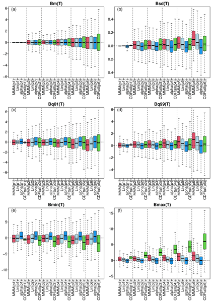
We aim to combine multiple global climate models (GCMs) to enhance the robustness of future projections. We introduce a novel approach, called "α pooling", aggregating the cumulative distribution functions (CDFs) of the models into a CDF more aligned with historical data. The new CDFs allow us to perform bias adjustment of all the raw climate simulations at once. Experiments with European temperature and precipitation demonstrate the superiority of this approach over conventional techniques.
Moctar Dembélé, Mathieu Vrac, Natalie Ceperley, Sander J. Zwart, Josh Larsen, Simon J. Dadson, Grégoire Mariéthoz, and Bettina Schaefli
Proc. IAHS, 385, 121–127, https://doi.org/10.5194/piahs-385-121-2024, https://doi.org/10.5194/piahs-385-121-2024, 2024
Short summary
Short summary
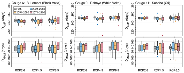
This study assesses the impact of climate change on the timing, seasonality and magnitude of mean annual minimum (MAM) flows and annual maximum flows (AMF) in the Volta River basin (VRB). Several climate change projection data are use to simulate river flow under multiple greenhouse gas emission scenarios. Future projections show that AMF could increase with various magnitude but negligible shift in time across the VRB, while MAM could decrease with up to 14 days of delay in occurrence.
Fabio Oriani, Gregoire Mariethoz, and Manuel Chevalier
Earth Syst. Sci. Data, 16, 731–742, https://doi.org/10.5194/essd-16-731-2024, https://doi.org/10.5194/essd-16-731-2024, 2024
Short summary
Short summary
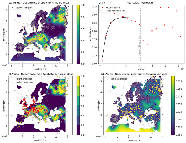
Modern and fossil pollen data contain precious information for reconstructing the climate and environment of the past. However, these data are only achieved for single locations with no continuity in space. We present here a systematic atlas of 194 digital maps containing the spatial estimation of contemporary pollen presence over Europe. This dataset constitutes a free and ready-to-use tool to study climate, biodiversity, and environment in time and space.
Mathieu Gravey and Grégoire Mariethoz
Geosci. Model Dev., 16, 5265–5279, https://doi.org/10.5194/gmd-16-5265-2023, https://doi.org/10.5194/gmd-16-5265-2023, 2023
Short summary
Short summary
Multiple‐point geostatistics are widely used to simulate complex spatial structures based on a training image. The use of these methods relies on the possibility of finding optimal training images and parametrization of the simulation algorithms. Here, we propose finding an optimal set of parameters using only the training image as input. The main advantage of our approach is to remove the risk of overfitting an objective function.

Nadav Peleg, Herminia Torelló-Sentelles, Grégoire Mariéthoz, Lionel Benoit, João P. Leitão, and Francesco Marra
Nat. Hazards Earth Syst. Sci., 23, 1233–1240, https://doi.org/10.5194/nhess-23-1233-2023, https://doi.org/10.5194/nhess-23-1233-2023, 2023
Short summary
Short summary
Floods in urban areas are one of the most common natural hazards. Due to climate change enhancing extreme rainfall and cities becoming larger and denser, the impacts of these events are expected to increase. A fast and reliable flood warning system should thus be implemented in flood-prone cities to warn the public of upcoming floods. The purpose of this brief communication is to discuss the potential implementation of low-cost acoustic rainfall sensors in short-term flood warning systems.
Moctar Dembélé, Mathieu Vrac, Natalie Ceperley, Sander J. Zwart, Josh Larsen, Simon J. Dadson, Grégoire Mariéthoz, and Bettina Schaefli
Hydrol. Earth Syst. Sci., 26, 1481–1506, https://doi.org/10.5194/hess-26-1481-2022, https://doi.org/10.5194/hess-26-1481-2022, 2022
Short summary
Short summary
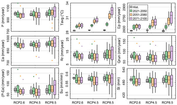
Climate change impacts on water resources in the Volta River basin are investigated under various global warming scenarios. Results reveal contrasting changes in future hydrological processes and water availability, depending on greenhouse gas emission scenarios, with implications for floods and drought occurrence over the 21st century. These findings provide insights for the elaboration of regional adaptation and mitigation strategies for climate change.
Zhenjiao Jiang, Dirk Mallants, Lei Gao, Tim Munday, Gregoire Mariethoz, and Luk Peeters
Geosci. Model Dev., 14, 3421–3435, https://doi.org/10.5194/gmd-14-3421-2021, https://doi.org/10.5194/gmd-14-3421-2021, 2021
Short summary
Short summary
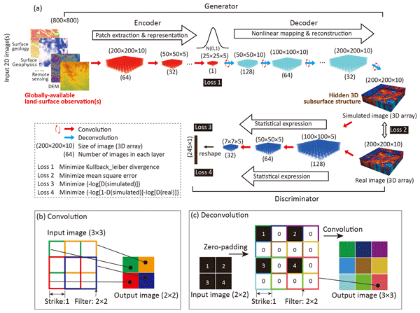
Fast and reliable tools are required to extract hidden information from big geophysical and remote sensing data. A deep-learning model in 3D image construction from 2D image(s) is here developed for paleovalley mapping from globally available digital elevation data. The outstanding performance for 3D subsurface imaging gives confidence that this generic novel tool will make better use of existing geophysical and remote sensing data for improved management of limited earth resources.
Cited articles
Arpat, G. B. and Caers, J.: Conditional Simulation with Patterns,
Mathe. Geol., 39, 177–203, https://doi.org/10.1007/s11004-006-9075-3, 2007.
Bancheri, M., Serafin, F., Bottazzi, M., Abera, W., Formetta, G., and Rigon, R.: The design, deployment, and testing of kriging models in GEOframe with SIK-0.9.8, Geosci. Model Dev., 11, 2189–2207, https://doi.org/10.5194/gmd-11-2189-2018, 2018.
Baninajar, E., Sharghi, Y., and Mariethoz, G.: MPS-APO: a rapid and
automatic parameter optimizer for multiple-point geostatistics, Stoch.
Environ. Res. Risk Assess., 33, 1969–1989, https://doi.org/10.1007/s00477-019-01742-7,
2019
Barfod, A. A. S., Vilhelmsen, T. N., Jørgensen, F., Christiansen, A. V., Høyer, A.-S., Straubhaar, J., and Møller, I.: Contributions to uncertainty related to hydrostratigraphic modeling using multiple-point statistics, Hydrol. Earth Syst. Sci., 22, 5485–5508, https://doi.org/10.5194/hess-22-5485-2018, 2018.
Blagodurov, S., Fedorova, A., Zhuravlev, S., and Kamali, A.: A case for
NUMA-aware contention management on multicore systems, in: 2010 19th
International Conference on Parallel Architectures and Compilation
Techniques (PACT), 11–15 Sept,
Vienna, Austria, 557–558, IEEE, 2010.
Bracewell, R. N.: The fourier transform and its applications, Boston,
McGraw-hill, 2000.
Cooley, J. W. and Tukey, J. W.: An algorithm for the machine
calculation of complex Fourier series, Mathe. Comput., 19, 297,
https://doi.org/10.2307/2003354, 1965.
Dimitrakopoulos, R., Mustapha, H., and Gloaguen, E.: High-order Statistics
of Spatial Random Fields: Exploring Spatial Cumulants for Modeling Complex
Non-Gaussian and Non-linear Phenomena, Math. Geosci., 42, 65, https://doi.org/10.1007/s11004-009-9258-9, 2010.
Frigo, M. and Johnson, S. G.: FFTW, available at:
http://www.fftw.org/fftw3.pdf (last access: 19 May 2020), 2018.
Gauss, C. F.: Demonstratio nova theorematis omnem functionem algebraicam rationalem integram, Helmstadii: apud C. G. Fleckeisen, https://doi.org/10.3931/e-rara-4271, 1799.
Gómez-Hernández, J. J. and Journel, A. G.: Joint Sequential
Simulation of MultiGaussian Fields, in: Geostatistics Tróia '92, Vol. 5,
85–94, Springer, Dordrecht, 1993.
Graeler, B., Pebesma, E., and Heuvelink, G.: Spatio-Temporal Interpolation
using gstat, R J., 8, 204–218, 2016.
Gravey, M., Rasera, L. G., and Mariethoz, G.: Analogue-based colorization of
remote sensing images using textural information, ISPRS J.
Photogram. Remote Sens., 147, 242–254,
https://doi.org/10.1016/j.isprsjprs.2018.11.003, 2019.
Guardiano, F. B. and Srivastava, R. M.: Multivariate Geostatistics: Beyond
Bivariate Moments, in: Geostatistics Tróia '92, Vol. 5, 133–144,
Springer, Dordrecht, 1993.
Hamming, R. W.: Error detecting and error correcting codes, edited by: The
Bell system technical, The Bell ystem technical, 29, 147–160,
https://doi.org/10.1002/j.1538-7305.1950.tb00463.x, 1950.
Hoffimann, J., Scheidt, C., Barfod, A., and Caers, J.: Stochastic simulation
by image quilting of process-based geological models, Elsevier,
https://doi.org/10.1016/j.cageo.2017.05.012, 2017.
Honarkhah, M. and Caers, J.: Stochastic Simulation of Patterns Using
Distance-Based Pattern Modeling, Math. Geosci., 42, 487–517,
https://doi.org/10.1007/s11004-010-9276-7, 2010.
Intel Corporation: Intel_Math Kernel Library Reference Manual
– C, 1–2606, 2019.
Jha, S. K., Mariethoz, G., Evans, J., McCabe, M. F., and Sharma, A.: A space
and time scale-dependent nonlinear geostatistical approach for downscaling
daily precipitation and temperature, Water Resour. Res., 51,
6244–6261, https://doi.org/10.1002/2014WR016729, 2015.
Shen, J. P. and Lipasti, M., H.: Modern Processor Design: Fundamentals of Superscalar Processors, Waveland Press, 2013.
Krantz, S. G.: A panorama of harmonic analysis, Washington, D.C.,
Mathematical Association of America, 1999
Latombe, G., Burke, A., Vrac, M., Levavasseur, G., Dumas, C., Kageyama, M., and Ramstein, G.: Comparison of spatial downscaling methods of general circulation model results to study climate variability during the Last Glacial Maximum, Geosci. Model Dev., 11, 2563–2579, https://doi.org/10.5194/gmd-11-2563-2018, 2018.
Li, B. and Babu, G. J.: A graduate course on statistical inference, New
York, Springer, 2019
Li, J. and Heap, A. D.: Spatial interpolation methods applied in the
environmental sciences: A review, Environ. Model Softw., 53, 173–189,
https://doi.org/10.1016/j.envsoft.2013.12.008, 2014.
Li, X., Mariethoz, G., Lu, D., and Linde, N.: Patch-based iterative
conditional geostatistical simulation using graph cuts, Water Resour.
Res., 52, 6297–6320, https://doi.org/10.1002/2015WR018378, 2016.
Mahmud, K., Mariethoz, G., Caers, J., Tahmasebi, P., and Baker, A.:
Simulation of Earth textures by conditional image quilting, Water Resour.
Res., 50, 3088–3107, https://doi.org/10.1002/2013WR015069, 2014.
Mariethoz, G.: A general parallelization strategy for random path based
geostatistical simulation methods, Comput. Geosci., 36,
953–958, https://doi.org/10.1016/j.cageo.2009.11.001, 2010.
Mariethoz, G. and Caers, J.: Multiple-point geostatistics: stochastic
modeling with training images, Wiley, 2014.
Mariethoz, G. and Kelly, B. F. J.: Modeling complex geological structures
with elementary training images and transform-invariant distances, Water
Resour. Res., 47, W07527, https://doi.org/10.1029/2011WR010412, 2011.
Mariethoz, G. and Lefebvre, S.: Bridges between multiple-point geostatistics
and texture synthesis_Review and guidelines for future
research, Comput. Geosci., 66, 66–80,
https://doi.org/10.1016/j.cageo.2014.01.001, 2014.
Mariethoz, G., Renard, P., and Straubhaar, J.: The Direct Sampling method to
perform multiple-point geostatistical simulations, Water Resour. Res.,
46, W11536, https://doi.org/10.1029/2008WR007621, 2010.
Matheron, G.: The intrinsic random functions and their applications,
Adv. Appl. Prob., 5, 439–468, https://doi.org/10.2307/1425829, 1973.
Meerschman, E., Pirot, G., Mariethoz, G., Straubhaar, J., Van Meirvenne, M.,
and Renard, P.: A practical guide to performing multiple-point statistical
simulations with the Direct Sampling algorithm, Comput. Geosci.,
52, 307–324, https://doi.org/10.1016/j.cageo.2012.09.019, 2013.
Oriani, F., Ohana-Levi, N., Marra, F., Straubhaar, J., Mariethoz, G.,
Renard, P., Karnieli, A., and Morin, E.: Simulating Small-Scale Rainfall
Fields Conditioned by Weather State and Elevation: A Data-Driven Approach
Based on Rainfall Radar Images, Water Resour. Res., 15, 265,
https://doi.org/10.1002/2017WR020876, 2017.
Rasera, L. G., Gravey, M., Lane, S. N., and Mariethoz, G.: Downscaling images with
trends using multiple-point statistics simulation: An application to digital
elevation models, Mathe. Geosci., 52, 145–187,
https://doi.org/10.1007/s11004-019-09818-4, 2020.
Renard, P. and Allard, D.: Connectivity metrics for subsurface flow and
transport, Adv. Water Resour., 51, 168–196,
https://doi.org/10.1016/j.advwatres.2011.12.001, 2013.
Rodríguez, P. V.: “A radix-2 FFT algorithm for Modern Single Instruction Multiple Data (SIMD) architectures,” 2002 IEEE International Conference on Acoustics, Speech, and Signal Processing, Orlando, FL, III-3220-III-3223, https://doi.org/10.1109/ICASSP.2002.5745335, 2020.
Shannon: A mathematical theory of communication, Wiley Online Library, 1948.
Straubhaar, J., Renard, P., Mariethoz, G., Froidevaux, R., and Besson, O.: An
Improved Parallel Multiple-point Algorithm Using a List Approach, Math.
Geosci., 43, 305–328, https://doi.org/10.1007/s11004-011-9328-7, 2011.
Strebelle, S.: Conditional simulation of complex geological structures using
multiple-point statistics, Mathe. Geol., 34, 1–21,
https://doi.org/10.1023/A:1014009426274, 2002.
Strebelle, S., Payrazyan, K., and Caers, J.: Modeling of a Deepwater
Turbidite Reservoir Conditional to Seismic Data Using Multiple-Point
Geostatistics, Society of Petroleum Engineers, 2002.
Stockham Jr., T. G.: High-speed convolution and correlation, Proceedings of
the 26–28 April 1966, Spring Joint Computer Conference on XX – AFIPS '66
(Spring), Presented at the the 26–28 April 1966, Spring joint computer
conference, https://doi.org/10.1145/1464182.1464209, 1966.
Tadić, J. M., Qiu, X., Yadav, V., and Michalak, A. M.: Mapping of satellite Earth observations using moving window block kriging, Geosci. Model Dev., 8, 3311–3319, https://doi.org/10.5194/gmd-8-3311-2015, 2015.
Tadić, J. M., Qiu, X., Miller, S., and Michalak, A. M.: Spatio-temporal approach to moving window block kriging of satellite data v1.0, Geosci. Model Dev., 10, 709–720, https://doi.org/10.5194/gmd-10-709-2017, 2017.
Tahmasebi, P.: Structural Adjustment for Accurate Conditioning in
Large-Scale Subsurface Systems, Adv. Water Resour., 101, 60–74,
https://doi.org/10.1016/j.advwatres.2017.01.009, 2017.
Tahmasebi, P., Sahimi, M., Mariethoz, G., and Hezarkhani, A.: Accelerating
geostatistical simulations using graphics processing units (GPU), Comput. Geosci., 46, 51–59, https://doi.org/10.1016/j.cageo.2012.03.028, 2012.
Vannametee, E., Babel, L. V., Hendriks, M. R., and Schuur, J.: Semi-automated
mapping of landforms using multiple point geostatistics, Elsevier,
https://doi.org/10.1016/j.geomorph.2014.05.032, 2014.
Wojcik, R., McLaughlin, D., Konings, A. G., and Entekhabi, D.: “Conditioning Stochastic Rainfall Replicates on Remote Sensing Data,” in: IEEE Transactions on Geoscience and Remote Sensing, 47, 2436–2449,
https://doi.org/10.1109/TGRS.2009.2016413, 2009.
Yin, G., Mariethoz, G., and McCabe, M.: Gap-Filling of Landsat 7 Imagery
Using the Direct Sampling Method, Remote Sens., 9, 12,
https://doi.org/10.3390/rs9010012, 2017.
Short summary
Stochastic simulations are key tools to generate complex spatial structures uses as input in geoscientific models. In this paper, we present a new open-source tool that enables to simulate complex structures in a straightforward and efficient manner, based on analogues. The method is tested on a variety of use cases to demonstrate the generality of the framework.
Stochastic simulations are key tools to generate complex spatial structures uses as input in...


