
Articles | Volume 19, issue 18
https://doi.org/10.5194/gmd-19-8855-2026
© Author(s) 2026. This work is distributed under
the Creative Commons Attribution 4.0 License.
the Creative Commons Attribution 4.0 License.
https://doi.org/10.5194/gmd-19-8855-2026
© Author(s) 2026. This work is distributed under
the Creative Commons Attribution 4.0 License.
the Creative Commons Attribution 4.0 License.
Development and technical paper
| 
21 Sep 2026
Development and technical paper |
| 21 Sep 2026
| 21 Sep 2026
Evaluation of plume rise parameterizations in GEM-MACHv2 with analysis of image data using a deep convolutional neural network
Kevin M. Axelrod
Department of Earth and Space Science and Engineering, York University, 4700 Keele Street, Toronto, ON M3J 1P3, Canada

Department of Earth and Space Science and Engineering, York University, 4700 Keele Street, Toronto, ON M3J 1P3, Canada
Mohammad Koushafar
Department of Earth and Space Science and Engineering, York University, 4700 Keele Street, Toronto, ON M3J 1P3, Canada
Jingliang Hao
Department of Earth and Space Science and Engineering, York University, 4700 Keele Street, Toronto, ON M3J 1P3, Canada
Paul Makar
Air Quality Research Division, Environment and Climate Change Canada, 4905 Dufferin Street, Toronto, ON M3H 5T4, Canada
Sepehr Fathi
Air Quality Research Division, Environment and Climate Change Canada, 4905 Dufferin Street, Toronto, ON M3H 5T4, Canada
Gunho Sohn
Department of Earth and Space Science and Engineering, York University, 4700 Keele Street, Toronto, ON M3J 1P3, Canada
Related authors
No articles found.
Mohammadjavad Ghorbanalivakili, Ashley Varghese, and Gunho Sohn
Int. Arch. Photogramm. Remote Sens. Spatial Inf. Sci., XLIX-B3-2026, 89–96, https://doi.org/10.5194/isprs-archives-XLIX-B3-2026-89-2026, https://doi.org/10.5194/isprs-archives-XLIX-B3-2026-89-2026, 2026
Ashley Varghese, Mohammadjavad Ghorbanalivaki, and Gunho Sohn
Int. Arch. Photogramm. Remote Sens. Spatial Inf. Sci., XLIX-B2-2026, 745–753, https://doi.org/10.5194/isprs-archives-XLIX-B2-2026-745-2026, https://doi.org/10.5194/isprs-archives-XLIX-B2-2026-745-2026, 2026
Youssef Korny, Sunghwan Yoo, and Gunho Sohn
Int. Arch. Photogramm. Remote Sens. Spatial Inf. Sci., XLIX-B2-2026, 705–713, https://doi.org/10.5194/isprs-archives-XLIX-B2-2026-705-2026, https://doi.org/10.5194/isprs-archives-XLIX-B2-2026-705-2026, 2026
Sunghwan Yoo and Gunho Sohn
Int. Arch. Photogramm. Remote Sens. Spatial Inf. Sci., XLIX-B2-2026, 315–320, https://doi.org/10.5194/isprs-archives-XLIX-B2-2026-315-2026, https://doi.org/10.5194/isprs-archives-XLIX-B2-2026-315-2026, 2026
Stefan Miller, Paul A. Makar, Kenjiro Toyota, Colin Lee, Verica Savic-Jovcic, Sepehr Fathi, Mahtab Majdzadeh, and Katherine Hayden
Atmos. Chem. Phys., 26, 9997–10027, https://doi.org/10.5194/acp-26-9997-2026, https://doi.org/10.5194/acp-26-9997-2026, 2026
Short summary
Short summary
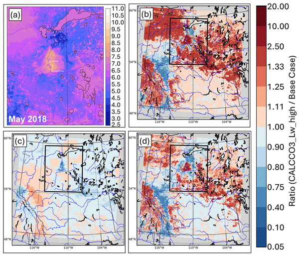
This work identifies an important and hitherto unsuspected controlling factor influencing the rate of deposition of atmospheric gases to foliage surfaces. We show base cation-containing dust that settles on foliage can raise the pH of thin water films on leaves, significantly increasing sulphur dioxide dry deposition rates (often by more than 1 cm s-1), and lowering concentrations (by up to 60%), near sources of alkaline dust emissions, changing sulphur deposition fluxes' spatial distribution.
Neda Kolahi, Costas Armenakis, and Mark D. Gordon
ISPRS Ann. Photogramm. Remote Sens. Spatial Inf. Sci., XI-3-2026, 157–162, https://doi.org/10.5194/isprs-annals-XI-3-2026-157-2026, https://doi.org/10.5194/isprs-annals-XI-3-2026-157-2026, 2026
Sepehr Fathi, Mark Gordon, and Jingliang Hao
Atmos. Meas. Tech., 19, 3911–3931, https://doi.org/10.5194/amt-19-3911-2026, https://doi.org/10.5194/amt-19-3911-2026, 2026
Short summary
Short summary
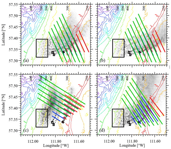
Aircraft are often used to measure emissions from industry and other sources by flying downwind of the source and measuring the pollutant winds and concentration. This study uses model simulation to help choose the best flight configuration and parameters for a given source type (e.g. smokestacks, mine faces, or surface emissions). The results provide uncertainty estimates based on downwind flight distances, which helps to plan aircraft-based measurements campaigns.
Chi-Tsan Wang, Patrick C. Campbell, Paul Makar, Siqi Ma, Irena Ivanova, Bok H. Baek, Wei-Ting Hung, Zachary Moon, Youhua Tang, Barry Baker, Rick Saylor, Jung-Hun Woo, and Daniel Tong
Atmos. Chem. Phys., 25, 16631–16655, https://doi.org/10.5194/acp-25-16631-2025, https://doi.org/10.5194/acp-25-16631-2025, 2025
Short summary
Short summary
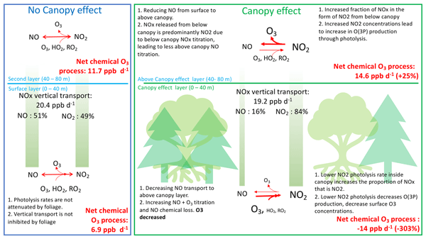
Forests influence air quality by altering ozone levels, but most air pollution models overlook canopy effects. Our study improves ozone predictions by incorporating forest canopy shading and turbulence into a widely used model. We found that tree cover reduces near-surface ozone by decreasing photolysis rates and diffusion inside canopy, resulting in lower ozone concentrations in densely forested areas. These findings enhance ozone surface prediction accuracy and improve air quality modeling.
Ioannis Kioutsioukis, Christian Hogrefe, Paul A. Makar, Ummugulsum Alyuz, Jesse O. Bash, Roberto Bellasio, Roberto Bianconi, Tim Butler, Olivia E. Clifton, Philip Cheung, Alma Hodzic, Richard Kranenburg, Aura Lupascu, Kester Momoh, Juan Luis Perez-Camaño, Jonathan Pleim, Young-Hee Ryu, Roberto San Jose, Donna Schwede, Ranjeet Sokhi, and Stefano Galmarini
Atmos. Chem. Phys., 25, 12923–12953, https://doi.org/10.5194/acp-25-12923-2025, https://doi.org/10.5194/acp-25-12923-2025, 2025
Short summary
Short summary
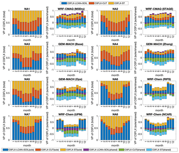
Deposition is key in air quality modeling. An unprecedented evaluation of the Air Quality Model Evaluation International Initiative phase 4 models is performed on different deposition schemes in relation to the land use and land cover (LULC) used. Among the results, LULC masks have to be harmonized and up-to-date information used in place of masks that are outdated and too coarse. Alternatively, LULC masks should be evaluated and intercompared when multiple model results are analyzed.
Christian Hogrefe, Stefano Galmarini, Paul A. Makar, Ioannis Kioutsioukis, Olivia E. Clifton, Ummugulsum Alyuz, Jesse O. Bash, Roberto Bellasio, Roberto Bianconi, Tim Butler, Philip Cheung, Alma Hodzic, Richard Kranenburg, Aurelia Lupascu, Kester Momoh, Juan Luis Perez-Camanyo, Jonathan E. Pleim, Young-Hee Ryu, Roberto San Jose, Martijn Schaap, Donna B. Schwede, and Ranjeet Sokhi
Atmos. Chem. Phys., 25, 12629–12656, https://doi.org/10.5194/acp-25-12629-2025, https://doi.org/10.5194/acp-25-12629-2025, 2025
Short summary
Short summary
Performed under the umbrella of Phase 4 of the Air Quality Model Evaluation International Initiative (AQMEII4), this study applies AQMEII4 diagnostic tools to better characterize how dry deposition removes pollutants from the atmosphere in regional-scale models. The results also strongly suggest that improvement and harmonization of the representation of land use in these models would serve the community in their future development efforts.
Muhammad Kamran, Mohammad Moein Sheikholeslami, and Gunho Sohn
Int. Arch. Photogramm. Remote Sens. Spatial Inf. Sci., XLVIII-G-2025, 765–771, https://doi.org/10.5194/isprs-archives-XLVIII-G-2025-765-2025, https://doi.org/10.5194/isprs-archives-XLVIII-G-2025-765-2025, 2025
Paul A. Makar, Philip Cheung, Christian Hogrefe, Ayodeji Akingunola, Ummugulsum Alyuz, Jesse O. Bash, Michael D. Bell, Roberto Bellasio, Roberto Bianconi, Tim Butler, Hazel Cathcart, Olivia E. Clifton, Alma Hodzic, Ioannis Kioutsioukis, Richard Kranenburg, Aurelia Lupascu, Jason A. Lynch, Kester Momoh, Juan L. Perez-Camanyo, Jonathan Pleim, Young-Hee Ryu, Roberto San Jose, Donna Schwede, Thomas Scheuschner, Mark W. Shephard, Ranjeet S. Sokhi, and Stefano Galmarini
Atmos. Chem. Phys., 25, 3049–3107, https://doi.org/10.5194/acp-25-3049-2025, https://doi.org/10.5194/acp-25-3049-2025, 2025
Short summary
Short summary
The large range of sulfur and nitrogen deposition estimates from air quality models results in a large range of predicted impacts. We used models and deposition diagnostics to identify the processes controlling atmospheric sulfur and nitrogen deposition variability. Controlling factors included the uptake of gases and aerosols by hydrometeors, aerosol inorganic chemistry, particle dry deposition, ammonia bidirectional fluxes, gas deposition via plant cuticles and soil, and land use data.
Dane Blanchard, Mark Gordon, Duc Huy Dang, Paul Andrew Makar, and Julian Aherne
Atmos. Chem. Phys., 25, 2423–2442, https://doi.org/10.5194/acp-25-2423-2025, https://doi.org/10.5194/acp-25-2423-2025, 2025
Short summary
Short summary
This study offers the first known evaluation of water-soluble brown carbon aerosols in the Athabasca oil sands region (AOSR), Canada. Fluorescence spectroscopy analysis of aerosol samples from five regional sites (collected during the summer of 2021) identified oil sands operations as a measurable brown carbon source. Industrial aerosol emissions were unlikely to impact regional radiative forcing. These findings show that fluorescence spectroscopy can be used to monitor brown carbon in the AOSR.
Sepehr Fathi, Paul Makar, Wanmin Gong, Junhua Zhang, Katherine Hayden, and Mark Gordon
Atmos. Chem. Phys., 25, 2385–2405, https://doi.org/10.5194/acp-25-2385-2025, https://doi.org/10.5194/acp-25-2385-2025, 2025
Short summary
Short summary
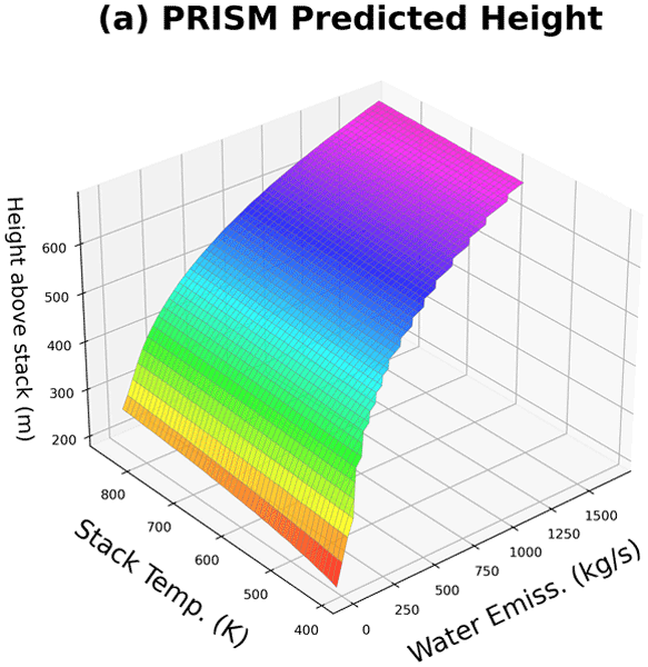
Our study explores the influence of water phase changes in plumes from industrial sources on atmospheric dispersion of emitted pollutants and air quality. Employing PRISM (Plume-Rise-Iterative-Stratified-Moist), a new method, we found that considering these effects significantly improves predictions of pollutant dispersion. This insight enhances our understanding of environmental impacts, enabling more accurate air quality modelling and fostering more effective pollution management strategies.
Hazel Cathcart, Julian Aherne, Michael D. Moran, Verica Savic-Jovcic, Paul A. Makar, and Amanda Cole
Biogeosciences, 22, 535–554, https://doi.org/10.5194/bg-22-535-2025, https://doi.org/10.5194/bg-22-535-2025, 2025
Short summary
Short summary
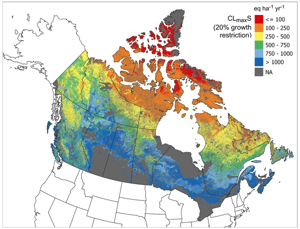
Deposition from sulfur and nitrogen pollution can harm ecosystems, and recovery from this type of pollution can take decades or longer. To identify risk to Canadian soils, we created maps showing sensitivity to sulfur and nitrogen pollution. Results show that some ecosystems are at risk from acid and nutrient nitrogen deposition: 10 % of protected areas are receiving acid deposition beyond their damage threshold, and 70 % may be receiving nitrogen deposition that could cause biodiversity loss.
Kerry Anderson, Jack Chen, Peter Englefield, Debora Griffin, Paul A. Makar, and Dan Thompson
Geosci. Model Dev., 17, 7713–7749, https://doi.org/10.5194/gmd-17-7713-2024, https://doi.org/10.5194/gmd-17-7713-2024, 2024
Short summary
Short summary
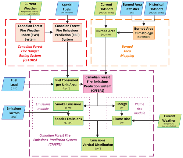
The Global Forest Fire Emissions Prediction System (GFFEPS) is a model that predicts smoke and carbon emissions from wildland fires. The model calculates emissions from the ground up based on satellite-detected fires, modelled weather and fire characteristics. Unlike other global models, GFFEPS uses daily weather conditions to capture changing burning conditions on a day-to-day basis. GFFEPS produced lower carbon emissions due to the changing weather not captured by the other models.
Debora Griffin, Jack Chen, Kerry Anderson, Paul Makar, Chris A. McLinden, Enrico Dammers, and Andre Fogal
Atmos. Chem. Phys., 24, 10159–10186, https://doi.org/10.5194/acp-24-10159-2024, https://doi.org/10.5194/acp-24-10159-2024, 2024
Short summary
Short summary
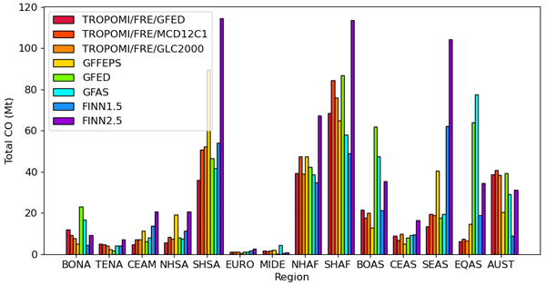
Satellite-derived CO emissions provide new insights into the understanding of global CO emission rates from wildfires. We use TROPOMI satellite data to create a global inventory database of wildfire CO emissions. These satellite-derived wildfire emissions are used for the evaluation and improvement of existing fire emission inventories and to examine how the wildfire CO emissions have changed over the past 2 decades.
Stefan J. Miller, Paul A. Makar, and Colin J. Lee
Geosci. Model Dev., 17, 2197–2219, https://doi.org/10.5194/gmd-17-2197-2024, https://doi.org/10.5194/gmd-17-2197-2024, 2024
Short summary
Short summary
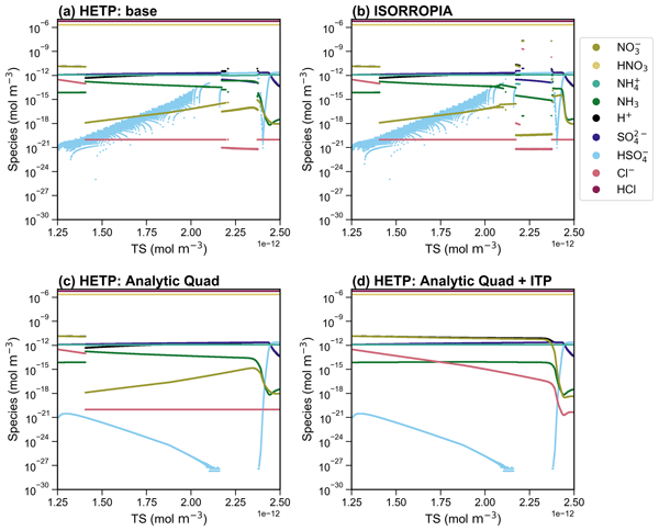
This work outlines a new solver written in Fortran to calculate the partitioning of metastable aerosols at thermodynamic equilibrium based on the forward algorithms of ISORROPIA II. The new code includes numerical improvements that decrease the computational speed (compared to ISORROPIA II) while improving the accuracy of the partitioning solution.
Roya Ghahreman, Wanmin Gong, Paul A. Makar, Alexandru Lupu, Amanda Cole, Kulbir Banwait, Colin Lee, and Ayodeji Akingunola
Geosci. Model Dev., 17, 685–707, https://doi.org/10.5194/gmd-17-685-2024, https://doi.org/10.5194/gmd-17-685-2024, 2024
Short summary
Short summary
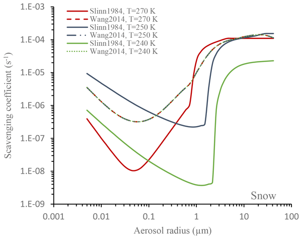
The article explores the impact of different representations of below-cloud scavenging on model biases. A new scavenging scheme and precipitation-phase partitioning improve the model's performance, with better SO42- scavenging and wet deposition of NO3- and NH4+.
S. Yoo, C. Ko, G. Sohn, and H. Lee
Int. Arch. Photogramm. Remote Sens. Spatial Inf. Sci., XLVIII-1-W2-2023, 209–215, https://doi.org/10.5194/isprs-archives-XLVIII-1-W2-2023-209-2023, https://doi.org/10.5194/isprs-archives-XLVIII-1-W2-2023-209-2023, 2023
M. Jameela and G. Sohn
ISPRS Ann. Photogramm. Remote Sens. Spatial Inf. Sci., X-1-W1-2023, 129–136, https://doi.org/10.5194/isprs-annals-X-1-W1-2023-129-2023, https://doi.org/10.5194/isprs-annals-X-1-W1-2023-129-2023, 2023
Colin J. Lee, Paul A. Makar, and Joana Soares
Geosci. Model Dev. Discuss., https://doi.org/10.5194/gmd-2023-185, https://doi.org/10.5194/gmd-2023-185, 2023
Publication in GMD not foreseen
Short summary
Short summary
Clustering is an analysis technique for finding similarities within datasets. We present a new implementation of the hierarchical clustering algorithm that is able to process much larger datasets than was previously possible, by spreading the program out over many connected computers in a high-performance computing system. We show airshed maps of a high-resolution regional model output domain, and find related air pollution profiles at monitoring stations separated by thousands of kilometers.
Xuanyi Zhang, Mark Gordon, Paul A. Makar, Timothy Jiang, Jonathan Davies, and David Tarasick
Atmos. Chem. Phys., 23, 13647–13664, https://doi.org/10.5194/acp-23-13647-2023, https://doi.org/10.5194/acp-23-13647-2023, 2023
Short summary
Short summary
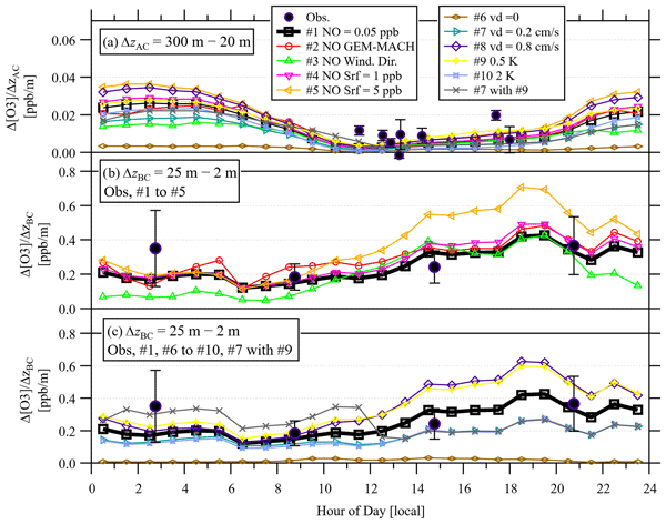
Measurements of ozone in the atmosphere were made in a forest downwind of oil sands mining and production facilities in northern Alberta. These measurements show that the emissions of other pollutants from oil sands production and processing reduce the amount of ozone in the forest. By using an atmospheric model combined with measurements, we find that the rate at which ozone is absorbed by the forest is lower than typical rates from similar measurements in other forests.
Olivia E. Clifton, Donna Schwede, Christian Hogrefe, Jesse O. Bash, Sam Bland, Philip Cheung, Mhairi Coyle, Lisa Emberson, Johannes Flemming, Erick Fredj, Stefano Galmarini, Laurens Ganzeveld, Orestis Gazetas, Ignacio Goded, Christopher D. Holmes, László Horváth, Vincent Huijnen, Qian Li, Paul A. Makar, Ivan Mammarella, Giovanni Manca, J. William Munger, Juan L. Pérez-Camanyo, Jonathan Pleim, Limei Ran, Roberto San Jose, Sam J. Silva, Ralf Staebler, Shihan Sun, Amos P. K. Tai, Eran Tas, Timo Vesala, Tamás Weidinger, Zhiyong Wu, and Leiming Zhang
Atmos. Chem. Phys., 23, 9911–9961, https://doi.org/10.5194/acp-23-9911-2023, https://doi.org/10.5194/acp-23-9911-2023, 2023
Short summary
Short summary
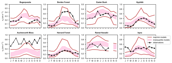
A primary sink of air pollutants is dry deposition. Dry deposition estimates differ across the models used to simulate atmospheric chemistry. Here, we introduce an effort to examine dry deposition schemes from atmospheric chemistry models. We provide our approach’s rationale, document the schemes, and describe datasets used to drive and evaluate the schemes. We also launch the analysis of results by evaluating against observations and identifying the processes leading to model–model differences.
Sepehr Fathi, Mark Gordon, and Yongsheng Chen
Geosci. Model Dev., 16, 5069–5091, https://doi.org/10.5194/gmd-16-5069-2023, https://doi.org/10.5194/gmd-16-5069-2023, 2023
Short summary
Short summary
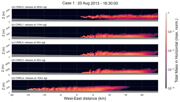
We have combined various capabilities within a WRF model to generate simulations of atmospheric pollutant dispersion at 50 m resolution. The study objective was to resolve transport processes at the scale of measurements to assess and optimize aircraft-based emission rate retrievals. Model performance evaluation resulted in agreement within 5 % of observed meteorological and within 1–2 standard deviations of observed wind fields. Mass was conserved in the model within 5 % of input emissions.
Mark Gordon, Dane Blanchard, Timothy Jiang, Paul A. Makar, Ralf M. Staebler, Julian Aherne, Cris Mihele, and Xuanyi Zhang
Atmos. Chem. Phys., 23, 7241–7255, https://doi.org/10.5194/acp-23-7241-2023, https://doi.org/10.5194/acp-23-7241-2023, 2023
Short summary
Short summary
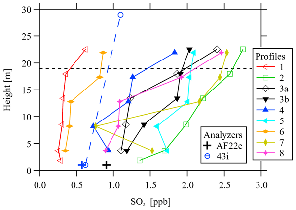
Measurements of the gas sulfur dioxide (SO2) were made in a forest downwind of oil sands mining and production facilities in northern Alberta. These measurements tell us the rate at which SO2 is absorbed by the forest. The measured rate is much higher than what is currently used by air quality models, which is supported by a previous study in this region. This suggests that SO2 may have a much shorter lifetime in the atmosphere at this location than currently predicted by models.
Timothy Jiang, Mark Gordon, Paul A. Makar, Ralf M. Staebler, and Michael Wheeler
Atmos. Chem. Phys., 23, 4361–4372, https://doi.org/10.5194/acp-23-4361-2023, https://doi.org/10.5194/acp-23-4361-2023, 2023
Short summary
Short summary
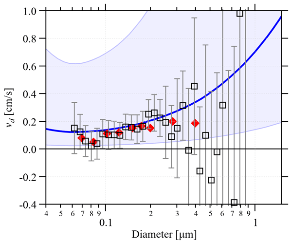
Measurements of submicron aerosols (particles smaller than 1 / 1000 of a millimeter) were made in a forest downwind of oil sands mining and production facilities in northern Alberta. These measurements tell us how quickly aerosols are absorbed by the forest (known as deposition rate) and how the deposition rate depends on the size of the aerosol. The measurements show good agreement with a parameterization developed from a recent study for deposition of aerosols to a similar pine forest.
Stefan J. Miller and Mark Gordon
Atmos. Meas. Tech., 15, 6563–6584, https://doi.org/10.5194/amt-15-6563-2022, https://doi.org/10.5194/amt-15-6563-2022, 2022
Short summary
Short summary
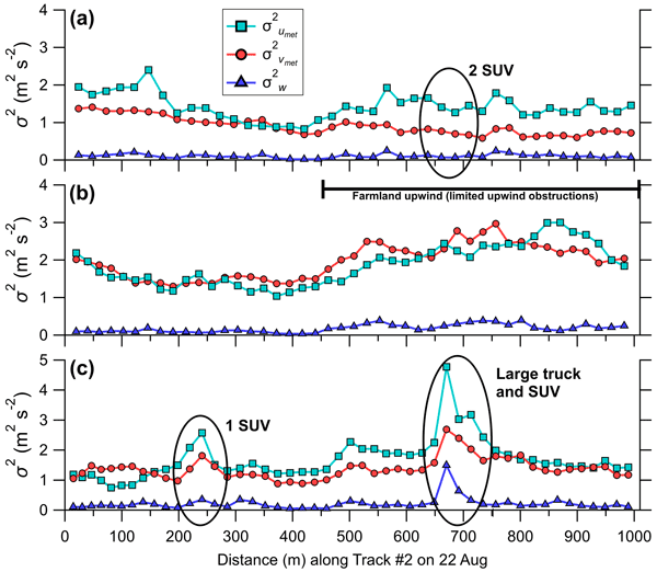
This research investigates the measurement of atmospheric turbulence using a low-cost instrumented car that travels at near-highway speeds and is impacted by upwind obstructions and other on-road traffic. We show that our car design can successfully measure the mean flow and atmospheric turbulence near the surface. We outline a technique to isolate and remove the effects of sporadic passing traffic from car-measured velocity variances and discuss potential measurement uncertainties.
Mahtab Majdzadeh, Craig A. Stroud, Christopher Sioris, Paul A. Makar, Ayodeji Akingunola, Chris McLinden, Xiaoyi Zhao, Michael D. Moran, Ihab Abboud, and Jack Chen
Geosci. Model Dev., 15, 219–249, https://doi.org/10.5194/gmd-15-219-2022, https://doi.org/10.5194/gmd-15-219-2022, 2022
Short summary
Short summary
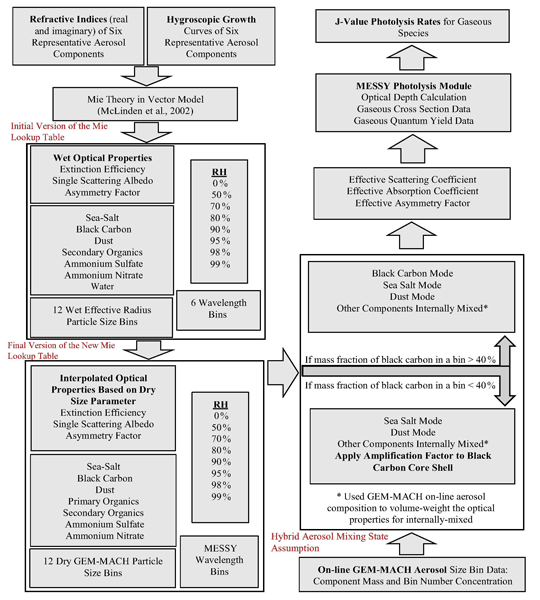
A new lookup table for aerosol optical properties based on a Mie scattering code was calculated and adopted within an improved version of the photolysis module in the GEM-MACH in-line chemical transport model. The modified version of the photolysis module makes use of online interactive aerosol feedback and applies core-shell parameterizations to the black carbon absorption efficiency based on Bond et al. (2006) to the size bins with black carbon mass fraction of less than 40 %.
Debora Griffin, Chris A. McLinden, Enrico Dammers, Cristen Adams, Chelsea E. Stockwell, Carsten Warneke, Ilann Bourgeois, Jeff Peischl, Thomas B. Ryerson, Kyle J. Zarzana, Jake P. Rowe, Rainer Volkamer, Christoph Knote, Natalie Kille, Theodore K. Koenig, Christopher F. Lee, Drew Rollins, Pamela S. Rickly, Jack Chen, Lukas Fehr, Adam Bourassa, Doug Degenstein, Katherine Hayden, Cristian Mihele, Sumi N. Wren, John Liggio, Ayodeji Akingunola, and Paul Makar
Atmos. Meas. Tech., 14, 7929–7957, https://doi.org/10.5194/amt-14-7929-2021, https://doi.org/10.5194/amt-14-7929-2021, 2021
Short summary
Short summary
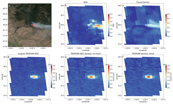
Satellite-derived NOx emissions from biomass burning are estimated with TROPOMI observations. Two common emission estimation methods are applied, and sensitivity tests with model output were performed to determine the accuracy of these methods. The effect of smoke aerosols on TROPOMI NO2 columns is estimated and compared to aircraft observations from four different aircraft campaigns measuring biomass burning plumes in 2018 and 2019 in North America.
Stefano Galmarini, Paul Makar, Olivia E. Clifton, Christian Hogrefe, Jesse O. Bash, Roberto Bellasio, Roberto Bianconi, Johannes Bieser, Tim Butler, Jason Ducker, Johannes Flemming, Alma Hodzic, Christopher D. Holmes, Ioannis Kioutsioukis, Richard Kranenburg, Aurelia Lupascu, Juan Luis Perez-Camanyo, Jonathan Pleim, Young-Hee Ryu, Roberto San Jose, Donna Schwede, Sam Silva, and Ralf Wolke
Atmos. Chem. Phys., 21, 15663–15697, https://doi.org/10.5194/acp-21-15663-2021, https://doi.org/10.5194/acp-21-15663-2021, 2021
Short summary
Short summary
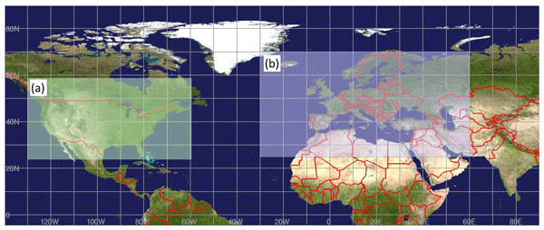
This technical note presents the research protocols for phase 4 of the Air Quality Model Evaluation International Initiative (AQMEII4). This initiative has three goals: (i) to define the state of wet and dry deposition in regional models, (ii) to evaluate how dry deposition influences air concentration and flux predictions, and (iii) to identify the causes for prediction differences. The evaluation compares LULC-specific dry deposition and effective conductances and fluxes.
Sepehr Fathi, Mark Gordon, Paul A. Makar, Ayodeji Akingunola, Andrea Darlington, John Liggio, Katherine Hayden, and Shao-Meng Li
Atmos. Chem. Phys., 21, 15461–15491, https://doi.org/10.5194/acp-21-15461-2021, https://doi.org/10.5194/acp-21-15461-2021, 2021
Short summary
Short summary
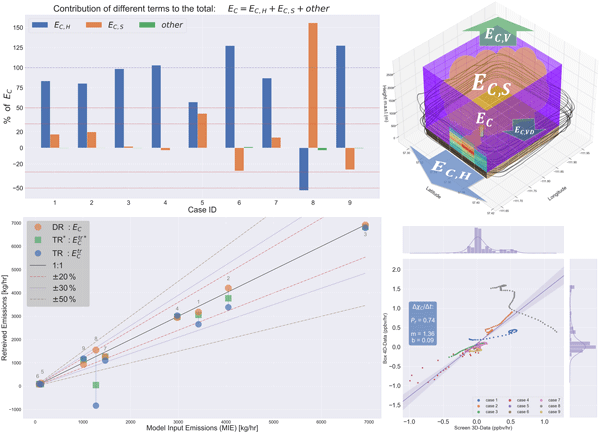
We have investigated the accuracy of aircraft-based mass balance methodologies through computer model simulations of the atmosphere and air quality at a regional high-resolution scale. We have defined new quantitative metrics to reduce emission retrieval uncertainty by evaluating top-down mass balance estimates against the known simulated meteorology and input emissions. We also recommend methodologies and flight strategies for improved retrievals in future aircraft-based studies.
A. U. Usmani, M. Jadidi, and G. Sohn
ISPRS Ann. Photogramm. Remote Sens. Spatial Inf. Sci., VIII-4-W2-2021, 183–188, https://doi.org/10.5194/isprs-annals-VIII-4-W2-2021-183-2021, https://doi.org/10.5194/isprs-annals-VIII-4-W2-2021-183-2021, 2021
A.-H. Hor and G. Sohn
ISPRS Ann. Photogramm. Remote Sens. Spatial Inf. Sci., VIII-4-W2-2021, 175–182, https://doi.org/10.5194/isprs-annals-VIII-4-W2-2021-175-2021, https://doi.org/10.5194/isprs-annals-VIII-4-W2-2021-175-2021, 2021
H. Kiavarz, M. Jadidi, A. Rajabifard, and G. Sohn
Int. Arch. Photogramm. Remote Sens. Spatial Inf. Sci., XLVI-4-W4-2021, 97–100, https://doi.org/10.5194/isprs-archives-XLVI-4-W4-2021-97-2021, https://doi.org/10.5194/isprs-archives-XLVI-4-W4-2021-97-2021, 2021
Xinxin Ye, Pargoal Arab, Ravan Ahmadov, Eric James, Georg A. Grell, Bradley Pierce, Aditya Kumar, Paul Makar, Jack Chen, Didier Davignon, Greg R. Carmichael, Gonzalo Ferrada, Jeff McQueen, Jianping Huang, Rajesh Kumar, Louisa Emmons, Farren L. Herron-Thorpe, Mark Parrington, Richard Engelen, Vincent-Henri Peuch, Arlindo da Silva, Amber Soja, Emily Gargulinski, Elizabeth Wiggins, Johnathan W. Hair, Marta Fenn, Taylor Shingler, Shobha Kondragunta, Alexei Lyapustin, Yujie Wang, Brent Holben, David M. Giles, and Pablo E. Saide
Atmos. Chem. Phys., 21, 14427–14469, https://doi.org/10.5194/acp-21-14427-2021, https://doi.org/10.5194/acp-21-14427-2021, 2021
Short summary
Short summary
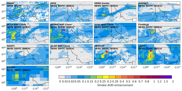
Wildfire smoke has crucial impacts on air quality, while uncertainties in the numerical forecasts remain significant. We present an evaluation of 12 real-time forecasting systems. Comparison of predicted smoke emissions suggests a large spread in magnitudes, with temporal patterns deviating from satellite detections. The performance for AOD and surface PM2.5 and their discrepancies highlighted the role of accurately represented spatiotemporal emission profiles in improving smoke forecasts.
Cited articles
AEIR: AEIR Air Emission Rates, https://open.alberta.ca/opendata/aeirairemissionrates, last access: 4 September 2026.
Akingunola, A., Makar, P. A., Zhang, J., Darlington, A., Li, S.-M., Gordon, M., Moran, M. D., and Zheng, Q.: A chemical transport model study of plume-rise and particle size distribution for the Athabasca oil sands, Atmos. Chem. Phys., 18, 8667–8688, https://doi.org/10.5194/acp-18-8667-2018, 2018.
Briggs, G. A.: Plume rise: A critical survey, Air Resources Atmospheric Turbulence and Diffusion Lab., Oak Ridge, Tenn., https://doi.org/10.2172/4743102, 1969.
Briggs, G. A.: Plume rise predictions, Lectures on air Pollution and environmental impact analyses, in: Workshop Proceedings, Boston, MA, USA, 29 September–3 October 1975, 59–111, https://doi.org/10.1007/978-1-935704-23-2_3, 1975.
Briggs, G. A.: Plume rise and buoyancy effects, Atmos. Sci. power Prod. US Dep. Energy, 327, 366, https://doi.org/10.2172/6503687, 1984.
Briggs, G. A.: Analytical Parameterizations of Diffusion: The Convective Boundary Layer, J. Appl. Meteorol. Clim., 24, https://doi.org/10.1175/1520-0450(1985)024<1167:APODTC>2.0.CO;2, 1985.
Bringfelt, B.: Plume Rise Measurements Chimneys, Atmos. Environ., 2, https://doi.org/10.1016/0004-6981(68)90065-6, 1968.
Byun, D. W. and Ching, J. K. S.: Science algorithms of the EPA Models-3 Community Multi-scale Air Quality (CMAQ) modeling system, U.S. Environmental Protection Agency, Washington, D.C., EPA/600/R-99/030 (NTIS PB2000-100561), https://cfpub.epa.gov/si/si_public_record_report.cfm?dirEntryId=63400&Lab=NERL (last access: 16 September 2026), 1999.
CEMS: Continuous Emission Monitoring System (CEMS) Code, Alberta Environmental Protection, Pub. No. Ref. 107, ISBN 0-7732-5038-7, 1998.
Charpentier, A. D., Bergerson, J. A., and MacLean, H. L.: Understanding the Canadian oil sands industry's greenhouse gas emissions, Environ. Res. Lett., 4, https://doi.org/10.1088/1748-9326/4/1/014005, 2009.
Cheng, M., Ma, P., He, R., Chen, J., Zhang, Z., and Huang, J.: Deep Convolutional Neural Networks based on Manifold for Smoke Recognition, Proc. Int. Jt. Conf. Neural Networks, July 2021, 1–7, https://doi.org/10.1109/IJCNN52387.2021.9534297, 2021.
De Visscher, A.: Air Dispersion Modeling: Foundations and Applications, Wiley, 664 pp., https://doi.org/10.1002/9781118723098, 2013.
Emery, C., Jung, J., and Yarwood, G.: Implementation of an alternative plume rise methodology in CAMx, Final Report, Work Order No. 582-7-84005-FY10-20, 2010.
England, W. G., Teuscher, L. H., and Snyder, R. B.: A Measurement Program to Determine Plume Configurations at the Beaver Gas Turbine Facility, Port Westward, Oregon, J. Air Pollut. Control Assoc., 26, 986–989, https://doi.org/10.1080/00022470.1976.10470350, 1976.
Fathi, S., Makar, P., Gong, W., Zhang, J., Hayden, K., and Gordon, M.: The importance of moist thermodynamics on neutral buoyancy height for plumes from anthropogenic sources, Atmos. Chem. Phys., 25, 2385–2405, https://doi.org/10.5194/acp-25-2385-2025, 2025.
Garratt, J. R.: Review: the atmospheric boundary layer, Earth Sci. Rev., 37, 89–134, https://doi.org/10.1016/0012-8252(94)90026-4, 1994.
Gordon, M., Li, S.-M., Staebler, R., Darlington, A., Hayden, K., O'Brien, J., and Wolde, M.: Determining air pollutant emission rates based on mass balance using airborne measurement data over the Alberta oil sands operations, Atmos. Meas. Tech., 8, 3745–3765, https://doi.org/10.5194/amt-8-3745-2015, 2015.
Gordon, M., Makar, P. A., Staebler, R. M., Zhang, J., Akingunola, A., Gong, W., and Li, S.-M.: A comparison of plume rise algorithms to stack plume measurements in the Athabasca oil sands, Atmos. Chem. Phys., 18, 14695–14714, https://doi.org/10.5194/acp-18-14695-2018, 2018.
Gordon, M., Gong, W., and Makar, P. A.: Code and data for the calculation of plume rise, V1, Borealis [code], https://doi.org/10.5683/SP3/WZVZBV, 2025a.
Gordon, M., Koushafar, M., Axelrod, K., and Sohn, G.: Smokestack Plume Images and Plume Identification Masks, V1, Federated Research Data Repository (FRDR) [data set], https://doi.org/10.20383/103.01448, 2025b.
Gu, K., Xia, Z., Qiao, J., and Lin, W.: Deep Dual-Channel Neural Network for Image-Based Smoke Detection, IEEE T. Multimedia, 22, 311–323, https://doi.org/10.1109/TMM.2019.2929009, 2020.
Guo, J., Zhang, J., and Shao, J.: A Harmonized Global Continental High-resolution Planetary Boundary Layer Height Dataset Covering 2017–2021, Zenodo, https://doi.org/10.5281/zenodo.6498004, 2022.
Guo, J., Zhang, J., Shao, J., Chen, T., Bai, K., Sun, Y., Li, N., Wu, J., Li, R., Li, J., Guo, Q., Cohen, J. B., Zhai, P., Xu, X., and Hu, F.: A merged continental planetary boundary layer height dataset based on high-resolution radiosonde measurements, ERA5 reanalysis, and GLDAS, Earth Syst. Sci. Data, 16, 1–14, https://doi.org/10.5194/essd-16-1-2024, 2024.
Hamilton, P. M.: Paper III: Plume height measurements at Northfleet and Tilbury power stations, Atmos. Environ., 1, 379–387, https://doi.org/10.1016/0004-6981(67)90054-6, 1967.
He, K., Zhang, X., Ren, S., and Sun, J.: Deep Residual Learning for Image Recognition, IEEE Conf. Comput. Vis. Pattern Recognit., arXiv, https://doi.org/10.48550/arXiv.1512.03385, 2016.
Jiang, X., Pang, Y., Li, X., Pan, J., and Xie, Y.: Deep neural networks with Elastic Rectified Linear Units for object recognition, Neurocomputing, 275, 1132–1139, https://doi.org/10.1016/j.neucom.2017.09.056, 2018.
JOSM: Joint Oil Sands Monitoring Program Emissions Inventory Compilation Report, Environment and Climate Change Canada and Alberta Environment and Parks, ISBN 978-1-4601-2565-6, 2016.
Kaimal, J. C. and Finnigan, J. J.: Atmospheric Boundary Layer Flows: Their Structures and Measurements, Oxford University Press, https://doi.org/10.1093/oso/9780195062397.001.0001, 1994.
Koushafar, M.: Automated Plume Rise Measurement based on Deep Neural Networks using Video Images, PhD Thesis, York University, https://hdl.handle.net/10315/41904 (last access: 16 September 2026), 2023.
Koushafar, M., Sohn, G., and Gordon, M.: Deep Convolutional Neural Network for Plume Rise Measurements in Industrial Environments, Remote Sens., 15, https://doi.org/10.3390/rs15123083, 2023.
Liu, H., Lei, F., Tong, C., Cui, C., and Wu, L.: Visual Smoke Detection Based on Ensemble Deep CNNs, Displays, 69, 1–10, https://doi.org/10.1016/j.displa.2021.102020, 2021.
Luhmann, T., Robson, S., Kyle, S., and Harley, I.: Close Range Photogrammetry: Principles, Methods and Applications, Whittles, Dunbeath, ISBN 9781870325509, 2006.
Mahrt, L.: The early evening boundary layer transition, Q. J. Roy. Meteor. Soc., 107, 329–343, https://doi.org/10.1002/qj.49710745205, 1981.
Makar, P. A., Gong, W., Hogrefe, C., Zhang, Y., Curci, G., Žabkar, R., Milbrandt, J., Im, U., Balzarini, A., Baró, R., Bianconi, R., Cheung, P., Forkel, R., Gravel, S., Hirtl, M., Honzak, L., Hou, A., Jiménez-Guerrero, P., Langer, M., Moran, M. D., Pabla, B., Pérez, J. L., Pirovano, G., San José, R., Tuccella, P., Werhahn, J., Zhang, J., and Galmarini, S.: Feedbacks between air pollution and weather, part 2: Effects on chemistry, Atmos. Environ., 115, 499–526, https://doi.org/10.1016/j.atmosenv.2014.10.021, 2015.
Moore, D. J.: A comparison of the trajectories of rising buoyant plumes with theoretical/empirical models, Atmos. Environ., 8, 441–457, 1974.
Rittmann, B. E.: Application of two-thirds law to plume rise from industrial-sized sources, Atmos. Environ., 16, 2575–2579, 1982.
Sharf, G., Peleg, M., Livnat, M., and Luria, M.: Plume rise measurements from large point sources in Israel, Atmos. Environ. A-Gen., 27, 1657–1663, https://doi.org/10.1016/0960-1686(93)90228-Q, 1993.
Simonyan, K. and Zisserman, A.: Very deep convolutional networks for large-scale image recognition, 3rd Int. Conf. Learn. Represent. ICLR 2015 – Conf. Track Proc., 1–14, arXiv, https://doi.org/10.48550/arXiv.1409.1556, 2015.
Snee, E., Jarvis, P. A., Simionato, R., Scollo, S., Prestifilippo, M., Degruyter, W., and Bonadonna, C.: Image analysis of volcanic plumes: A simple calibration tool to correct for the effect of wind, Volcanica, 6, 447–458, https://doi.org/10.30909/vol.06.02.447458, 2023.
VDI: Ausbreitung von Luftverunreinigungen in der Atmosphäre; Berechnung der Abgasfahnenüberhöhung [Dispersion of air pollutants in the atmosphere; determination of plume rise], Kommission Reinhaltung der Luft (KRdL) im VDI und DIN-Normenausschuss, 1985.
Webster, H. N. and Thomson, D. J.: Validation of a Lagrangian model plume rise scheme using the Kincaid data set, Atmos. Environ., 36, 5031–5042, 2002.
Zhang, J., Moran, M. D., Zheng, Q., Makar, P. A., Baratzadeh, P., Marson, G., Liu, P., and Li, S.-M.: Emissions preparation and analysis for multiscale air quality modeling over the Athabasca Oil Sands Region of Alberta, Canada, Atmos. Chem. Phys., 18, 10459–10481, https://doi.org/10.5194/acp-18-10459-2018, 2018.
Zhao, J., Guo, W., Zhang, Z., and Yu, W.: A coupled convolutional neural network for small and densely clustered ship detection in SAR images, Sci. China Inform. Sci., 62, 1–16, https://doi.org/10.1007/s11432-017-9405-6, 2019.
Short summary
The is a study of the plumes that rise from smokestacks. Knowing how these plume behave helps predict downwind pollutant concentrations. We use photos over a 2-year period to investigate how these plumes rise under different conditions and compare this to a commonly used model parameterization. It is found that the equations used to model plume rise in current models do well for some condition, but these equations can over-predict the plume rise, typically during the day when it is hot.
The is a study of the plumes that rise from smokestacks. Knowing how these plume behave helps...


