
Articles | Volume 19, issue 12
https://doi.org/10.5194/gmd-19-5515-2026
© Author(s) 2026. This work is distributed under
the Creative Commons Attribution 4.0 License.
the Creative Commons Attribution 4.0 License.
https://doi.org/10.5194/gmd-19-5515-2026
© Author(s) 2026. This work is distributed under
the Creative Commons Attribution 4.0 License.
the Creative Commons Attribution 4.0 License.
Model description paper
| 
25 Jun 2026
Model description paper |
| 25 Jun 2026
| 25 Jun 2026
palm_csd 25.10: a processing tool for static input data in the PALM model system
Sebastian Schubert
CORRESPONDING AUTHOR
Institute for Ecology, Technische Universität Berlin, Straße des 17. Juni 135, 10623 Berlin, Germany
Julian Anders
Institute of Meteorology and Climatology, Leibniz Universität Hannover, Herrenhäuser Str. 2, 30419 Hannover, Germany
Tobias Gronemeier
pecanode GmbH, Peterstr. 30, 38640 Goslar, Germany
Björn Maronga
Institute of Meteorology and Climatology, Leibniz Universität Hannover, Herrenhäuser Str. 2, 30419 Hannover, Germany
Mohamed Salim
Institute for Ecology, Technische Universität Berlin, Straße des 17. Juni 135, 10623 Berlin, Germany
Aswan University, Sahary City, Airport Road, 81528 Aswan, Egypt
Related authors
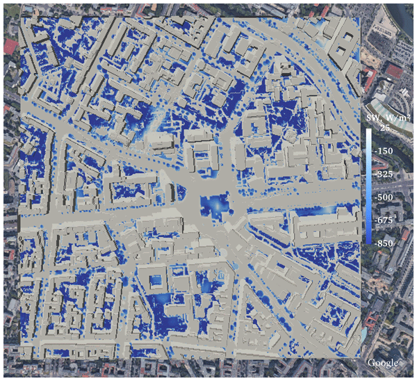
Mohamed H. Salim, Sebastian Schubert, Jaroslav Resler, Pavel Krč, Björn Maronga, Farah Kanani-Sühring, Matthias Sühring, and Christoph Schneider
Geosci. Model Dev., 15, 145–171, https://doi.org/10.5194/gmd-15-145-2022, https://doi.org/10.5194/gmd-15-145-2022, 2022
Short summary
Short summary
Radiative transfer processes are the main energy transport mechanism in urban areas which influence the surface energy budget and drive local convection. We show here the importance of each process to help modellers decide on how much detail they should include in their models to parameterize radiative transfer in urban areas. We showed how the flow field may change in response to these processes and the essential processes needed to assure acceptable quality of the numerical simulations.
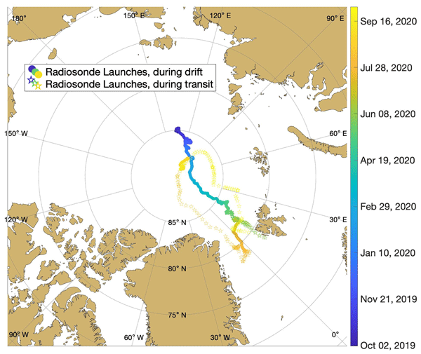
Gina C. Jozef, Robert Klingel, John J. Cassano, Björn Maronga, Gijs de Boer, Sandro Dahlke, and Christopher J. Cox
Earth Syst. Sci. Data, 15, 4983–4995, https://doi.org/10.5194/essd-15-4983-2023, https://doi.org/10.5194/essd-15-4983-2023, 2023
Short summary
Short summary
Observations from the MOSAiC expedition relating to lower-atmospheric temperature, wind, stability, moisture, and surface radiation budget from radiosondes, a meteorological tower, radiation station, and ceilometer were compiled to create a dataset which describes the thermodynamic and kinematic state of the central Arctic lower atmosphere between October 2019 and September 2020. This paper describes the methods used to develop this lower-atmospheric properties dataset.
Mohamed H. Salim, Sebastian Schubert, Jaroslav Resler, Pavel Krč, Björn Maronga, Farah Kanani-Sühring, Matthias Sühring, and Christoph Schneider
Geosci. Model Dev., 15, 145–171, https://doi.org/10.5194/gmd-15-145-2022, https://doi.org/10.5194/gmd-15-145-2022, 2022
Short summary
Short summary
Radiative transfer processes are the main energy transport mechanism in urban areas which influence the surface energy budget and drive local convection. We show here the importance of each process to help modellers decide on how much detail they should include in their models to parameterize radiative transfer in urban areas. We showed how the flow field may change in response to these processes and the essential processes needed to assure acceptable quality of the numerical simulations.
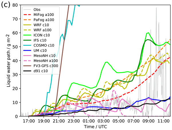
Ian Boutle, Wayne Angevine, Jian-Wen Bao, Thierry Bergot, Ritthik Bhattacharya, Andreas Bott, Leo Ducongé, Richard Forbes, Tobias Goecke, Evelyn Grell, Adrian Hill, Adele L. Igel, Innocent Kudzotsa, Christine Lac, Bjorn Maronga, Sami Romakkaniemi, Juerg Schmidli, Johannes Schwenkel, Gert-Jan Steeneveld, and Benoît Vié
Atmos. Chem. Phys., 22, 319–333, https://doi.org/10.5194/acp-22-319-2022, https://doi.org/10.5194/acp-22-319-2022, 2022
Short summary
Short summary
Fog forecasting is one of the biggest problems for numerical weather prediction. By comparing many models used for fog forecasting with others used for fog research, we hoped to help guide forecast improvements. We show some key processes that, if improved, will help improve fog forecasting, such as how water is deposited on the ground. We also showed that research models were not themselves a suitable baseline for comparison, and we discuss what future observations are required to improve them.
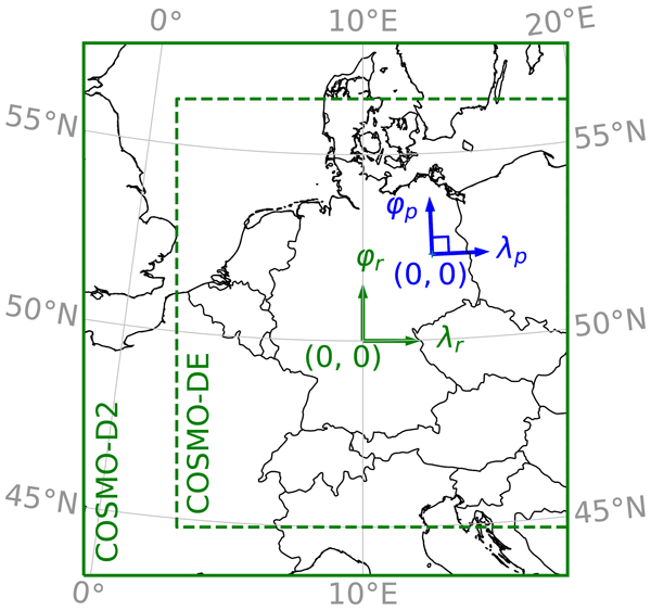
Eckhard Kadasch, Matthias Sühring, Tobias Gronemeier, and Siegfried Raasch
Geosci. Model Dev., 14, 5435–5465, https://doi.org/10.5194/gmd-14-5435-2021, https://doi.org/10.5194/gmd-14-5435-2021, 2021
Short summary
Short summary
In this paper, we provide a technical description of a newly developed interface for coupling the PALM model system 6.0 to the weather prediction model COSMO. The interface allows users of PALM to simulate the detailed atmospheric flow for relatively small regions of tens of kilometres under specific weather conditions, for instance, periods around observation campaigns or extreme weather situations. We demonstrate the interface using a benchmark simulation.
Katrin Frieda Gehrke, Matthias Sühring, and Björn Maronga
Geosci. Model Dev., 14, 5307–5329, https://doi.org/10.5194/gmd-14-5307-2021, https://doi.org/10.5194/gmd-14-5307-2021, 2021
Michal Belda, Jaroslav Resler, Jan Geletič, Pavel Krč, Björn Maronga, Matthias Sühring, Mona Kurppa, Farah Kanani-Sühring, Vladimír Fuka, Kryštof Eben, Nina Benešová, and Mikko Auvinen
Geosci. Model Dev., 14, 4443–4464, https://doi.org/10.5194/gmd-14-4443-2021, https://doi.org/10.5194/gmd-14-4443-2021, 2021
Short summary
Short summary
The analysis summarizes how sensitive the modelling of urban environment is to changes in physical parameters describing the city (e.g. reflectivity of surfaces) and to several heat island mitigation scenarios in a city quarter in Prague, Czech Republic. We used the large-eddy simulation modelling system PALM 6.0. Surface parameters connected to radiation show the highest sensitivity in this configuration. For heat island mitigation, urban vegetation is shown to be the most effective measure.
Cited articles
Anders, J. and Maronga, B.: Urban Microscale Simulations Based on a Local Climate Zone Wizard: Concept and Validation Using the PALM Model System, Urban Climate, 63, 102576, https://doi.org/10.1016/j.uclim.2025.102576, 2025. a
Anders, J., Schubert, S., Sauter, T., Tunn, S., Schneider, C., and Salim, M.: Modelling the impact of an urban development project on microclimate and outdoor thermal comfort in a mid-latitude city, Energ. Buildings, 296, 113324, https://doi.org/10.1016/j.enbuild.2023.113324, 2023. a
Anders, J., Schubert, S., Maronga, B., and Salim, M.: Simplifying heat stress assessment: Evaluating meteorological variables as single indicators of outdoor thermal comfort in urban environments, Building Environ., 274, 112658, https://doi.org/10.1016/j.buildenv.2025.112658, 2025. a
Belda, M., Resler, J., Geletič, J., Krč, P., Maronga, B., Sühring, M., Kurppa, M., Kanani-Sühring, F., Fuka, V., Eben, K., Benešová, N., and Auvinen, M.: Sensitivity analysis of the PALM model system 6.0 in the urban environment, Geosci. Model Dev., 14, 4443–4464, https://doi.org/10.5194/gmd-14-4443-2021, 2021. a
Bernard, J., Bocher, E., Le Saux Wiederhold, E., Leconte, F., and Masson, V.: Estimation of missing building height in OpenStreetMap data: a French case study using GeoClimate 0.0.1, Geosci. Model Dev., 15, 7505–7532, https://doi.org/10.5194/gmd-15-7505-2022, 2022. a
Brown, L. A., Fernandes, R., Djamai, N., Meier, C., Gobron, N., Morris, H., Canisius, F., Bai, G., Lerebourg, C., Lanconelli, C., Clerici, M., and Dash, J.: Validation of Baseline and Modified Sentinel-2 Level 2 Prototype Processor Leaf Area Index Retrievals over the United States, ISPRS J. Photogramm., 175, 71–87, https://doi.org/10.1016/j.isprsjprs.2021.02.020, 2021. a
Bruse, M. and Fleer, H.: Simulating surface–plant–air interactions inside urban environments with a three dimensional numerical model, Environ. Modell. Softw., 13, 373–384, https://doi.org/10.1016/s1364-8152(98)00042-5, 1998. a
Bureš, M. and Resler, J.: PALM-GeM: Geospatial Data Merging and Preprocessing into PALM, Zenodo, https://doi.org/10.5281/zenodo.11067859, 2024. a, b
Ching, J., Mills, G., Bechtel, B., See, L., Feddema, J., Wang, X., Ren, C., Brousse, O., Martilli, A., Neophytou, M., Mouzourides, P., Stewart, I., Hanna, A., Ng, E., Foley, M., Alexander, P., Aliaga, D., Niyogi, D., Shreevastava, A., Bhalachandran, P., Masson, V., Hidalgo, J., Fung, J., Andrade, M., Baklanov, A., Dai, W., Milcinski, G., Demuzere, M., Brunsell, N., Pesaresi, M., Miao, S., Mu, Q., Chen, F., and Theeuwes, N.: WUDAPT: An Urban Weather, Climate, and Environmental Modeling Infrastructure for the Anthropocene, B. Am. Meteorol. Soc., 99, 1907–1924, https://doi.org/10.1175/BAMS-D-16-0236.1, 2018. a
Demuzere, M., Argüeso, D., Zonato, A., and Kittner, J.: W2W: A Python Package That Injects WUDAPT's Local Climate Zone Information in WRF, Journal of Open Source Software, 7, 4432, https://doi.org/10.21105/joss.04432, 2022a. a, b, c
Demuzere, M., Kittner, J., Martilli, A., Mills, G., Moede, C., Stewart, I. D., van Vliet, J., and Bechtel, B.: A global map of local climate zones to support earth system modelling and urban-scale environmental science, Earth Syst. Sci. Data, 14, 3835–3873, https://doi.org/10.5194/essd-14-3835-2022, 2022b. a, b
Demuzere, M., Kittner, J., Martilli, A., Mills, G., Moede, C., Stewart, I. D., van Vliet, J., and Bechtel, B.: Global Map of Local Climate Zones, Zenodo, https://doi.org/10.5281/zenodo.8419340, 2023. a, b
D'hont, B., Calders, K., Bartholomeus, H., Lau, A., Terryn, L., Verhelst, T. E., and Verbeeck, H.: Evaluating Airborne, Mobile and Terrestrial Laser Scanning for Urban Tree Inventories: A Case Study in Ghent, Belgium, Urban For. Urban Gree., 99, 128428, https://doi.org/10.1016/j.ufug.2024.128428, 2024. a
Eichhorn, J. and Kniffka, A.: The numerical flow model MISKAM: State of development and evaluation of the basic version, Meteorol. Z., 19, 81–90, https://doi.org/10.1127/0941-2948/2010/0425, 2010. a
European Union: Directive 2007/2/EC of the European Parliament and of the Council of 14 March 2007 Establishing an Infrastructure for Spatial Information in the European Community (INSPIRE), http://data.europa.eu/eli/dir/2007/2/oj (last access: 23 June 2026), 2024. a
Fluck, S.: palmpy code repository, GitHub [code], https://github.com/stefanfluck/palmpy (last access: 13 October 2025), 2023. a
Gehrke, K. F., Sühring, M., and Maronga, B.: Modeling of land–surface interactions in the PALM model system 6.0: land surface model description, first evaluation, and sensitivity to model parameters, Geosci. Model Dev., 14, 5307–5329, https://doi.org/10.5194/gmd-14-5307-2021, 2021. a
Graser, A., Sutton, T., and Bernasocchi, M.: The QGIS project: Spatial without compromise, Patterns, 6, 101265, https://doi.org/10.1016/j.patter.2025.101265, 2025. a, b
Heldens, W., Burmeister, C., Kanani-Sühring, F., Maronga, B., Pavlik, D., Sühring, M., Zeidler, J., and Esch, T.: Geospatial input data for the PALM model system 6.0: model requirements, data sources and processing, Geosci. Model Dev., 13, 5833–5873, https://doi.org/10.5194/gmd-13-5833-2020, 2020. a, b, c, d, e, f
Kamoske, A. G., Dahlin, K. M., Stark, S. C., and Serbin, S. P.: Leaf Area Density from Airborne LiDAR: Comparing Sensors and Resolutions in a Temperate Broadleaf Forest Ecosystem, Forest Ecol. Manage., 433, 364–375, https://doi.org/10.1016/j.foreco.2018.11.017, 2019. a
Karttunen, S., Sühring, M., O'Connor, E., and Järvi, L.: PALM-SLUrb v24.04: a single-layer urban canopy model for the PALM model system – model description and first evaluation, Geosci. Model Dev., 18, 5725–5757, https://doi.org/10.5194/gmd-18-5725-2025, 2025. a
Khan, B., Banzhaf, S., Chan, E. C., Forkel, R., Kanani-Sühring, F., Ketelsen, K., Kurppa, M., Maronga, B., Mauder, M., Raasch, S., Russo, E., Schaap, M., and Sühring, M.: Development of an atmospheric chemistry model coupled to the PALM model system 6.0: implementation and first applications, Geosci. Model Dev., 14, 1171–1193, https://doi.org/10.5194/gmd-14-1171-2021, 2021. a
Krč, P., Resler, J., Sühring, M., Schubert, S., Salim, M. H., and Fuka, V.: Radiative Transfer Model 3.0 integrated into the PALM model system 6.0, Geosci. Model Dev., 14, 3095–3120, https://doi.org/10.5194/gmd-14-3095-2021, 2021. a
Lalic, B. and Mihailovic, D. T.: An Empirical Relation Describing Leaf-Area Density inside the Forest for Environmental Modeling, J. Appl. Meteorol. Clim., 43, 641–645, https://doi.org/10.1175/1520-0450(2004)043<0641:AERDLD>2.0.CO;2, 2004. a, b
Li, S., Dai, L., Wang, H., Wang, Y., He, Z., and Lin, S.: Estimating Leaf Area Density of Individual Trees Using the Point Cloud Segmentation of Terrestrial LiDAR Data and a Voxel-Based Model, Remote Sens., 9, 1202, https://doi.org/10.3390/rs9111202, 2017. a
Lin, D., Zhang, J., Khan, B., Katurji, M., and Revell, L. E.: GEO4PALM v1.1: an open-source geospatial data processing toolkit for the PALM model system, Geosci. Model Dev., 17, 815–845, https://doi.org/10.5194/gmd-17-815-2024, 2024. a, b
Markkanen, T., Rannik, Ü., Marcolla, B., Cescatti, A., and Vesala, T.: Footprints and Fetches for Fluxes over Forest Canopies with Varying Structure and Density, Bound.-Lay. Meteorol., 106, 437–459, https://doi.org/10.1023/A:1021261606719, 2003. a, b
Maronga, B., Gryschka, M., Heinze, R., Hoffmann, F., Kanani-Sühring, F., Keck, M., Ketelsen, K., Letzel, M. O., Sühring, M., and Raasch, S.: The Parallelized Large-Eddy Simulation Model (PALM) version 4.0 for atmospheric and oceanic flows: model formulation, recent developments, and future perspectives, Geosci. Model Dev., 8, 2515–2551, https://doi.org/10.5194/gmd-8-2515-2015, 2015. a
Maronga, B., Gross, G., Raasch, S., Banzhaf, S., Forkel, R., Heldens, W., Kanani-Sühring, F., Matzarakis, A., Mauder, M., Pavlik, D., Pfafferott, J., Schubert, S., Seckmeyer, G., Sieker, H., and Winderlich, K.: Development of a new urban climate model based on the model PALM – Project overview, planned work, and first achievements, Meteorol. Z., 28, 105–119, https://doi.org/10.1127/metz/2019/0909, 2019. a
Maronga, B., Banzhaf, S., Burmeister, C., Esch, T., Forkel, R., Fröhlich, D., Fuka, V., Gehrke, K. F., Geletič, J., Giersch, S., Gronemeier, T., Groß, G., Heldens, W., Hellsten, A., Hoffmann, F., Inagaki, A., Kadasch, E., Kanani-Sühring, F., Ketelsen, K., Khan, B. A., Knigge, C., Knoop, H., Krč, P., Kurppa, M., Maamari, H., Matzarakis, A., Mauder, M., Pallasch, M., Pavlik, D., Pfafferott, J., Resler, J., Rissmann, S., Russo, E., Salim, M., Schrempf, M., Schwenkel, J., Seckmeyer, G., Schubert, S., Sühring, M., von Tils, R., Vollmer, L., Ward, S., Witha, B., Wurps, H., Zeidler, J., and Raasch, S.: Overview of the PALM model system 6.0, Geosci. Model Dev., 13, 1335–1372, https://doi.org/10.5194/gmd-13-1335-2020, 2020. a, b
Masson, V., Heldens, W., Bocher, E., Bonhomme, M., Bucher, B., Burmeister, C., de Munck, C., Esch, T., Hidalgo, J., Kanani-Sühring, F., Kwok, Y.-T., Lemonsu, A., Lévy, J.-P., Maronga, B., Pavlik, D., Petit, G., See, L., Schoetter, R., Tornay, N., Votsis, A., and Zeidler, J.: City-Descriptive Input Data for Urban Climate Models: Model Requirements, Data Sources and Challenges, Urban Climate, 31, 100536, https://doi.org/10.1016/j.uclim.2019.100536, 2020. a
Moser-Reischl, A., Franceschi, E., Rahman, M. A., Rodrigues-Leite, J., Pretzsch, H., Pauleit, S., and Rötzer, T.: Spatial and Temporal Dynamics of the Leaf Area Index (LAI) of Selected Tree Species in Urban Environments, Urban For. Urban Gree., 107, 128795, https://doi.org/10.1016/j.ufug.2025.128795, 2025. a
Open Geospatial Consortium: OGC City Geography Markup Language (CityGML) Part 2: GML Encoding Standard, Version 3.0, http://www.opengis.net/doc/IS/CityGML-2/3.0 (last access: 23 June 2026), 2023. a
Pfafferott, J., Rißmann, S., Sühring, M., Kanani-Sühring, F., and Maronga, B.: Building indoor model in PALM-4U: indoor climate, energy demand, and the interaction between buildings and the urban microclimate, Geosci. Model Dev., 14, 3511–3519, https://doi.org/10.5194/gmd-14-3511-2021, 2021. a
Radović, J., Belda, M., Bureš, M., Eben, K., Geletič, J., Jura, J., Krč, P., Řezníček, H., and Resler, J.: Evaluating the radiative fidelity of PALM (v25.04) in high-resolution: impact of diverse urban morphology and vegetation on short-wave radiation, EGUsphere [preprint], https://doi.org/10.5194/egusphere-2026-1516, 2026. a
Resler, J., Krč, P., Belda, M., Juruš, P., Benešová, N., Lopata, J., Vlček, O., Damašková, D., Eben, K., Derbek, P., Maronga, B., and Kanani-Sühring, F.: PALM-USM v1.0: A new urban surface model integrated into the PALM large-eddy simulation model, Geosci. Model Dev., 10, 3635–3659, https://doi.org/10.5194/gmd-10-3635-2017, 2017. a
Resler, J., Eben, K., Geletič, J., Krč, P., Rosecký, M., Sühring, M., Belda, M., Fuka, V., Halenka, T., Huszár, P., Karlický, J., Benešová, N., Ďoubalová, J., Honzáková, K., Keder, J., Nápravníková, Š., and Vlček, O.: Validation of the PALM model system 6.0 in a real urban environment: a case study in Dejvice, Prague, the Czech Republic, Geosci. Model Dev., 14, 4797–4842, https://doi.org/10.5194/gmd-14-4797-2021, 2021. a
Salim, M. H., Schlünzen, K. H., Grawe, D., Boettcher, M., Gierisch, A. M. U., and Fock, B. H.: The microscale obstacle-resolving meteorological model MITRAS v2.0: model theory, Geosci. Model Dev., 11, 3427–3445, https://doi.org/10.5194/gmd-11-3427-2018, 2018. a
Salim, M. H., Schubert, S., Resler, J., Krč, P., Maronga, B., Kanani-Sühring, F., Sühring, M., and Schneider, C.: Importance of radiative transfer processes in urban climate models: a study based on the PALM 6.0 model system, Geosci. Model Dev., 15, 145–171, https://doi.org/10.5194/gmd-15-145-2022, 2022. a
Schubert, S. and State of Berlin, Germany: palm_csd example input data Berlin (Germany), Zenodo [data set], https://doi.org/10.5281/zenodo.20342892, 2026. a, b
Schubert, S., Grossman-Clarke, S., and Martilli, A.: A Double-Canyon Radiation Scheme for Multi-Layer Urban Canopy Models, Bound.-Lay. Meteorol., 145, 439–468, https://doi.org/10.1007/s10546-012-9728-3, 2012. a
Stewart, I. D. and Oke, T. R.: Local Climate Zones for Urban Temperature Studies, B. Am. Meteorol. Soc., 93, 1879–1900, https://doi.org/10.1175/BAMS-D-11-00019.1, 2012. a, b
Szatmári, D., Kopecká, M., and Feranec, J.: Accuracy Assessment of the Building Height Copernicus Data Layer: A Case Study of Bratislava, Slovakia, Land, 11, 590, https://doi.org/10.3390/land11040590, 2022. a
Virtanen, P., Gommers, R., Oliphant, T. E., Haberland, M., Reddy, T., Cournapeau, D., Burovski, E., Peterson, P., Weckesser, W., Bright, J., van der Walt, S. J., Brett, M., Wilson, J., Millman, K. J., Mayorov, N., Nelson, A. R. J., Jones, E., Kern, R., Larson, E., Carey, C. J., Polat, İ., Feng, Y., Moore, E. W., VanderPlas, J., Laxalde, D., Perktold, J., Cimrman, R., Henriksen, I., Quintero, E. A., Harris, C. R., Archibald, A. M., Ribeiro, A. H., Pedregosa, F., van Mulbregt, P., and SciPy 1.0 Contributors: SciPy 1.0: Fundamental Algorithms for Scientific Computing in Python, Nat. Methods, 17, 261–272, https://doi.org/10.1038/s41592-019-0686-2, 2020. a, b
Vogel, J., Stadler, S., Chockalingam, G., Afshari, A., Henning, J., and Winkler, M.: SanDyPALM v1.0: static and dynamic drivers for the PALM model to facilitate urban microclimate simulations, Geosci. Model Dev., 18, 6063–6094, https://doi.org/10.5194/gmd-18-6063-2025, 2025. a, b, c
Weiss, M., Baret, F., and Jay, S.: S2ToolBox Level 2 Products: LAI, FAPAR, FCOVER Version 2.0, Tech. rep., Institut national de recherche pour l'agriculture, l'alimentation et l'environnement, https://hal.inrae.fr/hal-03584016v1 (last access: 23 June 2026), 2020. a
Winkler, M., Stadler, S., Radon, J., and Henning, J.: PALM-4U GUI: A Cloud Based User-Friendly Graphical User Interface for the Urban Climate Model PALM-4U, in: Building Simulation 2023, Vol. 18 of Building Simulation, 1232–1239, IBPSA, https://doi.org/10.26868/25222708.2023.1670, 2023. a
Zhang, D., Liu, J., Ni, W., Sun, G., Zhang, Z., Liu, Q., and Wang, Q.: Estimation of Forest Leaf Area Index Using Height and Canopy Cover Information Extracted From Unmanned Aerial Vehicle Stereo Imagery, IEEE J. Sel. Top. Appl., 12, 471–481, https://doi.org/10.1109/JSTARS.2019.2891519, 2019. a
Short summary
We present palm_csd version 25.10, the current default preprocessing tool for generating the static input data for the building-resolving large-eddy simulation model PALM (Parallelized Large-eddy Simulation Model). This paper focuses on the processing of buildings, vegetation, pavement, water bodies, terrain height and land cover. We demonstrate the application of palm_csd using publicly available geodata for the city of Berlin (Germany). Common data inconsistencies and sources of uncertainty in urban geodata are discussed.
We present palm_csd version 25.10, the current default preprocessing tool for generating the...


