
Articles | Volume 19, issue 19
https://doi.org/10.5194/gmd-19-9677-2026
© Author(s) 2026. This work is distributed under
the Creative Commons Attribution 4.0 License.
the Creative Commons Attribution 4.0 License.
https://doi.org/10.5194/gmd-19-9677-2026
© Author(s) 2026. This work is distributed under
the Creative Commons Attribution 4.0 License.
the Creative Commons Attribution 4.0 License.
Model description paper
| 
12 Oct 2026
Model description paper |
| 12 Oct 2026
| 12 Oct 2026
MONKI: a three-dimensional Monte Carlo simulator for transfer of polarised light in planetary atmospheres

Geoscience and Remote Sensing Department, Delft University of Technology, Delft, the Netherlands
R&D Satellite Observations, Royal Netherlands Meteorological Institute (KNMI), De Bilt, the Netherlands
Ping Wang
R&D Satellite Observations, Royal Netherlands Meteorological Institute (KNMI), De Bilt, the Netherlands
Job I. Wiltink
R&D Satellite Observations, Royal Netherlands Meteorological Institute (KNMI), De Bilt, the Netherlands
Meteorology and Air Quality Group, Wageningen University & Research, Wageningen, the Netherlands
Piet Stammes
R&D Satellite Observations, Royal Netherlands Meteorological Institute (KNMI), De Bilt, the Netherlands
Daphne M. Stam
Leiden Observatory, Leiden University, Leiden, the Netherlands
David P. Donovan
R&D Satellite Observations, Royal Netherlands Meteorological Institute (KNMI), De Bilt, the Netherlands
A. Pier Siebesma
Geoscience and Remote Sensing Department, Delft University of Technology, Delft, the Netherlands
Related authors
Job I. Wiltink, Victor J. H. Trees, Chiel C. van Heerwaarden, and Jan Fokke Meirink
Atmos. Chem. Phys., 26, 7207–7233, https://doi.org/10.5194/acp-26-7207-2026, https://doi.org/10.5194/acp-26-7207-2026, 2026
Short summary
Short summary
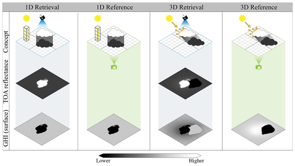
Retrievals of surface solar radiation from passive satellite instruments normally neglect the three-dimensional (3D) interaction between clouds and radiation. This study identifies error sources arising from this neglect and demonstrates their influence on retrieval accuracy across a range of spatial resolutions. At the resolution of current geostationary satellites, 3D interactions can already introduce considerable errors, underscoring the need to develop corrections that account for them.
Victor J. H. Trees, Ping Wang, Piet Stammes, Lieuwe G. Tilstra, David P. Donovan, and A. Pier Siebesma
Atmos. Meas. Tech., 18, 73–91, https://doi.org/10.5194/amt-18-73-2025, https://doi.org/10.5194/amt-18-73-2025, 2025
Short summary
Short summary
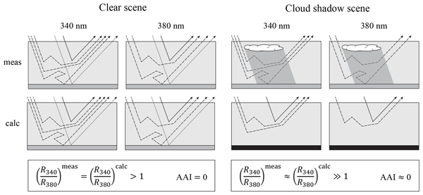
Our study investigates the impact of cloud shadows on satellite-based aerosol index measurements over Europe by TROPOMI. Using a cloud shadow detection algorithm and simulations, we found that the overall effect on the aerosol index is minimal. Interestingly, we found that cloud shadows are significantly bluer than their shadow-free surroundings, but the traditional algorithm already (partly) automatically corrects for this increased blueness.
Lieuwe G. Tilstra, Martin de Graaf, Victor J. H. Trees, Pavel Litvinov, Oleg Dubovik, and Piet Stammes
Atmos. Meas. Tech., 17, 2235–2256, https://doi.org/10.5194/amt-17-2235-2024, https://doi.org/10.5194/amt-17-2235-2024, 2024
Short summary
Short summary
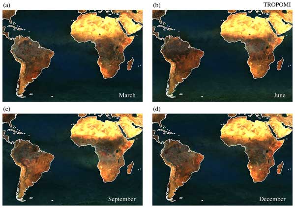
This paper introduces a new surface albedo climatology of directionally dependent Lambertian-equivalent reflectivity (DLER) observed by TROPOMI on the Sentinel-5 Precursor satellite. The database contains monthly fields of DLER for 21 wavelength bands at a relatively high spatial resolution of 0.125 by 0.125 degrees. The anisotropy of the surface reflection is handled by parameterisation of the viewing angle dependence.
Victor J. H. Trees, Ping Wang, Piet Stammes, Lieuwe G. Tilstra, David P. Donovan, and A. Pier Siebesma
Atmos. Meas. Tech., 15, 3121–3140, https://doi.org/10.5194/amt-15-3121-2022, https://doi.org/10.5194/amt-15-3121-2022, 2022
Short summary
Short summary
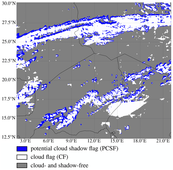
Cloud shadows are observed by the TROPOMI satellite instrument as a result of its high spatial resolution. These shadows contaminate TROPOMI's air quality measurements, because shadows are generally not taken into account in the models that are used for aerosol and trace gas retrievals. We present the Detection AlgoRithm for CLOud Shadows (DARCLOS) for TROPOMI, which is the first cloud shadow detection algorithm for a satellite spectrometer.
Konstantin Krüger, Martin Wirth, Athena Augusta Floutsi, David Patrick Donovan, Gerd-Jan van Zadelhoff, and Silke Martha Groß
Atmos. Meas. Tech., 19, 5923–5950, https://doi.org/10.5194/amt-19-5923-2026, https://doi.org/10.5194/amt-19-5923-2026, 2026
Short summary
Short summary
Cloud properties from three ATLID Level 2 products (A-TC, A-FM, A-CTH) of the EarthCARE satellite mission are validated using independent airborne lidar observations collected during satellite underflights in the tropics and extratropics. The products reliably represent cloud pixel distribution and cloud top height; though ice cloud pixels and cloud top height are slightly overestimated. Comparison with a more recent baseline shows improvements, supporting their use for cloud property studies.
Robin J. Hogan, Bernat Puigdomenech Treserras, Shannon L. Mason, Alexei Korolev, Zhipeng Qu, Kamil Mroz, David P. Donovan, Pavlos Kollias, and Mark D. Fielding
EGUsphere, https://doi.org/10.5194/egusphere-2026-5054, https://doi.org/10.5194/egusphere-2026-5054, 2026
Short summary
Short summary
The EarthCARE satellite carries advanced instruments that allow it to accurately infer vertical profiles of the properties of ice clouds, important for understanding their role in the climate system. Here we use detailed observations from meteorological research aircraft flying underneath the satellite to evaluate EarthCARE’s estimates of the mass of ice in the clouds, the average particle size, and even how fast the air is rising and falling within the cloud due to atmospheric gravity waves.
Martin de Graaf, Ping Wang, Nikos Benas, and Jan Fokke Meirink
EGUsphere, https://doi.org/10.5194/egusphere-2026-4481, https://doi.org/10.5194/egusphere-2026-4481, 2026
Short summary
Short summary
Clouds are monitored from space using satellite sensors, but the quantification of cloud properties are biased when smoke is overlying the clouds. This happens often near Africa, where biomass burning during the monsoonal dry season is common. The retrievals of the cloud properties can be improved when the absorption of the sunlight due to smoke is accounted for. In this paper, the change of cloud properties is quantified as a function of the amount of smoke in the atmosphere.
Tao Xie, Xiaoyun Zhang, Wenmei Li, Yixiang Chen, Ping Wang, Piet Stammes, Gijsbert Tilstra, Olaf Tuinder, Maarten Sneep, and Feng Lu
Int. Arch. Photogramm. Remote Sens. Spatial Inf. Sci., XLIX-B3-2026, 1487–1492, https://doi.org/10.5194/isprs-archives-XLIX-B3-2026-1487-2026, https://doi.org/10.5194/isprs-archives-XLIX-B3-2026-1487-2026, 2026
Holger Baars, Moritz Haarig, Leonard König, Athena A. Floutsi, Elizaveta Basharova, Julian Hofer, Henriette Gebauer, Ronny Engelmann, Dietrich Althausen, Annett Skupin, Benedikt Gast, Felix Fritzsch, Kevin Ohneiser, Cristofer Jimenez, Tom Gaudek, Martin Radenz, Håvard Buholdt, Birgit Heese, Andi Klamt, Patric Seifert, David P. Donovan, Gerd-Jan van Zadelhoff, Sabur F. Abdullaev, Shohina K. Khalifaeva, Dilovar F. Nozirov, and Ulla Wandinger
Atmos. Meas. Tech., 19, 3831–3864, https://doi.org/10.5194/amt-19-3831-2026, https://doi.org/10.5194/amt-19-3831-2026, 2026
Short summary
Short summary
The satellite mission EarthCARE (Earth Cloud, Aerosol, and Radiation Explorer) was launched in May 2024 and has 4 unique instruments on board. We used ground-based PollyNET/ACTRIS (Aerosol, Clouds and Trace gases Research Infrastructure) profiling data to discuss the quality of EarthCARE’s lidar products based on case studies from different geographic locations. Our investigations revealed that the space-borne lidar instrument has remarkable profiling capabilities but currently also still some limitations, however, not preventing first scientific studies when quality checking the data intensively.
Job I. Wiltink, Victor J. H. Trees, Chiel C. van Heerwaarden, and Jan Fokke Meirink
Atmos. Chem. Phys., 26, 7207–7233, https://doi.org/10.5194/acp-26-7207-2026, https://doi.org/10.5194/acp-26-7207-2026, 2026
Short summary
Short summary
Retrievals of surface solar radiation from passive satellite instruments normally neglect the three-dimensional (3D) interaction between clouds and radiation. This study identifies error sources arising from this neglect and demonstrates their influence on retrieval accuracy across a range of spatial resolutions. At the resolution of current geostationary satellites, 3D interactions can already introduce considerable errors, underscoring the need to develop corrections that account for them.
Thirza N. Feenstra, Willem Jan van de Berg, Gerd-Jan van Zadelhoff, David P. Donovan, Christiaan T. van Dalum, and Michiel R. van den Broeke
Atmos. Meas. Tech., 19, 1323–1344, https://doi.org/10.5194/amt-19-1323-2026, https://doi.org/10.5194/amt-19-1323-2026, 2026
Short summary
Short summary
Cloud representation brings large uncertainties in polar climate modeling. We show the first evaluation of Greenland clouds in the Regional Atmospheric Climate Model (RACMO2.4) with new EarthCARE satellite data. Comparing lidar and radar observations and retrieved cloud profiles with co-located RACMO output, we find RACMO captures low ice clouds but underestimates high clouds, mid-altitude liquid clouds, and snowfall. These results highlight EarthCARE's potential to improve polar climate models.
Konstantinos Rizos, Emmanouil Proestakis, Thanasis Georgiou, Antonis Gkikas, Eleni Marinou, Peristera Paschou, Kalliopi Artemis Voudouri, Athanasios Tsikerdekis, David P. Donovan, Gerd-Jan van Zadelhoff, Angela Benedetti, Holger Baars, Athena Augusta Floutsi, Nikos Benas, Martin Stengel, Christian Retscher, Edward Malina, and Vassilis Amiridis
Atmos. Meas. Tech., 19, 699–728, https://doi.org/10.5194/amt-19-699-2026, https://doi.org/10.5194/amt-19-699-2026, 2026
Short summary
Short summary
The Aeolus satellite's lidar system had limitations in detecting certain atmospheric layers and distinguishing between aerosol and cloud types. To improve accuracy, a new dust detection product was developed. By combining data from various sources and validating it with ground-based measurements, this enhanced product performs better than the original. It helps improve dust transport models and weather predictions, making it a valuable tool for atmospheric monitoring and forecasting.
Peristera Paschou, Nikolaos Siomos, Eleni Marinou, Antonis Gkikas, Samira M. Idrissa, Daniel T. Quaye, Désiré D. Fiogbe Attannon, Kalliopi Artemis Voudouri, Charikleia Meleti, David P. Donovan, George Georgoussis, Tommaso Parrinello, Thorsten Fehr, Jonas von Bismarck, and Vassilis Amiridis
Atmos. Meas. Tech., 18, 4731–4754, https://doi.org/10.5194/amt-18-4731-2025, https://doi.org/10.5194/amt-18-4731-2025, 2025
Short summary
Short summary
This study presents the results from a validation study on the Level 2A products (aerosol optical properties) of the ESA's (European Space Agency) Aeolus mission. Measurements from the eVe lidar, a combined linear/circular polarization and Raman lidar and ESA's ground reference system, that have been collected during the Joint Aeolus Tropical Atlantic Campaign are compared with collocated Aeolus Level 2A profiles obtained from the latest version (Baseline 16) of the Aeolus algorithms.
Job I. Wiltink, Hartwig Deneke, Chiel C. van Heerwaarden, and Jan Fokke Meirink
Atmos. Meas. Tech., 18, 3917–3936, https://doi.org/10.5194/amt-18-3917-2025, https://doi.org/10.5194/amt-18-3917-2025, 2025
Short summary
Short summary
Global horizontal irradiance retrievals from satellite observations are affected by spatial displacements due to parallax and cloud shadows. We assess different approaches to correct for these displacements and quantify their added value by comparison with a network of ground-based pyranometer observations. The corrections are found to become increasingly important at higher spatial resolutions and are most relevant for variable cloud types.
Martin de Graaf, Maarten Sneep, Mark ter Linden, L. Gijsbert Tilstra, David P. Donovan, Gerd-Jan van Zadelhoff, and J. Pepijn Veefkind
Atmos. Meas. Tech., 18, 2553–2571, https://doi.org/10.5194/amt-18-2553-2025, https://doi.org/10.5194/amt-18-2553-2025, 2025
Short summary
Short summary
The aerosol layer height (ALH) from the TROPOspheric Monitoring Instrument (TROPOMI) has been constantly improved since its release in 2019. Over bright surfaces, fitting the albedo improved the retrieval, as shown for a set of situations, ranging from multiple layers of smoke to thick desert dust plumes and low-altitude industrial pollution. The latest results of the operational ALH are compared to profiles from the ATmospheric LIDar (ATLID) on board the recently launched EarthCARE mission.
Laura Köhler, Julia Windmiller, Dariusz Baranowski, Michał Brennek, Michał Ciuryło, Lennéa Hayo, Daniel Kȩpski, Stefan Kinne, Beata Latos, Bertrand Lobo, Tobias Marke, Timo Nischik, Daria Paul, Piet Stammes, Artur Szkop, and Olaf Tuinder
Earth Syst. Sci. Data, 17, 633–659, https://doi.org/10.5194/essd-17-633-2025, https://doi.org/10.5194/essd-17-633-2025, 2025
Short summary
Short summary
We present atmospheric and oceanic data from the Atlantic References and Convection ship campaign with the Maria S. Merian from Mindelo to Punta Arenas observed with the integrated ship sensors; humidity and temperature profiler; ceilometer; aerosol instruments (Calitoo, Microtops, and DustTrak); radiosondes; uncrewed aircraft vehicles; and conductivity, temperature, and depth scans. The data include three complete profiles of the Intertropical Convergence Zone and a storm in the South Atlantic.
Victor J. H. Trees, Ping Wang, Piet Stammes, Lieuwe G. Tilstra, David P. Donovan, and A. Pier Siebesma
Atmos. Meas. Tech., 18, 73–91, https://doi.org/10.5194/amt-18-73-2025, https://doi.org/10.5194/amt-18-73-2025, 2025
Short summary
Short summary
Our study investigates the impact of cloud shadows on satellite-based aerosol index measurements over Europe by TROPOMI. Using a cloud shadow detection algorithm and simulations, we found that the overall effect on the aerosol index is minimal. Interestingly, we found that cloud shadows are significantly bluer than their shadow-free surroundings, but the traditional algorithm already (partly) automatically corrects for this increased blueness.
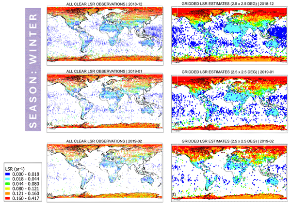
Lev D. Labzovskii, Gerd-Jan van Zadelhoff, David P. Donovan, Jos de Kloe, L. Gijsbert Tilstra, Ad Stoffelen, Damien Josset, and Piet Stammes
Atmos. Meas. Tech., 17, 7183–7208, https://doi.org/10.5194/amt-17-7183-2024, https://doi.org/10.5194/amt-17-7183-2024, 2024
Short summary
Short summary
The Atmospheric Laser Doppler Instrument (ALADIN) on the Aeolus satellite was the first of its kind to measure high-resolution vertical profiles of aerosols and cloud properties from space. We present an algorithm that produces Aeolus lidar surface returns (LSRs), containing useful information for measuring UV reflectivity. Aeolus LSRs matched well with existing UV reflectivity data from other satellites, like GOME-2 and TROPOMI, and demonstrated excellent sensitivity to modeled snow cover.
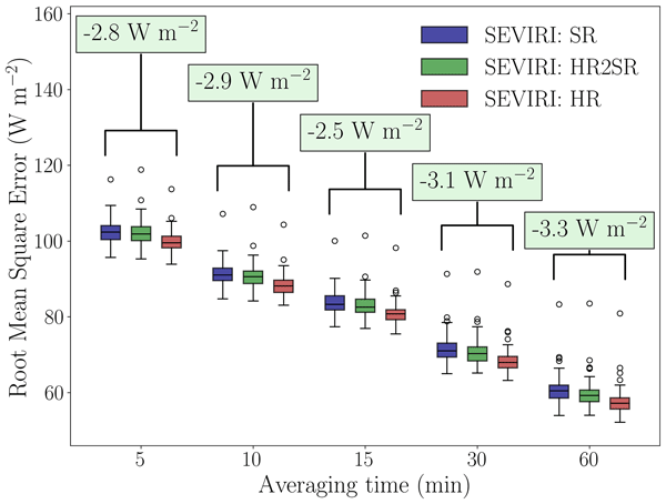
Job I. Wiltink, Hartwig Deneke, Yves-Marie Saint-Drenan, Chiel C. van Heerwaarden, and Jan Fokke Meirink
Atmos. Meas. Tech., 17, 6003–6024, https://doi.org/10.5194/amt-17-6003-2024, https://doi.org/10.5194/amt-17-6003-2024, 2024
Short summary
Short summary
Meteosat Spinning Enhanced Visible and Infrared Imager (SEVIRI) global horizontal irradiance (GHI) retrievals are validated at standard and increased spatial resolution against a network of 99 pyranometers. GHI accuracy is strongly dependent on the cloud regime. Days with variable cloud conditions show significant accuracy improvements when retrieved at higher resolution. We highlight the benefits of dense network observations and a cloud-regime-resolved approach in validating GHI retrievals.
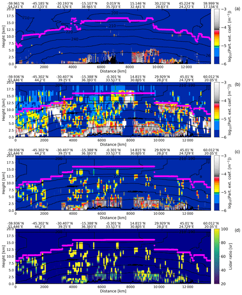
Ping Wang, David Patrick Donovan, Gerd-Jan van Zadelhoff, Jos de Kloe, Dorit Huber, and Katja Reissig
Atmos. Meas. Tech., 17, 5935–5955, https://doi.org/10.5194/amt-17-5935-2024, https://doi.org/10.5194/amt-17-5935-2024, 2024
Short summary
Short summary
We describe the new feature mask (AEL-FM) and aerosol profile retrieval (AEL-PRO) algorithms developed for Aeolus lidar and present the evaluation of the Aeolus products using CALIPSO data for dust aerosols over Africa. We have found that Aeolus and CALIPSO show similar aerosol patterns in the collocated orbits and have good agreement for the extinction coefficients for the dust aerosols, especially for the cloud-free scenes. The finding is applicable to Aeolus L2A product Baseline 17.
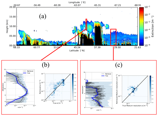
David Patrick Donovan, Gerd-Jan van Zadelhoff, and Ping Wang
Atmos. Meas. Tech., 17, 5301–5340, https://doi.org/10.5194/amt-17-5301-2024, https://doi.org/10.5194/amt-17-5301-2024, 2024
Short summary
Short summary
ATLID (atmospheric lidar) is the lidar to be flown on the Earth Clouds and Radiation Explorer satellite (EarthCARE). EarthCARE is a joint European–Japanese satellite mission that was launched in May 2024. ATLID is an advanced lidar optimized for cloud and aerosol property profile measurements. This paper describes some of the key novel algorithms being applied to this lidar to retrieve cloud and aerosol properties. Example results based on simulated data are presented and discussed.
Franciscus Liqui Lung, Christian Jakob, A. Pier Siebesma, and Fredrik Jansson
Geosci. Model Dev., 17, 4053–4076, https://doi.org/10.5194/gmd-17-4053-2024, https://doi.org/10.5194/gmd-17-4053-2024, 2024
Short summary
Short summary
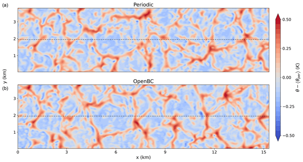
Traditionally, high-resolution atmospheric models employ periodic boundary conditions, which limit simulations to domains without horizontal variations. In this research open boundary conditions are developed to replace the periodic boundary conditions. The implementation is tested in a controlled setup, and the results show minimal disturbances. Using these boundary conditions, high-resolution models can be forced by a coarser model to study atmospheric phenomena in realistic background states.
Juliëtte C. S. Anema, Klaas Folkert Boersma, Piet Stammes, Gerbrand Koren, William Woodgate, Philipp Köhler, Christian Frankenberg, and Jacqui Stol
Biogeosciences, 21, 2297–2311, https://doi.org/10.5194/bg-21-2297-2024, https://doi.org/10.5194/bg-21-2297-2024, 2024
Short summary
Short summary
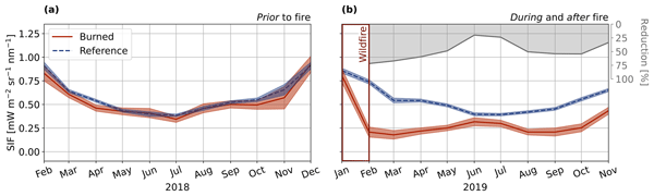
To keep the Paris agreement goals within reach, negative emissions are necessary. They can be achieved with mitigation techniques, such as reforestation, which remove CO2 from the atmosphere. While governments have pinned their hopes on them, there is not yet a good set of tools to objectively determine whether negative emissions do what they promise. Here we show how satellite measurements of plant fluorescence are useful in detecting carbon uptake due to reforestation and vegetation regrowth.
Andrés Yarce Botero, Michiel van Weele, Arjo Segers, Pier Siebesma, and Henk Eskes
Geosci. Model Dev., 17, 3765–3781, https://doi.org/10.5194/gmd-17-3765-2024, https://doi.org/10.5194/gmd-17-3765-2024, 2024
Short summary
Short summary
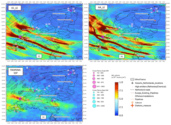
HARMONIE WINS50 reanalysis data with 0.025° × 0.025° resolution from 2019 to 2021 were coupled with the LOTOS-EUROS Chemical Transport Model. HARMONIE and ECMWF meteorology configurations against Cabauw observations (52.0° N, 4.9° W) were evaluated as simulated NO2 concentrations with ground-level sensors. Differences in crucial meteorological input parameters (boundary layer height, vertical diffusion coefficient) between the hydrostatic and non-hydrostatic models were analysed.
Nicole Docter, Anja Hünerbein, David P. Donovan, Rene Preusker, Jürgen Fischer, Jan Fokke Meirink, Piet Stammes, and Michael Eisinger
Atmos. Meas. Tech., 17, 2507–2519, https://doi.org/10.5194/amt-17-2507-2024, https://doi.org/10.5194/amt-17-2507-2024, 2024
Short summary
Short summary
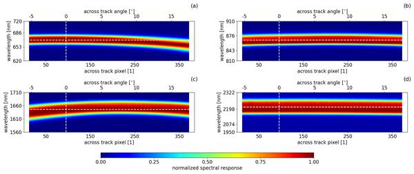
MSI is the imaging spectrometer on board EarthCARE and will provide across-track information on clouds and aerosol properties. The MSI solar channels exhibit a spectral misalignment effect (SMILE) in the measurements. This paper describes and evaluates how the SMILE will affect the cloud and aerosol retrievals that do not account for it.
Lieuwe G. Tilstra, Martin de Graaf, Victor J. H. Trees, Pavel Litvinov, Oleg Dubovik, and Piet Stammes
Atmos. Meas. Tech., 17, 2235–2256, https://doi.org/10.5194/amt-17-2235-2024, https://doi.org/10.5194/amt-17-2235-2024, 2024
Short summary
Short summary
This paper introduces a new surface albedo climatology of directionally dependent Lambertian-equivalent reflectivity (DLER) observed by TROPOMI on the Sentinel-5 Precursor satellite. The database contains monthly fields of DLER for 21 wavelength bands at a relatively high spatial resolution of 0.125 by 0.125 degrees. The anisotropy of the surface reflection is handled by parameterisation of the viewing angle dependence.
Shannon L. Mason, Howard W. Barker, Jason N. S. Cole, Nicole Docter, David P. Donovan, Robin J. Hogan, Anja Hünerbein, Pavlos Kollias, Bernat Puigdomènech Treserras, Zhipeng Qu, Ulla Wandinger, and Gerd-Jan van Zadelhoff
Atmos. Meas. Tech., 17, 875–898, https://doi.org/10.5194/amt-17-875-2024, https://doi.org/10.5194/amt-17-875-2024, 2024
Short summary
Short summary
When the EarthCARE mission enters its operational phase, many retrieval data products will be available, which will overlap both in terms of the measurements they use and the geophysical quantities they report. In this pre-launch study, we use simulated EarthCARE scenes to compare the coverage and performance of many data products from the European Space Agency production model, with the intention of better understanding the relation between products and providing a compact guide to users.
Moritz Haarig, Anja Hünerbein, Ulla Wandinger, Nicole Docter, Sebastian Bley, David Donovan, and Gerd-Jan van Zadelhoff
Atmos. Meas. Tech., 16, 5953–5975, https://doi.org/10.5194/amt-16-5953-2023, https://doi.org/10.5194/amt-16-5953-2023, 2023
Short summary
Short summary
The atmospheric lidar (ATLID) and Multi-Spectral Imager (MSI) will be carried by the EarthCARE satellite. The synergistic ATLID–MSI Column Products (AM-COL) algorithm described in the paper combines the strengths of ATLID in vertically resolved profiles of aerosol and clouds (e.g., cloud top height) with the strengths of MSI in observing the complete scene beside the satellite track and in extending the lidar information to the swath. The algorithm is validated against simulated test scenes.
David P. Donovan, Pavlos Kollias, Almudena Velázquez Blázquez, and Gerd-Jan van Zadelhoff
Atmos. Meas. Tech., 16, 5327–5356, https://doi.org/10.5194/amt-16-5327-2023, https://doi.org/10.5194/amt-16-5327-2023, 2023
Short summary
Short summary
The Earth Cloud, Aerosol and Radiation Explorer mission (EarthCARE) is a multi-instrument cloud–aerosol–radiation-oriented satellite for climate and weather applications. For this satellite mission to be successful, the development and implementation of new techniques for turning the measured raw signals into useful data is required. This paper describes how atmospheric model data were used as the basis for creating realistic high-resolution simulated data sets to facilitate this process.
Zhipeng Qu, David P. Donovan, Howard W. Barker, Jason N. S. Cole, Mark W. Shephard, and Vincent Huijnen
Atmos. Meas. Tech., 16, 4927–4946, https://doi.org/10.5194/amt-16-4927-2023, https://doi.org/10.5194/amt-16-4927-2023, 2023
Short summary
Short summary
The EarthCARE satellite mission Level 2 algorithm development requires realistic 3D cloud and aerosol scenes along the satellite orbits. One of the best ways to produce these scenes is to use a high-resolution numerical weather prediction model to simulate atmospheric conditions at 250 m horizontal resolution. This paper describes the production and validation of three EarthCARE test scenes.
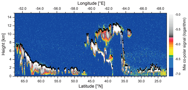
Ulla Wandinger, Moritz Haarig, Holger Baars, David Donovan, and Gerd-Jan van Zadelhoff
Atmos. Meas. Tech., 16, 4031–4052, https://doi.org/10.5194/amt-16-4031-2023, https://doi.org/10.5194/amt-16-4031-2023, 2023
Short summary
Short summary
We introduce the algorithms that have been developed to derive cloud top height and aerosol layer products from observations with the Atmospheric Lidar (ATLID) onboard the Earth Cloud, Aerosol and Radiation Explorer (EarthCARE). The products provide information on the uppermost cloud and geometrical and optical properties of aerosol layers in an atmospheric column. They can be used individually but also serve as input for algorithms that combine observations with EarthCARE’s lidar and imager.
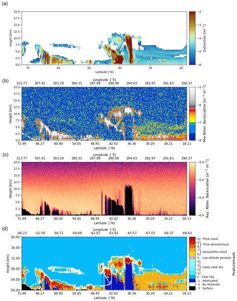
Gerd-Jan van Zadelhoff, David P. Donovan, and Ping Wang
Atmos. Meas. Tech., 16, 3631–3651, https://doi.org/10.5194/amt-16-3631-2023, https://doi.org/10.5194/amt-16-3631-2023, 2023
Short summary
Short summary
The Earth Clouds, Aerosols and Radiation (EarthCARE) satellite mission features the UV lidar ATLID. The ATLID FeatureMask algorithm provides a high-resolution detection probability mask which is used to guide smoothing strategies within the ATLID profile retrieval algorithm, one step further in the EarthCARE level-2 processing chain, in which the microphysical retrievals and target classification are performed.
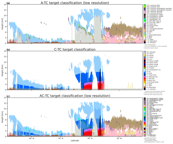
Abdanour Irbah, Julien Delanoë, Gerd-Jan van Zadelhoff, David P. Donovan, Pavlos Kollias, Bernat Puigdomènech Treserras, Shannon Mason, Robin J. Hogan, and Aleksandra Tatarevic
Atmos. Meas. Tech., 16, 2795–2820, https://doi.org/10.5194/amt-16-2795-2023, https://doi.org/10.5194/amt-16-2795-2023, 2023
Short summary
Short summary
The Cloud Profiling Radar (CPR) and ATmospheric LIDar (ATLID) aboard the EarthCARE satellite are used to probe the Earth's atmosphere by measuring cloud and aerosol profiles. ATLID is sensitive to aerosols and small cloud particles and CPR to large ice particles, snowflakes and raindrops. It is the synergy of the measurements of these two instruments that allows a better classification of the atmospheric targets and the description of the associated products, which are the subject of this paper.
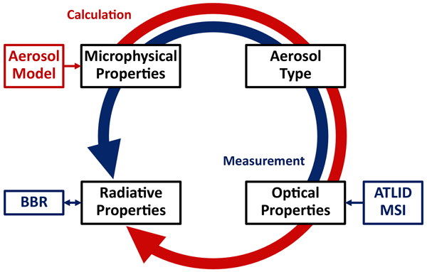
Ulla Wandinger, Athena Augusta Floutsi, Holger Baars, Moritz Haarig, Albert Ansmann, Anja Hünerbein, Nicole Docter, David Donovan, Gerd-Jan van Zadelhoff, Shannon Mason, and Jason Cole
Atmos. Meas. Tech., 16, 2485–2510, https://doi.org/10.5194/amt-16-2485-2023, https://doi.org/10.5194/amt-16-2485-2023, 2023
Short summary
Short summary
We introduce an aerosol classification model that has been developed for the Earth Clouds, Aerosols and Radiation Explorer (EarthCARE). The model provides a consistent description of microphysical, optical, and radiative properties of common aerosol types such as dust, sea salt, pollution, and smoke. It is used for aerosol classification and assessment of radiation effects based on the synergy of active and passive observations with lidar, imager, and radiometer of the multi-instrument platform.
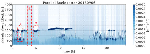
Martin de Graaf, Karolina Sarna, Jessica Brown, Elma V. Tenner, Manon Schenkels, and David P. Donovan
Atmos. Chem. Phys., 23, 5373–5391, https://doi.org/10.5194/acp-23-5373-2023, https://doi.org/10.5194/acp-23-5373-2023, 2023
Short summary
Short summary
Clouds over the oceans reflect sunlight and cool the earth. Simultaneous measurements were performed of cloud droplet sizes and smoke particles in and near the cloud base over Ascension Island, a remote island in the Atlantic Ocean, to determine the sensitivity of cloud droplets to smoke from the African continent. The smoke was found to reduce cloud droplet sizes, which makes the cloud droplets more susceptible to evaporation, reducing cloud lifetime.
Congcong Qiao, Song Liu, Juan Huo, Xihan Mu, Ping Wang, Shengjie Jia, Xuehua Fan, and Minzheng Duan
Atmos. Meas. Tech., 16, 1539–1549, https://doi.org/10.5194/amt-16-1539-2023, https://doi.org/10.5194/amt-16-1539-2023, 2023
Short summary
Short summary
We established a spectral-fitting method to derive precipitable water vapor (PWV) and aerosol optical depth based on a strict radiative transfer theory by the spectral measurements of direct sun from EKO MS711 and MS712 spectroradiometers. The retrievals were compared with that of the colocated CE-318 photometer; the results showed a high degree of consistency. In the PWV inversion, a strong water vapor absorption band around 1370 nm is introduced to retrieve PWV in a relatively dry atmosphere.
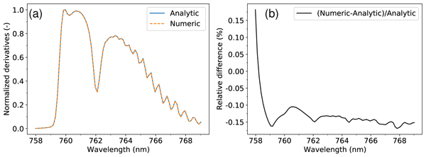
Johan F. de Haan, Ping Wang, Maarten Sneep, J. Pepijn Veefkind, and Piet Stammes
Geosci. Model Dev., 15, 7031–7050, https://doi.org/10.5194/gmd-15-7031-2022, https://doi.org/10.5194/gmd-15-7031-2022, 2022
Short summary
Short summary
We present an overview of the DISAMAR radiative transfer code, highlighting the novel semi-analytical derivatives for the doubling–adding formulae and the new DISMAS technique for weak absorbers. DISAMAR includes forward simulations and retrievals for satellite spectral measurements from 270 to 2400 nm to determine instrument specifications for passive remote sensing. It has been used in various Sentinel-4/5P/5 projects and in the TROPOMI aerosol layer height and ozone profile products.
Victor J. H. Trees, Ping Wang, Piet Stammes, Lieuwe G. Tilstra, David P. Donovan, and A. Pier Siebesma
Atmos. Meas. Tech., 15, 3121–3140, https://doi.org/10.5194/amt-15-3121-2022, https://doi.org/10.5194/amt-15-3121-2022, 2022
Short summary
Short summary
Cloud shadows are observed by the TROPOMI satellite instrument as a result of its high spatial resolution. These shadows contaminate TROPOMI's air quality measurements, because shadows are generally not taken into account in the models that are used for aerosol and trace gas retrievals. We present the Detection AlgoRithm for CLOud Shadows (DARCLOS) for TROPOMI, which is the first cloud shadow detection algorithm for a satellite spectrometer.
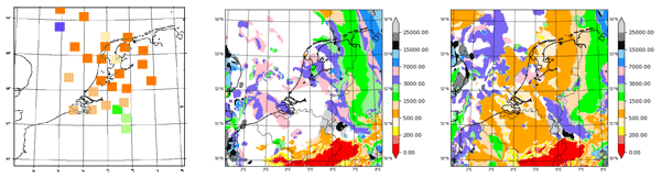
Wim C. de Rooy, Pier Siebesma, Peter Baas, Geert Lenderink, Stephan R. de Roode, Hylke de Vries, Erik van Meijgaard, Jan Fokke Meirink, Sander Tijm, and Bram van 't Veen
Geosci. Model Dev., 15, 1513–1543, https://doi.org/10.5194/gmd-15-1513-2022, https://doi.org/10.5194/gmd-15-1513-2022, 2022
Short summary
Short summary
This paper describes a comprehensive model update to the boundary layer schemes. Because the involved parameterisations are all built on widely applied frameworks, the here-described modifications are applicable to many NWP and climate models. The model update contains substantial modifications to the cloud, turbulence, and convection schemes and leads to a substantial improvement of several aspects of the model, especially low cloud forecasts.
Hugues Brenot, Nicolas Theys, Lieven Clarisse, Jeroen van Gent, Daniel R. Hurtmans, Sophie Vandenbussche, Nikolaos Papagiannopoulos, Lucia Mona, Timo Virtanen, Andreas Uppstu, Mikhail Sofiev, Luca Bugliaro, Margarita Vázquez-Navarro, Pascal Hedelt, Michelle Maree Parks, Sara Barsotti, Mauro Coltelli, William Moreland, Simona Scollo, Giuseppe Salerno, Delia Arnold-Arias, Marcus Hirtl, Tuomas Peltonen, Juhani Lahtinen, Klaus Sievers, Florian Lipok, Rolf Rüfenacht, Alexander Haefele, Maxime Hervo, Saskia Wagenaar, Wim Som de Cerff, Jos de Laat, Arnoud Apituley, Piet Stammes, Quentin Laffineur, Andy Delcloo, Robertson Lennart, Carl-Herbert Rokitansky, Arturo Vargas, Markus Kerschbaum, Christian Resch, Raimund Zopp, Matthieu Plu, Vincent-Henri Peuch, Michel Van Roozendael, and Gerhard Wotawa
Nat. Hazards Earth Syst. Sci., 21, 3367–3405, https://doi.org/10.5194/nhess-21-3367-2021, https://doi.org/10.5194/nhess-21-3367-2021, 2021
Short summary
Short summary
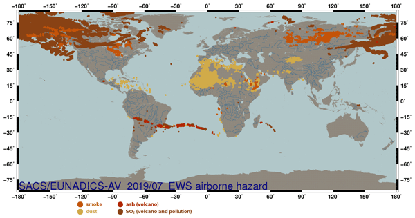
The purpose of the EUNADICS-AV (European Natural Airborne Disaster Information and Coordination System for Aviation) prototype early warning system (EWS) is to develop the combined use of harmonised data products from satellite, ground-based and in situ instruments to produce alerts of airborne hazards (volcanic, dust, smoke and radionuclide clouds), satisfying the requirement of aviation air traffic management (ATM) stakeholders (https://cordis.europa.eu/project/id/723986).
Cited articles
Anderson, G. P., Clough, S. A., Kneizys, F. X., Chetwynd, J. H., and Shettle, E. P.: AFGL Atmospheric Constituent Profiles (0–120 km), AFGL-TR-86-0110, Air Force Geophysics Laboratory, Hanscom Air Force Base, MA, Environmental Research Papers, No. 954, ADA175173, 1986. a
Bagnulo, S., Belskaya, I., Cellino, A., Kwon, Y. G., Muñoz, O., and Stam, D. M.: Polarimetry of Solar System minor bodies and planets: Polarimetry of Solar System minor bodies and planets, Astron. Astrophys. Rev., 32, 7, https://doi.org/10.1007/s00159-024-00157-w, 2024. a
Barker, H. W., Goldstein, R. K., and Stevens, D. E.: Monte Carlo Simulation of Solar Reflectances for Cloudy Atmospheres, J. Atmos. Sci., 60, 1881–1894, https://doi.org/10.1175/1520-0469(2003)060<1881:MCSOSR>2.0.CO;2, 2003. a, b, c
Barlakas, V., Macke, A., and Wendisch, M.: SPARTA – Solver for Polarized Atmospheric Radiative Transfer Applications: Introduction and application to Saharan dust fields, J. Quant. Spectrosc. Ra., 178, 77–92, https://doi.org/10.1016/j.jqsrt.2016.02.019, 2016. a, b
Bartel, S. and Hielscher, A. H.: Monte Carlo Simulations of the Diffuse Backscattering Mueller Matrix for Highly Scattering Media, Appl. Optics, 39, 1580–1588, https://doi.org/10.1364/AO.39.001580, 2000. a
Bass, A. M. and Paur, R. J.: The ultraviolet cross-sections of ozone. I. The measurements. II – Results and temperature dependence, in: Atmospheric ozone; Proceedings of the Quadrennial, edited by: Zerefos, C. S. and Ghazi, A., 606–616, https://doi.org/10.1007/978-94-009-5313-0_120, 1985. a, b
Bates, D. R.: Rayleigh scattering by air, Planet. Space Sci., 32, 785–790, https://doi.org/10.1016/0032-0633(84)90102-8, 1984. a
Bodhaine, B. A., Wood, N. B., Dutton, E. G., and Slusser, J. R.: On Rayleigh Optical Depth Calculations, J. Atmos. Ocean. Tech., 16, 1854, https://doi.org/10.1175/1520-0426(1999)016<1854:ORODC>2.0.CO;2, 1999. a
Breon, F. M. and Doutriaux-Boucher, M.: A Comparison of Cloud Droplet Radii Measured From Space, IEEE T. Geosci. Remote Sens., 43, 1796–1805, https://doi.org/10.1109/TGRS.2005.852838, 2005. a
Buras, R. and Mayer, B.: Efficient unbiased variance reduction techniques for Monte Carlo simulations of radiative transfer in cloudy atmospheres: The solution, J. Quant. Spectrosc. Ra., 112, 434–447, https://doi.org/10.1016/j.jqsrt.2010.10.005, 2011. a
Collins, D. G., Blättner, W. G., Wells, M. B., and Horak, H. G.: Backward Monte Carlo Calculations of the Polarization Characteristics of the Radiation Emerging from Spherical-Shell Atmospheres, Appl. Optics, 11, 2684–2696, https://doi.org/10.1364/AO.11.002684, 1972. a, b, c
Cornet, C., C-Labonnote, L., and Szczap, F.: Three-dimensional polarized Monte Carlo atmospheric radiative transfer model (3DMCPOL): 3D effects on polarized visible reflectances of a cirrus cloud, J. Quant. Spectrosc. Ra., 111, 174–186, https://doi.org/10.1016/j.jqsrt.2009.06.013, 2010. a, b
Cornet, C., C.-Labonnote, L., Waquet, F., Szczap, F., Deaconu, L., Parol, F., Vanbauce, C., Thieuleux, F., and Riédi, J.: Cloud heterogeneity on cloud and aerosol above cloud properties retrieved from simulated total and polarized reflectances, Atmos. Meas. Tech., 11, 3627–3643, https://doi.org/10.5194/amt-11-3627-2018, 2018. a
Deirmendjian, D.: Electromagnetic scattering on spherical polydispersions., American Elsevier Publishing Company, ISBN 0-444-00038-0, 1969. a
Dekking, F., Kraaikamp, C., Lopuhaa, H., and Meester, L.: A modern introduction to probability theory and statistics, Springer Londen, ISBN 1-85233-896-2, https://doi.org/10.1007/1-84628-168-7, 2005. a
Deschamps, P. Y., Breon, F. M., Leroy, M., Podaire, A., Bricaud, A., Buriez, J. C., and Seze, G.: The POLDER mission: instrument characteristics and scientific objectives, IEEE T. Geosci. Remote Sens., 32, 598–615, https://doi.org/10.1109/36.297978, 1994. a
Deutschmann, T.: On Modeling Elastic and Inelastic Polarized Radiation Transport in the Earth Atmosphere with Monte Carlo Methods, Dissertation (Dr. Rer. Nat.), Universität Leipzig, Leipzig, Germany, http://www.tim-deutschmann.de/McArtim/documents/Dissertation.pdf (last access: 2 October 2026), 2015. a
Deutschmann, T., Beirle, S., Frieß, U., Grzegorski, M., Kern, C., Kritten, L., Platt, U., Prados-Román, C., Puķı¯te, J., Wagner, T., Werner, B., and Pfeilsticker, K.: The Monte Carlo atmospheric radiative transfer model McArtim: Introduction and validation of Jacobians and 3D features, J. Quant. Spectrosc. Ra., 112, 1119–1137, https://doi.org/10.1016/j.jqsrt.2010.12.009, 2011. a, b
Emde, C. and Mayer, B.: Errors induced by the neglect of polarization in radiance calculations for three-dimensional cloudy atmospheres, J. Quant. Spectrosc. Ra., 218, 151–160, https://doi.org/10.1016/j.jqsrt.2018.07.001, 2018. a
Emde, C., Buras, R., Mayer, B., and Blumthaler, M.: The impact of aerosols on polarized sky radiance: model development, validation, and applications, Atmos. Chem. Phys., 10, 383–396, https://doi.org/10.5194/acp-10-383-2010, 2010. a, b, c, d
Emde, C., Barlakas, V., Cornet, C., Evans, F., Wang, Z., Labonotte, L. C., Macke, A., Mayer, B., and Wendisch, M.: IPRT polarized radiative transfer model intercomparison project – Three-dimensional test cases (phase B), J. Quant. Spectrosc. Ra., 209, 19–44, https://doi.org/10.1016/j.jqsrt.2018.01.024, 2018. a, b, c, d, e, f, g, h, i, j, k, l, m, n, o, p
Evans, K. F.: The Spherical Harmonics Discrete Ordinate Method for Three-Dimensional Atmospheric Radiative Transfer, J. Atmos. Sci., 55, 429–446, https://doi.org/10.1175/1520-0469(1998)055<0429:TSHDOM>2.0.CO;2, 1998. a
Fauchez, T., Cornet, C., Szczap, F., Dubuisson, P., and Rosambert, T.: Impact of cirrus clouds heterogeneities on top-of-atmosphere thermal infrared radiation, Atmos. Chem. Phys., 14, 5599–5615, https://doi.org/10.5194/acp-14-5599-2014, 2014. a
Gay, B., Vaillon, R., and Pınar Mengüç, M.: Polarization imaging of multiply-scattered radiation based on integral-vector Monte Carlo method, J. Quant. Spectrosc. Ra., 111, 287–294, 2010. a
Ghail, R., Ansan, V., Bovolo, F., Breuer, D., Campbell, B., and Kiefer, W.: EnVision assessment study report – Understanding why Earth's closest neighbour is so different (ESA/SCI(2021)1), European Space Agency, https://sci.esa.int/web/cosmic-vision/-/envision-assessment-study-report-yellow-book (last access: 2 October 2026), 2021. a
Hale, G. M. and Querry, M. R.: Optical Constants of Water in the 200-nm to 200 µm Wavelength Region, Appl. Optics, 12, 555–563, https://doi.org/10.1364/AO.12.000555, 1973. a
Hansen, J. E. and Hovenier, J. W.: Interpretation of the polarization of Venus, J. Atmos. Sci., 31, 1137–1160, https://doi.org/10.1175/1520-0469(1974)031<1137:IOTPOV>2.0.CO;2, 1974. a, b
Hasekamp, O. P.: Capability of multi-viewing-angle photo-polarimetric measurements for the simultaneous retrieval of aerosol and cloud properties, Atmos. Meas. Tech., 3, 839–851, https://doi.org/10.5194/amt-3-839-2010, 2010. a
Hasekamp, O. P., Fu, G., Rusli, S. P., Wu, L., Di Noia, A., Brugh, J. A. D., Landgraf, J., Martijn Smit, J., Rietjens, J., and van Amerongen, A.: Aerosol measurements by SPEXone on the NASA PACE mission: expected retrieval capabilities, J. Quant. Spectrosc. Ra., 227, 170–184, https://doi.org/10.1016/j.jqsrt.2019.02.006, 2019. a
Haus, R., Kappel, D., and Arnold, G.: Radiative heating and cooling in the middle and lower atmosphere of Venus and responses to atmospheric and spectroscopic parameter variations, Planet. Space Sci., 117, 262–294, https://doi.org/10.1016/j.pss.2015.06.024, 2015. a, b
Hovenier, J. W. and van der Mee, C. V. M.: Fundamental relationships relevant to the transfer of polarized light in a scattering atmosphere, Astron. Astrophys., 128, 1–16, 1983. a
Karalidi, T., Stam, D. M., and Hovenier, J. W.: Flux and polarisation spectra of water clouds on exoplanets, Astron. Astrophys., 530, A69, https://doi.org/10.1051/0004-6361/201116449, 2011. a
Kemp, J., Henson, G., Steiner, C., Beardsley, I., and Powell, E.: The optical polarization of the Sun, measured at a sensitivity of parts in ten million, Nature, 328, https://doi.org/10.1038/328092a0, 1987. a, b
Kroese, D. P., Taimre, T., and Botev, Z. I.: Handbook of Monte Carlo Methods, Wiley Series in Probability and Statistics, John Wiley & Sons, ISBN 978-0-470-17793-8, https://doi.org/10.1002/9781118014967, 2011. a, b, c, d
Liou, K. N.: An Introduction to Atmospheric Radiation, Academic Press, San Diego, CA, 2nd edn., ISBN 9780124514515, 2002. a
Marbach, T., Riedi, J., Lacan, A., and Schlüssel, P.: The 3MI mission: multi-viewing-channel-polarisation imager of the EUMETSAT polar system: second generation (EPS-SG) dedicated to aerosol and cloud monitoring, in: Polarization Science and Remote Sensing VII, edited by: Shaw, J. A. and LeMaster, D. A., Vol. 9613, Society of Photo-Optical Instrumentation Engineers (SPIE) Conference Series, 961310, https://doi.org/10.1117/12.2186978, 2015. a
Marchand, R. and Ackerman, T.: Evaluation of radiometric measurements from the NASA Multiangle Imaging Spectroradiometer (MISR): Two- and three-dimensional radiative transfer modeling of an inhomogeneous stratocumulus cloud deck, J. Geophys. Res.-Atmos., 109, D18208, https://doi.org/10.1029/2004JD004710, 2004. a
Marchuk, G. I., Mikhailov, G. A., Nazaraliev, M. A., Darbinjan, R. A., Kargin, B. A., and Elepov, B. S.: The Monte Carlo Methods in Atmospheric Optics, Vol. 12, Springer Series in Optical Sciences, Springer-Verlag, Berlin, Heidelberg, ISBN 978-3-662-13503-7, https://doi.org/10.1007/978-3-540-35237-2, 1980. a, b, c, d, e
Marshak, A., Platnick, S., Várnai, T., Wen, G., and Cahalan, R. F.: Impact of three-dimensional radiative effects on satellite retrievals of cloud droplet sizes, J. Geophys. Res.-Atmos., 111, D09207, https://doi.org/10.1029/2005JD006686, 2006. a
McBride, B. A., Sienkiewicz, N., Xu, X., Puthukkudy, A., Fernandez-Borda, R., and Martins, J. V.: In-flight characterization of the Hyper-Angular Rainbow Polarimeter (HARP2) on the NASA PACE mission, in: Society of Photo-Optical Instrumentation Engineers (SPIE) Conference Series, edited by: Babu, S. R., Hélière, A., and Kimura, T., Vol. 13192, Society of Photo-Optical Instrumentation Engineers (SPIE) Conference Series, 131920H, https://doi.org/10.1117/12.3033680, 2024. a
Mishchenko, M. I. and Travis, L. D.: Satellite retrieval of aerosol properties over the ocean using polarization as well as intensity of reflected sunlight, J. Geophys. Res., 102, 16989–17013, https://doi.org/10.1029/96JD02425, 1997. a
Mishchenko, M. I., Lacis, A. A., and Travis, L. D.: Errors induced by the neglect of polarization in radiance calculations for Rayleigh-scattering atmospheres, J. Quant. Spectrosc. Ra., 51, 491–510, https://doi.org/10.1016/0022-4073(94)90149-X, 1994. a
Moroz, V. I.: The Atmosphere of Venus, Space Sci. Rev., 29, 3–127, https://doi.org/10.1007/BF00177144, 1981. a
Natraj, V., Li, K.-F., and Yung, Y. L.: Rayleigh Scattering in Planetary Atmospheres: Corrected Tables Through Accurate Computation of X and Y Functions, Astrophys. J., 691, 1909–1920, https://doi.org/10.1088/0004-637X/691/2/1909, 2009. a
Neefs, E., Vandaele, A. C., De Cock, R., Erwin, J., Robert, S., Thomas, I. R., Berkenbosch, S., Jacobs, L., Bogaert, P., Beeckman, B., Brassine, A., Messios, N., De Donder, E., Bolsée, D., Pereira, N., Tackley, P., Gerya, T., Kögl, S., Kögl, P., Gröbelbauer, H. P., Wirz, F., Székely, G., Eaton, N., Roibás-Millán, E., Torralbo, I., Rubio-Arnaldo, H., Alvarez, J. M., Navajas Ortega, D., De Vos, L., Sørensen, R., Moelans, W., Algoedt, A., Blau, M., Stam, D., Renotte, E., Klinkenberg, P., Borguet, B., Thomas, S., Vervaeke, M., Thienpont, H., Castro, J. M., and Jimenez, J.: VenSpec-H spectrometer on the ESA EnVision mission: Design, modeling, analysis, Acta Astronaut., 226, 178–201, https://doi.org/10.1016/j.actaastro.2024.10.018, 2025. a
Palmer, K. F. and Williams, D.: Optical constants of sulfuric acid; application to the clouds of Venus?, Appl. Optics, 14, 208–219, https://doi.org/10.1364/AO.14.000208, 1975. a
Peck, E. R. and Reeder, K.: Dispersion of Air*, J. Opt. Soc. Am., 62, 958, https://doi.org/10.1364/JOSA.62.000958, 1972. a, b
Ramon, D., Steinmetz, F., Jolivet, D., Compiègne, M., and Frouin, R.: Modeling polarized radiative transfer in the ocean-atmosphere system with the GPU-accelerated SMART-G Monte Carlo code, J. Quant. Spectrosc. Ra., 222, 89–107, https://doi.org/10.1016/j.jqsrt.2018.10.017, 2019. a, b
Rice, J. A.: Mathematical Statistics and Data Analysis, Cengage Learning, Belmont, CA, 3rd Edn., ISBN 978-0-534-39942-9, 2007. a
Rossi, L., Berzosa-Molina, J., Desert, J. M., Fossati, L., García Muñoz, A., Haswell, C., Kabath, P., Kislyakova, K., Stam, D., and Vidotto, A.: Spectropolarimetry as a tool for understanding the diversity of planetary atmospheres, Exp. Astron., 54, 1187–1196, https://doi.org/10.1007/s10686-021-09813-w, 2022. a
Seiff, A., Schofield, J. T., Kliore, A. J., Taylor, F. W., Limaye, S. S., Revercomb, H. E., Sromovsky, L. A., Kerzhanovich, V. V., Moroz, V. I., and Marov, M. Y.: Models of the structure of the atmosphere of Venus from the surface to 100 kilometers altitude, Adv. Space Res., 5, 3–58, https://doi.org/10.1016/0273-1177(85)90197-8, 1985. a
Sneep, M. and Ubachs, W.: Direct measurement of the Rayleigh scattering cross section in various gases, J. Quant. Spectrosc. Ra., 92, 293–310, https://doi.org/10.1016/j.jqsrt.2004.07.025, 2005. a, b, c
Spada, F., Krol, M. C., and Stammes, P.: McSCIA: application of the Equivalence Theorem in a Monte Carlo radiative transfer model for spherical shell atmospheres, Atmos. Chem. Phys., 6, 4823–4842, https://doi.org/10.5194/acp-6-4823-2006, 2006. a
Spilling, D. and Thales, A.: The Multi Angle Polarimeter (MAP) on board ESA's Copernicus Carbon Dioxide Monitoring mission (CO2M), in: International Conference on Space Optics – ICSO 2020, edited by: Cugny, B., Sodnik, Z., and Karafolas, N., Vol. 11852, 118520R, International Society for Optics and Photonics, SPIE, https://doi.org/10.1117/12.2599174, 2021. a
Stam, D. M.: Spectropolarimetric signatures of Earth-like extrasolar planets, Astron. Astrophys., 482, 989–1007, https://doi.org/10.1051/0004-6361:20078358, 2008. a
Stam, D. M. and Hovenier, J. W.: Errors in calculated planetary phase functions and albedos due to neglecting polarization, Astron. Astrophys., 444, 275–286, https://doi.org/10.1051/0004-6361:20053698, 2005. a
Stam, D. M., de Haan, J. F., Hovenier, J. W., and Stammes, P.: A fast method for simulating observations of polarized light emerging from the atmosphere applied to the oxygen-A band, J. Quant. Spectrosc. Ra., 64, 131–149, https://doi.org/10.1016/S0022-4073(99)00009-6, 2000. a
Stammes, P.: Spectral radiance modelling in the UV-visible range, IRS 2000: Current Problems in Atmospheric Radiation, edited by: Smith, W. L. and Timofeyev, Y. M., A. Deepak Publishing, Hampton, Virginia, 385–388, ISBN 978-0-937194-43-0, 2001. a
Stap, F. A., Hasekamp, O. P., Emde, C., and Röckmann, T.: Influence of 3D effects on 1D aerosol retrievals in synthetic, partially clouded scenes, J. Quant. Spectrosc. Ra., 170, 54–68, https://doi.org/10.1016/j.jqsrt.2015.10.008, 2016a. a
Stap, F. A., Hasekamp, O. P., Emde, C., and Röckmann, T.: Multiangle photopolarimetric aerosol retrievals in the vicinity of clouds: Synthetic study based on a large eddy simulation, J. Geophys. Res.-Atmos., 121, 12914–12935, https://doi.org/10.1002/2016JD024787, 2016b. a
Stevens, B., Moeng, C.-H., and Sullivan, P. P.: Large-Eddy Simulations of Radiatively Driven Convection: Sensitivities to the Representation of Small Scales, J. Atmos. Sci., 56, 3963–3984, https://doi.org/10.1175/1520-0469(1999)056<3963:LESORD>2.0.CO;2, 1999. a
Trees, V.: MONKI (Monte Carlo KNMI), Zenodo [code, data set], https://doi.org/10.5281/zenodo.22737661, 2026. a
Trees, V. J. H. and Stam, D. M.: Blue, white, and red ocean planets. Simulations of orbital variations in flux and polarization colors, Astron. Astrophys., 626, A129, https://doi.org/10.1051/0004-6361/201935399, 2019. a
Trees, V. J. H. and Stam, D. M.: Ocean signatures in the total flux and polarization spectra of Earth-like exoplanets, Astron. Astrophys., 664, A172, https://doi.org/10.1051/0004-6361/202243591, 2022. a
Trees, V. J. H., Wang, P., Stammes, P., Tilstra, L. G., Donovan, D. P., and Siebesma, A. P.: DARCLOS: a cloud shadow detection algorithm for TROPOMI, Atmos. Meas. Tech., 15, 3121–3140, https://doi.org/10.5194/amt-15-3121-2022, 2022. a
Trees, V. J. H., Wang, P., Stammes, P., Tilstra, L. G., Donovan, D. P., and Siebesma, A. P.: Cancellation of cloud shadow effects in the absorbing aerosol index retrieval algorithm of TROPOMI, Atmos. Meas. Tech., 18, 73–91, https://doi.org/10.5194/amt-18-73-2025, 2025. a, b
van Amerongen, A., Rietjens, J., Campo, J., Dogan, E., Dingjan, J., Nalla, R., Caron, J., and Hasekamp, O.: SPEXone: a compact multi-angle polarimeter, in: International Conference on Space Optics – ICSO 2018, edited by: Sodnik, Z., Karafolas, N., and Cugny, B., Vol. 11180, Society of Photo-Optical Instrumentation Engineers (SPIE) Conference Series, 111800L, https://doi.org/10.1117/12.2535940, 2019. a
van de Hulst, H. C.: Light Scattering by Small Particles, Dover Publications, New York, ISBN 978-0486642284, 1981. a
Vanderbilt, V., Grant, L., and Daughtry, C.: Polarization of light scattered by vegetation, P. IEEE, 73, 1012–1024, https://doi.org/10.1109/PROC.1985.13232, 1985. a
Várnai, T., Marshak, A., and Yang, W.: Multi-satellite aerosol observations in the vicinity of clouds, Atmos. Chem. Phys., 13, 3899–3908, https://doi.org/10.5194/acp-13-3899-2013, 2013. a
Vaughan, S. R., Gebhard, T. D., Bott, K., Casewell, S. L., Cowan, N. B., Doelman, D. S., Kenworthy, M., Mazoyer, J., Millar-Blanchaer, M. A., Trees, V. J. H., Stam, D. M., Absil, O., Altinier, L., Baudoz, P., Belikov, R., Bidot, A., Birkby, J. L., Bonse, M. J., Brandl, B., Carlotti, A., Choquet, E., van Dam, D., Desai, N., Fogarty, K., Fowler, J., van Gorkom, K., Gutierrez, Y., Guyon, O., Haffert, S. Y., Herscovici-Schiller, O., Hours, A., Juanola-Parramon, R., Kleisioti, E., König, L., van Kooten, M., Krasteva, M., Laginja, I., Landman, R., Leboulleux, L., Mouillet, D., N'Diaye, M., Por, E. H., Pueyo, L., and Snik, F.: Chasing rainbows and ocean glints: Inner working angle constraints for the Habitable Worlds Observatory, Mon. Not. R. Astron. Soc., 524, 5477–5485, https://doi.org/10.1093/mnras/stad2127, 2023. a
Veefkind, J. P., Aben, I., McMullan, K., Förster, H., de Vries, J., Otter, G., Claas, J., Eskes, H. J., de Haan, J. F., Kleipool, Q., van Weele, M., Hasekamp, O., Hoogeveen, R., Landgraf, J., Snel, R., Tol, P., Ingmann, P., Voors, R., Kruizinga, B., Vink, R., Visser, H., and Levelt, P. F.: TROPOMI on the ESA Sentinel-5 Precursor: A GMES mission for global observations of the atmospheric composition for climate, air quality and ozone layer applications, Remote Sens. Environ., 120, 70–83, https://doi.org/10.1016/j.rse.2011.09.027, 2012. a
Wang, Z., Cui, S., Yang, J., Gao, H., Liu, C., and Zhang, Z.: A novel hybrid scattering order-dependent variance reduction method for Monte Carlo simulations of radiative transfer in cloudy atmosphere, J. Quant. Spectrosc. Ra., 189, 283–302, https://doi.org/10.1016/j.jqsrt.2016.12.002, 2017. a, b
Wang, Z., Cui, S., Zhang, Z., Yang, J., Gao, H., and Zhang, F.: Theoretical extension of universal forward and backward Monte Carlo radiative transfer modeling for passive and active polarization observation simulations, J. Quant. Spectrosc. Ra., 235, 81–94, https://doi.org/10.1016/j.jqsrt.2019.06.025, 2019. a, b, c
Waquet, F., Cornet, C., Deuzé, J.-L., Dubovik, O., Ducos, F., Goloub, P., Herman, M., Lapyonok, T., Labonnote, L. C., Riedi, J., Tanré, D., Thieuleux, F., and Vanbauce, C.: Retrieval of aerosol microphysical and optical properties above liquid clouds from POLDER/PARASOL polarization measurements, Atmos. Meas. Tech., 6, 991–1016, https://doi.org/10.5194/amt-6-991-2013, 2013. a
Wen, G., Marshak, A., Levy, R. C., Remer, L. A., Loeb, N. G., Várnai, T., and Cahalan, R. F.: Improvement of MODIS aerosol retrievals near clouds, J. Geophys. Res.-Atmos., 118, 9168–9181, https://doi.org/10.1002/jgrd.50617, 2013. a
Werdell, P. J., Behrenfeld, M. J., Bontempi, P. S., Boss, E., Cairns, B., Davis, G. T., Franz, B. A., Gliese, U. B., Gorman, E. T., Hasekamp, O., Knobelspiesse, K. D., Mannino, A., Martins, J. V., McClain, C. R., Meister, G., and Remer, L. A.: The Plankton, Aerosol, Cloud, Ocean Ecosystem Mission: Status, Science, Advances, B. Am. Meteorol. Soc., 100, 1775–1794, https://doi.org/10.1175/BAMS-D-18-0056.1, 2019. a
Whitney, B. A.: Monte Carlo radiative transfer, in: Fluid Flows To Black Holes: A Tribute to S Chandrasekhar on His Birth Centenary, edited by: Saikia, D. J. and Trimble, V., 151–176, World Scientific Publishing Co. Pte. Ltd, https://doi.org/10.1142/9789814374774_0011, 2011. a
Wilmouth, D. M. and Sayres, D. S.: Determination of Rayleigh scattering cross sections and indices of refraction for Ar, CO2, SF6, and CH4 using BBCES in the ultraviolet, J. Quant. Spectrosc. Ra., 255, 107224, https://doi.org/10.1016/j.jqsrt.2020.107224, 2020. a, b
Wiltink, J. I., Trees, V. J. H., van Heerwaarden, C. C., and Meirink, J. F.: Errors in satellite-based global horizontal irradiance retrievals due to three-dimensional cloud-radiation interactions, Atmos. Chem. Phys., 26, 7207–7233, https://doi.org/10.5194/acp-26-7207-2026, 2026. a
Short summary
We present MONKI (Monte Carlo KNMI), an accurate and efficient Fortran radiative transfer code for simulating total and polarised sunlight in 3D planetary atmospheres. Its novelty is the derivation of Monte Carlo equations for the transfer of polarised light, fully accounting for polarisation-dependent scattering directions. This formulation gives reliable convergence even for optically thick, strongly polarising atmospheres, supporting observations of Earth, Venus, or any other planet.
We present MONKI (Monte Carlo KNMI), an accurate and efficient Fortran radiative transfer code...


