
Articles | Volume 19, issue 18
https://doi.org/10.5194/gmd-19-8915-2026
© Author(s) 2026. This work is distributed under
the Creative Commons Attribution 4.0 License.
the Creative Commons Attribution 4.0 License.
https://doi.org/10.5194/gmd-19-8915-2026
© Author(s) 2026. This work is distributed under
the Creative Commons Attribution 4.0 License.
the Creative Commons Attribution 4.0 License.
Model description paper
| 
22 Sep 2026
Model description paper |
| 22 Sep 2026
| 22 Sep 2026
DIRECT 1.0: a diffusion-based generative model for dense sea surface temperature reconstructions from sparse satellite observations
Grega Rovšček
CORRESPONDING AUTHOR

Faculty of Computer and Information Science, Visual Cognitive Systems Lab, University of Ljubljana, Ljubljana, Slovenia
Matjaž Ličer
Slovenian Environment Agency, Office for Meteorology, Hydrology and Oceanography, Ljubljana, Slovenia
National Institute of Biology, Marine Biology Station, Piran, Slovenia
Faculty of Mathematics and Physics, University of Ljubljana, Ljubljana, Slovenia
Alexander Barth
Department of Astrophysics, Geophysics and Oceanography, Geohydrodynamics and Environment Research, University of Liège, Liège, Belgium
Matej Kristan
Faculty of Computer and Information Science, Visual Cognitive Systems Lab, University of Ljubljana, Ljubljana, Slovenia
Related authors
No articles found.
Zhuomin Li, Aida Alvera-Azcárate, Alexander Barth, Nathaniel Bensoussan, Lei Guan, and Na Xu
EGUsphere, https://doi.org/10.5194/egusphere-2026-5436, https://doi.org/10.5194/egusphere-2026-5436, 2026
This preprint is open for discussion and under review for Ocean Science (OS).
Short summary
Short summary
In the Gulf of Lion, summer–autumn northwest winds drive coastal upwelling cooling often masked in satellite/reanalysis SST by clouds and strict quality control. We reconstruct HY-1D COCTS SST and validate against three coastal stations. It captures most events but underestimates cooling. We add wind-informed cloud detection using wind speed/direction to recover cold upwelling pixels mislabeled as cloud. Results match in situ SST better, improving SST availability for upwelling studies.
Iva Međugorac, Nikola Metličić, Jadranka Šepić, Marko Rus, Srđan Čupić, Matej Kristan, and Matjaž Ličer
EGUsphere, https://doi.org/10.5194/egusphere-2026-3411, https://doi.org/10.5194/egusphere-2026-3411, 2026
Short summary
Short summary
Strong high-frequency sea-level oscillations can cause coastal flooding and damage along the Adriatic coast. Using over 20 years of observations, we tested whether convolutional neural networks can predict these events from sea-level and atmospheric data. The models reproduced typical oscillations well, but rare extremes were often underestimated.
Fabio Giordano, Matjaž Ličer, Stefano Querin, Stefano Salon, and Martin Vodopivec
EGUsphere, https://doi.org/10.5194/egusphere-2026-2567, https://doi.org/10.5194/egusphere-2026-2567, 2026
Short summary
Short summary
In summer 2023, the Gulf of Trieste (Adriatic, Mediterranean Sea) experienced extreme bottom temperatures recorded by a thermometer at 20 m depth. However, the three-month bottom marine heatwave was not detectable from the surface. The event followed a prolonged drought: high salinity and density of surface waters caused unusually deep mixing, allowing warm surface waters to reach the seafloor and imposing extreme stress on bottom-dwelling biota.
Abel Dechenne, Aida Alvera-Azcarate, Jean-Marie Beckers, and Alexander Barth
EGUsphere, https://doi.org/10.5194/egusphere-2026-1627, https://doi.org/10.5194/egusphere-2026-1627, 2026
Short summary
Short summary
The current work is dedicated to interpolate surface currents of the Mediterranean Sea. These surface currents maps are created based on drifters, satellites and radars observations. With a nine years analysis, the reconstructed surface currents highlight the winter to summer variation as a coastal, deep and stable circulation to a gyral and non-stable circulation. The central Ionian Sea was analysed, we highlighted the appearance of two gyres associated to the autumn-winter period.
Marko Rus, Matjaž Ličer, and Matej Kristan
Geosci. Model Dev., 19, 2177–2195, https://doi.org/10.5194/gmd-19-2177-2026, https://doi.org/10.5194/gmd-19-2177-2026, 2026
Short summary
Short summary
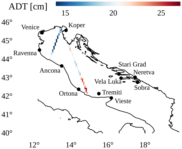
This paper introduces HIDRA-D, a novel deep-learning model for dense, gridded sea level forecasting from sparse satellite altimetry and tide gauge data. By forecasting low-frequency spatial components, HIDRA-D offers a faster alternative to traditional numerical models. Evaluated on the satellite altimetry data in the Adriatic Sea, it outperforms the NEMO general circulation model, reducing the mean absolute error by 28.0 %. The model is robust but shows limitations in complex coastal areas.

Ehsan Mehdipour, Hongyan Xi, Alexander Barth, Aida Alvera-Azcárate, Adalbert Wilhelm, and Astrid Bracher
Geosci. Model Dev., 19, 1619–1643, https://doi.org/10.5194/gmd-19-1619-2026, https://doi.org/10.5194/gmd-19-1619-2026, 2026
Short summary
Short summary
Phytoplankton are vital for marine ecosystems and nutrient cycling, detectable by optical satellites. Data gaps caused by clouds and other non-optimal conditions limit comprehensive analyses like trend monitoring. This study evaluated DINCAE and DINEOF gap-filling methods for reconstructing chlorophyll a datasets, including total chlorophyll a and five major phytoplankton groups. Both methods showed robust reconstruction capabilities, aiding pattern detection and long-term ocean colour analysis.
Cécile Pujol, Alexander Barth, Iván Pérez-Santos, Pamela Linford, and Aida Alvera-Azcárate
Earth Syst. Sci. Data Discuss., https://doi.org/10.5194/essd-2026-42, https://doi.org/10.5194/essd-2026-42, 2026
Preprint under review for ESSD
Short summary
Short summary
In this study, we present the first high-resolution, four-dimensional temperature climatology for Northern Chilean Patagonia, a region characterised by a complex network of fjords and channels. The climatology win based on approximately three million in situ observations collected over the past 75 years and interpolated into continuous temperature fields with a horizontal resolution of about 900 m and 32 vertical levels, providing monthly and daily fields from the surface to 400 m depth.
Bayoumy Mohamed, Alexander Barth, Dimitry Van der Zande, and Aida Alvera-Azcárate
Ocean Sci., 21, 2505–2525, https://doi.org/10.5194/os-21-2505-2025, https://doi.org/10.5194/os-21-2505-2025, 2025
Short summary
Short summary
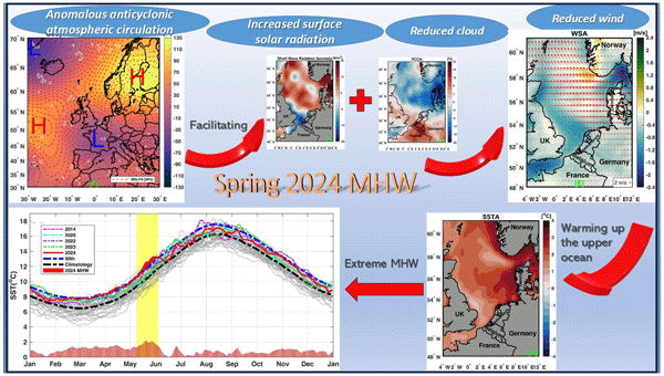
We quantified the role of climate change and internal variability in marine heatwaves (MHWs) in the North Sea over more than 4 decades (1982–2024). A key finding is the 2013 climate shift, which was associated with increased warming and MHWs. Long-term warming accounted for 80 % of the observed trend in MHW frequency. The most intense MHW event in May 2024 was attributed to an anomalous anticyclonic atmospheric circulation. We also explored the impact of MHWs on chlorophyll concentration.
Matjaž Zupančič Muc, Vitjan Zavrtanik, Alexander Barth, Aida Alvera-Azcarate, Matjaž Ličer, and Matej Kristan
Geosci. Model Dev., 18, 5549–5573, https://doi.org/10.5194/gmd-18-5549-2025, https://doi.org/10.5194/gmd-18-5549-2025, 2025
Short summary
Short summary
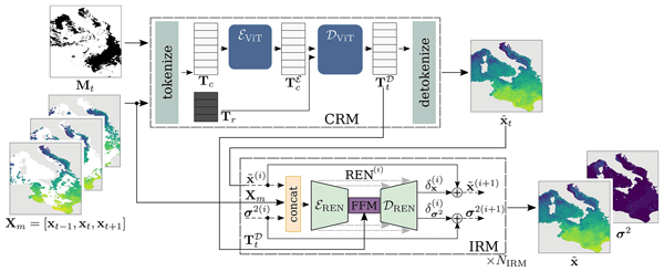
Accurate sea surface temperature data (SST) are crucial for weather forecasting and climate modeling, but satellite observations are often incomplete. We developed a new method called CRITER, which uses machine learning to fill in the gaps in SST data. Our two-stage approach reconstructs large-scale patterns and refines details. Tested on Mediterranean, Adriatic, and Atlantic sea data, CRITER outperforms current methods, reducing errors by up to 44 %.
Amirhossein Barzandeh, Matjaž Ličer, Marko Rus, Matej Kristan, Ilja Maljutenko, Jüri Elken, Priidik Lagemaa, and Rivo Uiboupin
Ocean Sci., 21, 1315–1327, https://doi.org/10.5194/os-21-1315-2025, https://doi.org/10.5194/os-21-1315-2025, 2025
Short summary
Short summary
We evaluated a deep-learning model, HIDRA2, for predicting sea levels along the Estonian coast and compared it to traditional numerical models. HIDRA2 performed better overall, offering faster forecasts and valuable uncertainty estimates using ensemble predictions.
Aida Alvera-Azcárate, Dimitry Van der Zande, Alexander Barth, Antoine Dille, Joppe Massant, and Jean-Marie Beckers
Ocean Sci., 21, 787–805, https://doi.org/10.5194/os-21-787-2025, https://doi.org/10.5194/os-21-787-2025, 2025
Short summary
Short summary
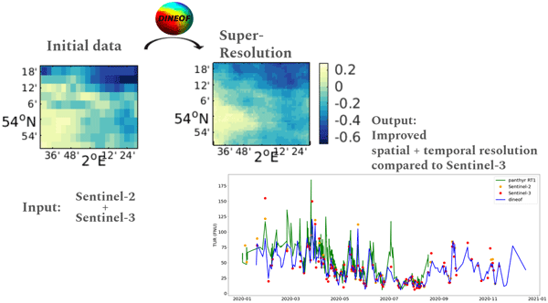
This work presents an approach for increasing the spatial resolution of satellite data and interpolating gaps due to cloud cover, using a method called DINEOF (data-interpolating empirical orthogonal functions). The method is tested on turbidity and chlorophyll-a concentration data in the Belgian coastal zone and the North Sea. The results show that we are able to improve the spatial resolution of these data in order to perform analyses of spatial and temporal variability in coastal regions.
Cécile Pujol, Alexander Barth, Iván Pérez-Santos, Pamela Muñoz-Linford, and Aida Alvera-Azcárate
EGUsphere, https://doi.org/10.5194/egusphere-2025-1421, https://doi.org/10.5194/egusphere-2025-1421, 2025
Preprint archived
Short summary
Short summary
Marine heatwaves and cold spells are periods of extreme sea temperatures. This study focuses on Chilean Northern Patagonia, a fjord region vulnerable due to its aquaculture. It aims to understand these events' distribution and identify the most affected basins. Results show higher intensity in enclosed areas like Reloncaví Sound and Puyuhuapi Fjord. Marine heatwaves are becoming more frequent over time, while cold spells are decreasing.

Marko Rus, Hrvoje Mihanović, Matjaž Ličer, and Matej Kristan
Geosci. Model Dev., 18, 605–620, https://doi.org/10.5194/gmd-18-605-2025, https://doi.org/10.5194/gmd-18-605-2025, 2025
Short summary
Short summary
HIDRA3 is a deep-learning model for predicting sea levels and storm surges, offering significant improvements over previous models and numerical simulations. It utilizes data from multiple tide gauges, enhancing predictions even with limited historical data and during sensor outages. With its advanced architecture, HIDRA3 outperforms current state-of-the-art models by achieving a mean absolute error of up to 15 % lower, proving effective for coastal flood forecasting under diverse conditions.
Alexander Barth, Julien Brajard, Aida Alvera-Azcárate, Bayoumy Mohamed, Charles Troupin, and Jean-Marie Beckers
Ocean Sci., 20, 1567–1584, https://doi.org/10.5194/os-20-1567-2024, https://doi.org/10.5194/os-20-1567-2024, 2024
Short summary
Short summary
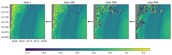
Most satellite observations have gaps, for example, due to clouds. This paper presents a method to reconstruct missing data in satellite observations of the chlorophyll a concentration in the Black Sea. Rather than giving a single possible reconstructed field, the discussed method provides an ensemble of possible reconstructions using a generative neural network. The resulting ensemble is validated using techniques from numerical weather prediction and ocean modelling.

Peter Mlakar, Antonio Ricchi, Sandro Carniel, Davide Bonaldo, and Matjaž Ličer
Geosci. Model Dev., 17, 4705–4725, https://doi.org/10.5194/gmd-17-4705-2024, https://doi.org/10.5194/gmd-17-4705-2024, 2024
Short summary
Short summary
We propose a new point-prediction model, the DEep Learning WAVe Emulating model (DELWAVE), which successfully emulates the Simulating WAves Nearshore model (SWAN) over synoptic to climate timescales. Compared to control climatology over all wind directions, the mismatch between DELWAVE and SWAN is generally small compared to the difference between scenario and control conditions, suggesting that the noise introduced by surrogate modelling is substantially weaker than the climate change signal.
Francesca Doglioni, Robert Ricker, Benjamin Rabe, Alexander Barth, Charles Troupin, and Torsten Kanzow
Earth Syst. Sci. Data, 15, 225–263, https://doi.org/10.5194/essd-15-225-2023, https://doi.org/10.5194/essd-15-225-2023, 2023
Short summary
Short summary
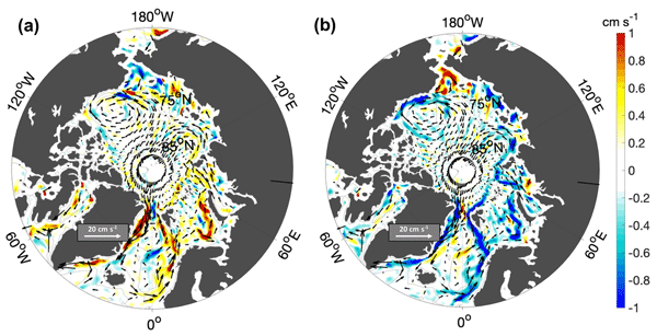
This paper presents a new satellite-derived gridded dataset, including 10 years of sea surface height and geostrophic velocity at monthly resolution, over the Arctic ice-covered and ice-free regions, up to 88° N. We assess the dataset by comparison to independent satellite and mooring data. Results correlate well with independent satellite data at monthly timescales, and the geostrophic velocity fields can resolve seasonal to interannual variability of boundary currents wider than about 50 km.
Marko Rus, Anja Fettich, Matej Kristan, and Matjaž Ličer
Geosci. Model Dev., 16, 271–288, https://doi.org/10.5194/gmd-16-271-2023, https://doi.org/10.5194/gmd-16-271-2023, 2023
Short summary
Short summary
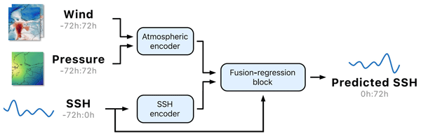
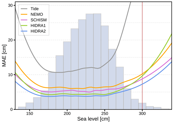
We propose a new fast and reliable deep-learning architecture HIDRA2 for sea level and storm surge modeling. HIDRA2 features new feature encoders and a fusion-regression block. We test HIDRA2 on Adriatic storm surges, which depend on an interaction between tides and seiches. We demonstrate that HIDRA2 learns to effectively mimic the timing and amplitude of Adriatic seiches. This is essential for reliable HIDRA2 predictions of total storm surge sea levels.

Nydia Catalina Reyes Suárez, Valentina Tirelli, Laura Ursella, Matjaž Ličer, Massimo Celio, and Vanessa Cardin
Ocean Sci., 18, 1321–1337, https://doi.org/10.5194/os-18-1321-2022, https://doi.org/10.5194/os-18-1321-2022, 2022
Short summary
Short summary
Explaining the dynamics of jellyfish blooms is a challenge for scientists. Biological and meteo-oceanographic data were combined on different timescales to explain the exceptional bloom of the jellyfish Rhizostoma pulmo in the Gulf of Trieste (Adriatic Sea) in April 2021. The bloom was associated with anomalously warm seasonal sea conditions. Then, a strong bora wind event enhanced upwelling and mixing of the water column, causing jellyfish to rise to the surface and accumulate along the coast.
Begoña Pérez Gómez, Ivica Vilibić, Jadranka Šepić, Iva Međugorac, Matjaž Ličer, Laurent Testut, Claire Fraboul, Marta Marcos, Hassen Abdellaoui, Enrique Álvarez Fanjul, Darko Barbalić, Benjamín Casas, Antonio Castaño-Tierno, Srđan Čupić, Aldo Drago, María Angeles Fraile, Daniele A. Galliano, Adam Gauci, Branislav Gloginja, Víctor Martín Guijarro, Maja Jeromel, Marcos Larrad Revuelto, Ayah Lazar, Ibrahim Haktan Keskin, Igor Medvedev, Abdelkader Menassri, Mohamed Aïssa Meslem, Hrvoje Mihanović, Sara Morucci, Dragos Niculescu, José Manuel Quijano de Benito, Josep Pascual, Atanas Palazov, Marco Picone, Fabio Raicich, Mohamed Said, Jordi Salat, Erdinc Sezen, Mehmet Simav, Georgios Sylaios, Elena Tel, Joaquín Tintoré, Klodian Zaimi, and George Zodiatis
Ocean Sci., 18, 997–1053, https://doi.org/10.5194/os-18-997-2022, https://doi.org/10.5194/os-18-997-2022, 2022
Short summary
Short summary
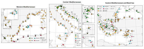
This description and mapping of coastal sea level monitoring networks in the Mediterranean and Black seas reveals the existence of 240 presently operational tide gauges. Information is provided about the type of sensor, time sampling, data availability, and ancillary measurements. An assessment of the fit-for-purpose status of the network is also included, along with recommendations to mitigate existing bottlenecks and improve the network, in a context of sea level rise and increasing extremes.
Pablo Lorente, Eva Aguiar, Michele Bendoni, Maristella Berta, Carlo Brandini, Alejandro Cáceres-Euse, Fulvio Capodici, Daniela Cianelli, Giuseppe Ciraolo, Lorenzo Corgnati, Vlado Dadić, Bartolomeo Doronzo, Aldo Drago, Dylan Dumas, Pierpaolo Falco, Maria Fattorini, Adam Gauci, Roberto Gómez, Annalisa Griffa, Charles-Antoine Guérin, Ismael Hernández-Carrasco, Jaime Hernández-Lasheras, Matjaž Ličer, Marcello G. Magaldi, Carlo Mantovani, Hrvoje Mihanović, Anne Molcard, Baptiste Mourre, Alejandro Orfila, Adèle Révelard, Emma Reyes, Jorge Sánchez, Simona Saviano, Roberta Sciascia, Stefano Taddei, Joaquín Tintoré, Yaron Toledo, Laura Ursella, Marco Uttieri, Ivica Vilibić, Enrico Zambianchi, and Vanessa Cardin
Ocean Sci., 18, 761–795, https://doi.org/10.5194/os-18-761-2022, https://doi.org/10.5194/os-18-761-2022, 2022
Short summary
Short summary
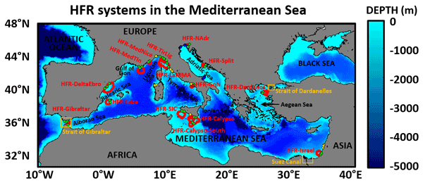
High-frequency radar (HFR) is a land-based remote sensing technology that can provide maps of the surface circulation over broad coastal areas, along with wave and wind information. The main goal of this work is to showcase the current status of the Mediterranean HFR network as well as present and future applications of this sensor for societal benefit such as search and rescue operations, safe vessel navigation, tracking of marine pollutants, and the monitoring of extreme events.
Emma Reyes, Eva Aguiar, Michele Bendoni, Maristella Berta, Carlo Brandini, Alejandro Cáceres-Euse, Fulvio Capodici, Vanessa Cardin, Daniela Cianelli, Giuseppe Ciraolo, Lorenzo Corgnati, Vlado Dadić, Bartolomeo Doronzo, Aldo Drago, Dylan Dumas, Pierpaolo Falco, Maria Fattorini, Maria J. Fernandes, Adam Gauci, Roberto Gómez, Annalisa Griffa, Charles-Antoine Guérin, Ismael Hernández-Carrasco, Jaime Hernández-Lasheras, Matjaž Ličer, Pablo Lorente, Marcello G. Magaldi, Carlo Mantovani, Hrvoje Mihanović, Anne Molcard, Baptiste Mourre, Adèle Révelard, Catalina Reyes-Suárez, Simona Saviano, Roberta Sciascia, Stefano Taddei, Joaquín Tintoré, Yaron Toledo, Marco Uttieri, Ivica Vilibić, Enrico Zambianchi, and Alejandro Orfila
Ocean Sci., 18, 797–837, https://doi.org/10.5194/os-18-797-2022, https://doi.org/10.5194/os-18-797-2022, 2022
Short summary
Short summary
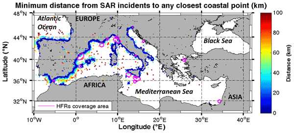
This work reviews the existing advanced and emerging scientific and societal applications using HFR data, developed to address the major challenges identified in Mediterranean coastal waters organized around three main topics: maritime safety, extreme hazards and environmental transport processes. It also includes a discussion and preliminary assessment of the capabilities of existing HFR applications, finally providing a set of recommendations towards setting out future prospects.
Alexander Barth, Aida Alvera-Azcárate, Charles Troupin, and Jean-Marie Beckers
Geosci. Model Dev., 15, 2183–2196, https://doi.org/10.5194/gmd-15-2183-2022, https://doi.org/10.5194/gmd-15-2183-2022, 2022
Short summary
Short summary
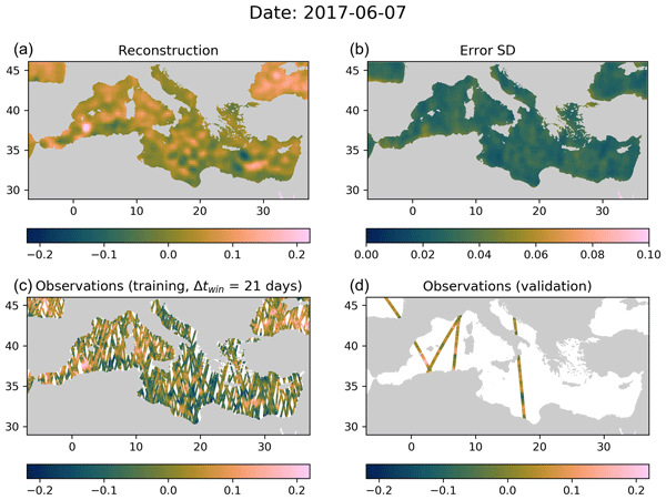
Earth-observing satellites provide routine measurement of several ocean parameters. However, these datasets have a significant amount of missing data due to the presence of clouds or other limitations of the employed sensors. This paper describes a method to infer the value of the missing satellite data based on a convolutional autoencoder (a specific type of neural network architecture). The technique also provides a reliable error estimate of the interpolated value.
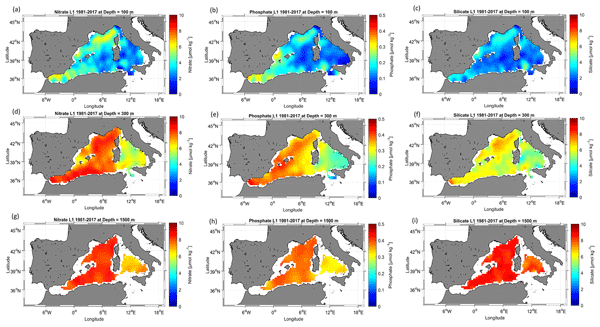
Malek Belgacem, Katrin Schroeder, Alexander Barth, Charles Troupin, Bruno Pavoni, Patrick Raimbault, Nicole Garcia, Mireno Borghini, and Jacopo Chiggiato
Earth Syst. Sci. Data, 13, 5915–5949, https://doi.org/10.5194/essd-13-5915-2021, https://doi.org/10.5194/essd-13-5915-2021, 2021
Short summary
Short summary
The Mediterranean Sea exhibits an anti-estuarine circulation, responsible for its low productivity. Understanding this peculiar character is still a challenge since there is no exact quantification of nutrient sinks and sources. Because nutrient in situ observations are generally infrequent and scattered in space and time, climatological mapping is often applied to sparse data in order to understand the biogeochemical state of the ocean. The dataset presented here partly addresses these issues.
Cited articles
Alvera-Azcárate, A., Barth, A., Rixen, M., and Beckers, J.: Reconstruction of incomplete oceanographic data sets using empirical orthogonal functions: application to the Adriatic Sea surface temperature, Ocean Model., 9, 325–346, https://doi.org/10.1016/j.ocemod.2004.08.001, 2005. a
Barth, A., Alvera-Azcárate, A., Licer, M., and Beckers, J.-M.: DINCAE 1.0: a convolutional neural network with error estimates to reconstruct sea surface temperature satellite observations, Geosci. Model Dev., 13, 1609–1622, https://doi.org/10.5194/gmd-13-1609-2020, 2020. a
Barth, A., Alvera-Azcárate, A., Troupin, C., and Beckers, J.-M.: DINCAE 2.0: multivariate convolutional neural network with error estimates to reconstruct sea surface temperature satellite and altimetry observations, Geosci. Model Dev., 15, 2183–2196, https://doi.org/10.5194/gmd-15-2183-2022, 2022. a, b, c, d, e, f, g, h
Barth, A., Brajard, J., Alvera-Azcárate, A., Mohamed, B., Troupin, C., and Beckers, J.-M.: Ensemble reconstruction of missing satellite data using a denoising diffusion model: application to chlorophyll a concentration in the Black Sea, Ocean Sci., 20, 1567–1584, https://doi.org/10.5194/os-20-1567-2024, 2024. a
Bojinski, S., Verstraete, M., Peterson, T. C., Richter, C., Simmons, A., and Zemp, M.: The Concept of Essential Climate Variables in Support of Climate Research, Applications, and Policy, B. Am. Meteorol. Soc., 95, 1431–1443, https://doi.org/10.1175/BAMS-D-13-00047.1, 2014. a
Croitoru, F.-A., Hondru, V., Ionescu, R. T., and Shah, M.: Diffusion Models in Vision: A Survey, IEEE T. Pattern Anal, 45, 10850–10869, https://doi.org/10.1109/TPAMI.2023.3261988, 2023. a
Donlon, C., Robinson, I., Casey, K. S., Vazquez-Cuervo, J., Armstrong, E., Arino, O., Gentemann, C., May, D., LeBorgne, P., Piollé, J., Barton, I., Beggs, H., Poulter, D. J. S., Merchant, C. J., Bingham, A., Heinz, S., Harris, A., Wick, G., Emery, B., Minnett, P., Evans, R., Llewellyn-Jones, D., Mutlow, C., Reynolds, R. W., Kawamura, H., and Rayner, N.: The Global Ocean Data Assimilation Experiment High-resolution Sea Surface Temperature Pilot Project, B. Am. Meteorol. Soc., 88, 1197–1214, https://doi.org/10.1175/BAMS-88-8-1197, 2007. a
E.U. Copernicus Marine Service Information: Mediterranean Sea – High Resolution L3S Sea Surface Temperature Reprocessed, Copernicus Marine Data Store (MDS) [data set], https://doi.org/10.48670/moi-00314, 2024a. a
E.U. Copernicus Marine Service Information: European North West Shelf/Iberia Biscay Irish Seas – High Resolution ODYSSEA Sea Surface Temperature Multi-sensor L3 Observations Reprocessed, Copernicus Marine Data Store (MDS) [data set], https://doi.org/10.48670/moi-00311, 2024b. a, b
E.U. Copernicus Marine Service Information: Mediterranean Sea – High Resolution and Ultra High Resolution L3S Sea Surface Temperature, Copernicus Marine Data Store (MDS) [data set], https://doi.org/10.48670/moi-00171, 2024c. a, b
E.U. Copernicus Marine Service Information (CMEMS): ESA SST CCI and C3S reprocessed sea surface temperature analyses, Marine Data Store (MDS) [data set], https://doi.org/10.48670/moi-00169, 2026a. a
E.U. Copernicus Marine Service Information (CMEMS): Global Ocean OSTIA Sea Surface Temperature and Sea Ice Reprocessed, Marine Data Store (MDS) [data set], https://doi.org/10.48670/moi-00168, 2026b. a
Garcia-Soto, C., Cheng, L., Caesar, L., Schmidtko, S., Jewett, E. B., Cheripka, A., Rigor, I., Caballero, A., Chiba, S., Báez, J. C., Zielinski, T., and Abraham, J. P.: An overview of ocean climate change indicators: Sea surface temperature, ocean heat content, ocean pH, dissolved oxygen concentration, arctic sea ice extent, thickness and volume, sea level and strength of the AMOC (Atlantic Meridional Overturning Circulation), Front. Mar. Sci., 8, 642372, https://doi.org/10.3389/fmars.2021.642372, 2021. a
Harris, F.: On the use of windows for harmonic analysis with the discrete Fourier transform, P. IEEE, 66, 51–83, https://doi.org/10.1109/PROC.1978.10837, 1978. a
Ho, J., Jain, A., and Abbeel, P.: Denoising Diffusion Probabilistic Models, in: Advances in Neural Information Processing Systems, edited by: Larochelle, H., Ranzato, M., Hadsell, R., Balcan, M., and Lin, H., vol. 33, 6840–6851, Curran Associates, Inc., https://proceedings.neurips.cc/paper_files/paper/2020/file/4c5bcfec8584af0d967f1ab10179ca4b-Paper.pdf (last access: 5 March 2026), 2020. a
Kullback, S. and Leibler, R. A.: On Information and Sufficiency, Ann. Math. Stat., 22, 79–86, http://www.jstor.org/stable/2236703 (last access: 5 March 2026), 1951. a
Li, H., Wang, Y., Yang, K., Huang, G., Xia, X., Chen, Z., Tao, W., Lyu, C., Chen, L., Zhang, M., Hu, K., Gong, H., Fu, D., and Wang, L.: Probabilistic reconstruction of global sea surface temperature using generative diffusion models, arXiv [preprint], https://doi.org/10.48550/arXiv.2603.16272, 2026. a, b
Li, X., Ren, Y., Jin, X., Lan, C., Wang, X., Zeng, W., Wang, X., and Chen, Z.: Diffusion Models for Image Restoration and Enhancement – A Comprehensive Survey, arXiv [preprint], https://doi.org/10.48550/arXiv.2308.09388, 2023. a
Li, Z., Wei, D., Zhang, X., Gao, Y., and Zhang, D.: A Daily High-Resolution Sea Surface Temperature Reconstruction Using an I-DINCAE and DNN Model Based on FY-3C Thermal Infrared Data, Remote Sens., 16, https://doi.org/10.3390/rs16101745, 2024. a
Lipman, Y., Havasi, M., Holderrieth, P., Shaul, N., Le, M., Karrer, B., Chen, R. T. Q., Lopez-Paz, D., Ben-Hamu, H., and Gat, I.: Flow Matching Guide and Code, arXiv [preprint], https://doi.org/10.48550/arXiv.2412.06264, 2024. a
Liu, H., Wang, Y., Qian, B., Wang, M., and Rui, Y.: Structure Matters: Tackling the Semantic Discrepancy in Diffusion Models for Image Inpainting, in: Proceedings of the IEEE/CVF Conference on Computer Vision and Pattern Recognition (CVPR), 8038–8047, https://doi.org/10.1109/CVPR52733.2024.00768, 2024. a
Lugmayr, A., Danelljan, M., Romero, A., Yu, F., Timofte, R., and Van Gool, L.: RePaint: Inpainting Using Denoising Diffusion Probabilistic Models, in: Proceedings of the IEEE/CVF Conference on Computer Vision and Pattern Recognition (CVPR), 11461–11471, https://doi.org/10.1109/CVPR52688.2022.01117, 2022. a
Matheron, G.: Principles of geostatistics, Econ. Geol., 58, 1246–1266, 1963. a
Matheson, J. E. and Winkler, R. L.: Scoring Rules for Continuous Probability Distributions, Manage. Sci., 22, 1087–1096, http://www.jstor.org/stable/2629907 (last access: 6 March 2026), 1976. a
O'Carroll, A. G., Armstrong, E. M., Beggs, H. M., Bouali, M., Casey, K. S., Corlett, G. K., Dash, P., Donlon, C. J., Gentemann, C. L., Høyer, J. L., Ignatov, A., Kabobah, K., Kachi, M., Kurihara, Y., Karagali, I., Maturi, E., Merchant, C. J., Marullo, S., Minnett, P. J., Pennybacker, M., Ramakrishnan, B., Ramsankaran, R., Santoleri, R., Sunder, S., Saux Picart, S., Vázquez-Cuervo, J., and Wimmer, W.: Observational Needs of Sea Surface Temperature, Front. Mar. Sci., 6, https://doi.org/10.3389/fmars.2019.00420, 2019. a
Perez, E., Strub, F., de Vries, H., Dumoulin, V., and Courville, A.: FiLM: Visual Reasoning with a General Conditioning Layer, Proceedings of the AAAI Conference on Artificial Intelligence, 32, https://doi.org/10.1609/aaai.v32i1.11671, 2018. a, b
Qian, Z., Liu, T., Bathiany, S., Yang, S., Hess, P., Bochow, N., Burmester, C., Gelbrecht, M., Groenke, B., and Boers, N.: Generative deep learning improves reconstruction of global historical climate records, arXiv [preprint], https://doi.org/10.48550/arXiv.2602.16515, 2026. a, b, c
Rahman, R. and Rahaman, H.: Evaluation of sea surface temperature from ocean reanalysis products over the North Indian Ocean, Front. Mar. Sci., 11, https://doi.org/10.3389/fmars.2024.1461696, 2024. a
Remote Sensing Systems: Microwave OI SST Product, Version 5.1, https://www.remss.com/measurements/sea-surface-temperature/oisst-description/ (last access: 13 July 2026), 2022 (data available at https://data.remss.com/SST/daily/mw/v05.1/netcdf/, last access: 13 July 2026). a
Ricchi, A., Sangelantoni, L., Redaelli, G., Mazzarella, V., Montopoli, M., Miglietta, M. M., Tiesi, A., Mazzà, S., Rotunno, R., and Ferretti, R.: Impact of the SST and topography on the development of a large-hail storm event, on the Adriatic Sea, Atmos. Res., 296, 107078, https://doi.org/10.1016/j.atmosres.2023.107078, 2023. a
Rovscek, G.: Grega Rovscek/DIRECT: Release 1.0, Zenodo [code], https://doi.org/10.5281/zenodo.18875310, 2026. a
Rovšček, G., Ličer, M., and Kristan, M.: Dense Spatiotemporal Reconstruction of Sea Surface Temperature with Conditional Flow Matching, in: Proceedings of the 29th Computer Vision Winter Workshop (CVWW), Jindřichův Hradec, Czech Republic, https://cmp.felk.cvut.cz/cvww2026/assets/pdfs/CVWW2026-43-final.pdf (last access: 10 March 2026), 2026. a
Senatore, A., Furnari, L., and Mendicino, G.: Impact of high-resolution sea surface temperature representation on the forecast of small Mediterranean catchments' hydrological responses to heavy precipitation, Hydrol. Earth Syst. Sci., 24, 269–291, https://doi.org/10.5194/hess-24-269-2020, 2020. a
Song, Y., Lyu, P., Fei, B., Ling, F., Ouyang, W., and Bai, L.: ReconMOST: Multi-Layer Sea Temperature Reconstruction with Observations-Guided Diffusion, arXiv [preprint], https://doi.org/10.48550/arXiv.2506.10391, 2025. a, b
Stoica, P. and Moses, R. L.: Spectral analysis of signals, vol. 452, Pearson Prentice Hall Upper Saddle River, NJ, ISBN 9780131139565, 2005. a
Taburet, G., Sanchez-Roman, A., Ballarotta, M., Pujol, M.-I., Legeais, J.-F., Fournier, F., Faugere, Y., and Dibarboure, G.: DUACS DT2018: 25 years of reprocessed sea level altimetry products, Ocean Sci., 15, 1207–1224, https://doi.org/10.5194/os-15-1207-2019, 2019. a
Wang, H., Han, J., Fan, W., Zhang, W., and Liu, H.: PhyDA: Physics-Guided Diffusion Models for Data Assimilation in Atmospheric Systems, arXiv [preprint], https://doi.org/10.48550/arXiv.2505.12882, 2025. a, b
Xing, Z., Feng, Q., Chen, H., Dai, Q., Hu, H., Xu, H., Wu, Z., and Jiang, Y.-G.: A survey on video diffusion models, ACM Comput. Surv., 57, 1–42, 2024. a
Zupancic Muc, M., Zavrtanik, V., Barth, A., Alvera-Azcarate, A., Licer, M., and Kristan, M.: CRITER 1.0: Sea Surface Temperature Evaluation Datasets, Zenodo [data set], https://doi.org/10.5281/zenodo.13923189, 2024. a
Zupančič Muc, M., Zavrtanik, V., Barth, A., Alvera-Azcarate, A., Ličer, M., and Kristan, M.: CRITER 1.0: a coarse reconstruction with iterative refinement network for sparse spatio-temporal satellite data, Geosci. Model Dev., 18, 5549–5573, https://doi.org/10.5194/gmd-18-5549-2025, 2025. a, b, c, d, e, f, g, h, i, j, k, l, m, n, o
Short summary
Satellite measurements of sea surface temperature are often blocked by clouds, leaving large gaps in the data used to study the ocean and climate. We developed a new computer model that fills in these missing areas while also estimating how uncertain the reconstruction is. Tests on several ocean regions show more accurate results and more realistic patterns, helping scientists better analyze and model ocean conditions.
Satellite measurements of sea surface temperature are often blocked by clouds, leaving large...


