Articles | Volume 19, issue 14
https://doi.org/10.5194/gmd-19-6967-2026
© Author(s) 2026. This work is distributed under
the Creative Commons Attribution 4.0 License.
https://doi.org/10.5194/gmd-19-6967-2026
© Author(s) 2026. This work is distributed under
the Creative Commons Attribution 4.0 License.
GEE-DisALEXI: cloud-based implementation of the DisALEXI model for evapotranspiration monitoring using Google Earth Engine
Yun Yang
CORRESPONDING AUTHOR
School of Integrative Plant Science, Cornell University, Ithaca, NY, United States
Martha Anderson
Hydrology and Remote Sensing Laboratory, USDA ARS, Beltsville, MD, United States
Charles Morton
Desert Research Institution, Reno, NV, United States
Yanghui Kang
Department of Biological Systems Engineering, Virginia Tech, Blacksburg, VA, United States
Feng Gao
Hydrology and Remote Sensing Laboratory, USDA ARS, Beltsville, MD, United States
Weina Duan
School of Integrative Plant Science, Cornell University, Ithaca, NY, United States
Hui Liu
School of Integrative Plant Science, Cornell University, Ithaca, NY, United States
John Volk
Desert Research Institution, Reno, NV, United States
Christopher Hain
Marshall Space Flight Center, NASA, Huntsville, AL, United States
Related authors
No articles found.
Sadegh Ranjbar, Danielle Losos, Sophie Hoffman, Yafang Zhong, Jason A. Otkin, Ankur R. Desai, Martha C. Anderson, Christopher R. Hain, and Paul C. Stoy
Hydrol. Earth Syst. Sci., 30, 4927–4955, https://doi.org/10.5194/hess-30-4927-2026, https://doi.org/10.5194/hess-30-4927-2026, 2026
Short summary
Short summary
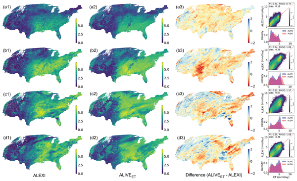
Water moves from land to air in a process called evapotranspiration, which affects weather, crops, and water supply. Using satellites and AI, we created a system that tracks this water movement every five minutes, day and night, even through clouds. This provides continuous insights that can help manage water, predict weather, and better understand the water cycle.
Yikun Zhang, Hua Yan, Wenzhe Jiao, Yanghui Kang, Marty R. Schmer, Ryan D. Stewart, Benjamin F. Tracy, and Yongfa You
Earth Syst. Sci. Data Discuss., https://doi.org/10.5194/essd-2026-237, https://doi.org/10.5194/essd-2026-237, 2026
Preprint under review for ESSD
Short summary
Short summary
Crop residues, the plant material left after harvest, are an important resource for soil health and for livestock and bioenergy uses. We developed a high-resolution dataset to track how much residue is produced and how it is used across the United States from 2001 to 2021. Most residues remain on fields, while smaller amounts are used for animals and bioenergy, and very little is burned. This work provides a clearer basis for managing residues more effectively and sustainably.
Yanghui Kang, Maoya Bassiouni, Max Gaber, Xinchen Lu, and Trevor F. Keenan
Earth Syst. Sci. Data, 17, 3009–3046, https://doi.org/10.5194/essd-17-3009-2025, https://doi.org/10.5194/essd-17-3009-2025, 2025
Short summary
Short summary
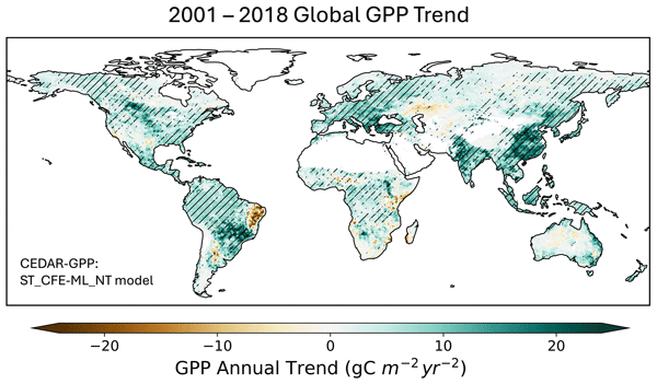
CEDAR-GPP provides spatiotemporally upscaled estimates of gross primary productivity (GPP) globally, uniquely incorporating the direct effect of elevated atmospheric CO2 on photosynthesis. This dataset was produced by upscaling eddy covariance data with machine learning and a broad range of satellite and climate variables. Available at monthly and 0.05° resolution from 1982 to 2020, CEDAR-GPP offers critical insights into ecosystem–climate interactions and the global carbon cycle.
R. Bradley Pierce, Monica Harkey, Allen Lenzen, Lee M. Cronce, Jason A. Otkin, Jonathan L. Case, David S. Henderson, Zac Adelman, Tsengel Nergui, and Christopher R. Hain
Atmos. Chem. Phys., 23, 9613–9635, https://doi.org/10.5194/acp-23-9613-2023, https://doi.org/10.5194/acp-23-9613-2023, 2023
Short summary
Short summary
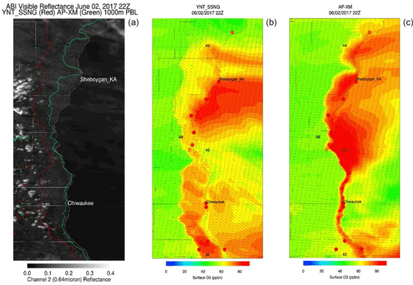
We evaluate two high-resolution model simulations with different meteorological inputs but identical chemistry and anthropogenic emissions, with the goal of identifying a model configuration best suited for characterizing air quality in locations where lake breezes commonly affect local air quality along the Lake Michigan shoreline. This analysis complements other studies in evaluating the impact of meteorological inputs and parameterizations on air quality in a complex environment.
Jason A. Otkin, Lee M. Cronce, Jonathan L. Case, R. Bradley Pierce, Monica Harkey, Allen Lenzen, David S. Henderson, Zac Adelman, Tsengel Nergui, and Christopher R. Hain
Atmos. Chem. Phys., 23, 7935–7954, https://doi.org/10.5194/acp-23-7935-2023, https://doi.org/10.5194/acp-23-7935-2023, 2023
Short summary
Short summary
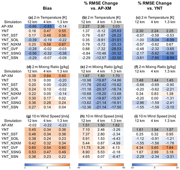
We performed model simulations to assess the impact of different parameterization schemes, surface initialization datasets, and analysis nudging on lower-tropospheric conditions near Lake Michigan. Simulations were run with high-resolution, real-time datasets depicting lake surface temperatures, green vegetation fraction, and soil moisture. The most accurate results were obtained when using high-resolution sea surface temperature and soil datasets to constrain the model simulations.
Xuanli Li, Jason B. Roberts, Jayanthi Srikishen, Jonathan L. Case, Walter A. Petersen, Gyuwon Lee, and Christopher R. Hain
Geosci. Model Dev., 15, 5287–5308, https://doi.org/10.5194/gmd-15-5287-2022, https://doi.org/10.5194/gmd-15-5287-2022, 2022
Short summary
Short summary
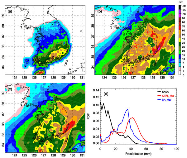
This research assimilated the Global Precipitation Measurement (GPM) satellite-retrieved ocean surface meteorology data into the Weather Research and Forecasting (WRF) model with the Gridpoint Statistical Interpolation (GSI) system. This was for two snowstorms during the International Collaborative Experiments for PyeongChang 2018 Olympic and Paralympic Winter Games' (ICE-POP 2018) field experiments. The results indicated a positive impact of the data for short-term forecasts for heavy snowfall.
Sangchul Lee, Dongho Kim, Gregory W. McCarty, Martha Anderson, Feng Gao, Fangni Lei, Glenn E. Moglen, Xuesong Zhang, Haw Yen, Junyu Qi, Wade Crow, In-Young Yeo, and Liang Sun
Hydrol. Earth Syst. Sci. Discuss., https://doi.org/10.5194/hess-2022-187, https://doi.org/10.5194/hess-2022-187, 2022
Manuscript not accepted for further review
Short summary
Short summary
Watershed modeling is important to protect water resources. However, errors are involved in watershed modeling. To reduce errors, remotely sensed evapotranspiration data are widely used. However, the use of remotely sensed evapotranspiration data still includes errors. This study applied two remotely sensed data (evapotranspiration and leaf area index) into watershed modeling to reduce errors. The results showed advancement of watershed modeling by two remotely sensed data.
Cited articles
Agrawal, Y., Kumar, M., Ananthakrishnan, S., and Kumarapuram, G.: Evapotranspiration Modeling Using Different Tree Based Ensembled Machine Learning Algorithm, Water Resour. Manage., 36, https://doi.org/10.1007/s11269-022-03067-7, 2022.
Ahmad, S. K., Holmes, T. R., Kumar, S. V., Lahmers, T. M., Liu, P. W., Nie, W., Getirana, A., Orland, E., Bindlish, R., Guzman, A., Hain, C. R., Melton, F. S., Locke, K. A., and Yang, Y.: Droughts impede water balance recovery from fires in the Western United States, Nat. Ecol. Evol., 8, https://doi.org/10.1038/s41559-023-02266-8, 2024.
Allen, R. G., Tasumi, M., and Trezza, R.: Satellite-based energy balance for mapping evapotranspiration with internalized calibration (METRIC) – Model, J. Irrig. Drain. Eng., 133, 380–394, 2007.
Anderson, M. and Kustas, W.: Thermal Remote Sensing of Drought and Evapotranspiration, Eos Trans. Am. Geophysi. Union, 89, 233, https://doi.org/10.1029/2008EO260001, 2008.
Anderson, M., Neale, C., Li, F., Norman, J., Kustas, W., Jayanthi, H., and Chavez, J.: Upscaling ground observations of vegetation water content, canopy height, and leaf area index during SMEX02 using aircraft and Landsat imagery, Remote Sens. Environ., 92, 447–464, https://doi.org/10.1016/j.rse.2004.03.019, 2004a.
Anderson, M., Gao, F., Knipper, K., Hain, C., Dulaney, W., Baldocchi, D., Eichelmann, E., Hemes, K., Yang, Y., and Medellin-Azuara, J.: Field-Scale Assessment of Land and Water Use Change over the California Delta Using Remote Sensing, Remote Sens., 10, 889, https://doi.org/10.3390/rs10060889, 2018.
Anderson, M., Yang, Y., Xue, J., Knipper, K., Yang, Y., Gao, F., Hain, C., Kustas, W. P., Cawse-Nicholson, K., Hulley, G., Fisher, J. B., Alfieri, J., Meyers, T., Prueger, J. H., Baldocchi, D., and Sanchez, C.: Interoperability of ECOSTRESS and Landsat for mapping evapotranpiration time series at sub-field scales, Remote Sens. Environ., 252, 112189, https://doi.org/10.1016/J.RSE.2020.112189, 2020.
Anderson, M. C., Norman, J. M., Diak, G. R., Kustas, W. P., and Mecikalski, J. R.: A two-source time-integrated model for estimating surface fluxes using thermal infrared remote sensing, Remote Sens. Environ., 60, 195–216, 1997.
Anderson, M. C., Norman, J. M., Mecikalski, J. R., Torn, R. D., Kustas, W. P., and Basara, J. B.: A multiscale remote sensing model for disaggregating regional fluxes to micrometeorological scales, J. Hydrometeorol., 5, 343–363, 2004b.
Anderson, M. C., Norman, J. M., Kustas, W. P., Li, F., Prueger, J. H., and Mecikalski, J. R.: Effects of vegetation clumping on two–source model estimates of surface energy fluxes from an agricultural landscape during SMACEX, J. Hydrometeorol., 6, 892–909, 2005.
Anderson, M. C., Norman, J. M., Mecikalski, J. R., Otkin, J. a., and Kustas, W. P.: A climatological study of evapotranspiration and moisture stress across the continental United States based on thermal remote sensing: 1. Model formulation, J. Geophys. Res., 112, D10117, https://doi.org/10.1029/2006JD007506, 2007a.
Anderson, M. C., Kustas, W. P., and Norman, J. M.: Upscaling Flux Observations from Local to Continental Scales Using Thermal Remote Sensing, Agron. J., 99, 240, https://doi.org/10.2134/agronj2005.0096S, 2007b.
Anderson, M. C., Hain, C., Wardlow, B., Pimstein, A., Mecikalski, J. R., and Kustas, W. P.: Evaluation of Drought Indices Based on Thermal Remote Sensing of Evapotranspiration over the Continental United States, J. Climate, 24, 2025–2044, https://doi.org/10.1175/2010JCLI3812.1, 2011.
Anderson, M. C., Allen, R. G., Morse, A., and Kustas, W. P.: Use of Landsat thermal imagery in monitoring evapotranspiration and managing water resources, Remote Sens. Environ., 122, 50–65, https://doi.org/10.1016/j.rse.2011.08.025, 2012.
Anderson, M. C., Cammalleri, C., Hain, C. R., Otkin, J., Zhan, X., and Kustas, W.: Using a Diagnostic Soil-Plant-Atmosphere Model for Monitoring Drought at Field to Continental Scales, Proced. Environ. Sci., 19, 47–56, https://doi.org/10.1016/j.proenv.2013.06.006, 2013.
Anderson, M. C., Zolin, C. A., Sentelhas, P. C., Hain, C. R., Semmens, K., Yilmaz, M. T., Gao, F., Otkin, J. A., and Tetrault, R.: The Evaporative Stress Index as an indicator of agricultural drought in Brazil: An assessment based on crop yield impacts, Remote Sens. Environ., 174, 82–99, 2016.
Anderson, M. C., Kustas, W. P., Norman, J. M., Diak, G. T., Hain, C. R., Gao, F., Yang, Y., Knipper, K. R., Xue, J., Yang, Y., Crow, W. T., Holmes, T. R. H., Nieto, H., Guzinski, R., Otkin, J. A., Mecikalski, J. R., Cammalleri, C., Torres-Rua, A. T., Zhan, X., Fang, L., Colaizzi, P. D., and Agam, N.: A brief history of the thermal IR-based Two-Source Energy Balance (TSEB) model – diagnosing evapotranspiration from plant to global scales, Agr. Forest Meteorol., 350, 109951, https://doi.org/10.1016/j.agrformet.2024.109951, 2024.
Aragon, B., Houborg, R., Tu, K., Fisher, J. B., and McCabe, M.: Cubesats enable high spatiotemporal retrievals of crop-water use for precision agriculture, Remote Sens., 10, https://doi.org/10.3390/rs10121867, 2018.
Brutsaert, W.: Hydrology: an introduction, in: 3rd Edn., Cambridge University Press, Cambridge, https://doi.org/10.1017/9781316471562, 2023.
Cammalleri, C., Anderson, M. C., Gao, F., Hain, C. R., and Kustas, W. P.: A data fusion approach for mapping daily evapotranspiration at field scale, Water Resour. Res., 49, 4672–4686, https://doi.org/10.1002/wrcr.20349, 2013.
Caldwell, P. V., Sun, G., McNulty, S. G., Cohen, E. C., and Moore Myers, J. A.: Impacts of impervious cover, water withdrawals, and climate change on river flows in the conterminous US, Hydrol. Earth Syst. Sci., 16, 2839–2857, https://doi.org/10.5194/hess-16-2839-2012, 2012.
Daly, C., Neilson, R. P., and Phillips, D. L.: A statistical-topographic model for mapping climatological precipitation over mountainous terrain, J. Appl. Meteorol., 33, 140–158, 1994.
Dee, D. P., Balmaseda, M., Balsamo, G., Engelen, R., Simmons, A. J., and Thépaut, J. N.: Toward a consistent reanalysis of the climate system, B. Am. Meteorol. Soc., 95, https://doi.org/10.1175/BAMS-D-13-00043.1, 2014.
Fisher, J. B., Tu, K. P., and Baldocchi, D. D.: Global estimates of the land–atmosphere water flux based on monthly AVHRR and ISLSCP-II data, validated at 16 FLUXNET sites, Remote Sens. Environ., 112, 901–919, 2008.
Gao, F., Kustas, W. P., and Anderson, M. C.: A data mining approach for sharpening thermal satellite imagery over land, Remote Sens., 4, 3287–3319, 2012a.
Gao, F., Anderson, M. C., Kustas, W. P., and Wang, Y.: Simple method for retrieving leaf area index from Landsat using MODIS leaf area index products as reference, J. Appl. Remote Sens., 6, 63551–63554, 2012b.
Goodnow, S., Yang, Y., Liu, H., and Schulz, A.: Impacts of Southern Pine Beetle (Dendroctonus frontalis Zimmerman) on Loblolly Pine (Pinus taeda L.) Canopy and Water Use in the Homochitto National Forest, Mississippi, USA, Endeavors, 1, 2, https://doi.org/10.55533/3071-012X.1008, 2025.
Gorelick, N., Hancher, M., Dixon, M., Ilyushchenko, S., Thau, D., and Moore, R.: Google Earth Engine: Planetary-scale geospatial analysis for everyone, Remote Sens. Environ., 202, https://doi.org/10.1016/j.rse.2017.06.031, 2017.
Gowda, P. H., Chavez, J. L., Colaizzi, P. D., Evett, S. R., Howell, T. A., and Tolk, J. A.: ET mapping for agricultural water management: Present status and challenges, Irrig. Sci., 26, 223–237, https://doi.org/10.1007/s00271-007-0088-6, 2008.
Hain, C. R., Crow, W. T., Anderson, M. C., and Yilmaz, M. T.: Diagnosing Neglected Soil Moisture Source/Sink Processes via a Thermal Infrared-based Two-Source Energy Balance Model, J. Hydrometeorol., 16, 1070–1086, https://doi.org/10.1175/JHM-D-14-0017.1, 2015.
Isaacson, B. N., Yang, Y., Anderson, M. C., Clark, K. L., and Grabosky, J. C.: The effects of forest composition and management on evapotranspiration in the New Jersey Pinelands, Agr. Forest Meteorol., 339, 109588, https://doi.org/10.1016/j.agrformet.2023.109588, 2023.
Kang, Y., Ozdogan, M., Gao, F., Anderson, M. C., White, W. A., Yang, Y., Yang, Y., and Erickson, T. A.: A data-driven approach to estimate leaf area index for Landsat images over the contiguous US, Remote Sens. Environ., 258, 112383, https://doi.org/10.1016/J.RSE.2021.112383, 2021.
Kljun, N., Calanca, P., Rotach, M. W., and Schmid, H. P.: A simple two-dimensional parameterisation for Flux Footprint Prediction (FFP), Geosci. Model Dev., 8, 3695–3713, https://doi.org/10.5194/gmd-8-3695-2015, 2015.
Knipper, K., Anderson, M., Bambach, N., Kustas, W., Gao, F., Zahn, E., Hain, C., McElrone, A., Belfiore, O. R., Castro, S., Alsina, M. M., and Saa, S.: Evaluation of Partitioned Evaporation and Transpiration Estimates within the DisALEXI Modeling Framework over Irrigated Crops in California, Remote Sens., 15, https://doi.org/10.3390/rs15010068, 2023.
Knipper, K., Anderson, M., Bambach, N., Melton, F., Ellis, Z., Yang, Y., Volk, J., McElrone, A. J., Kustas, W., and Roby, M.: A comparative analysis of OpenET for evaluating evapotranspiration in California almond orchards, Agr. Forest Meteorol., 355, 110146, https://doi.org/10.1016/j.agrformet.2024.110146, 2024.
Knipper, K. R., Kustas, W. P., Anderson, M. C., Alfieri, J. G., Prueger, J. H., Hain, C. R., Gao, F., Yang, Y., McKee, L. G., Nieto, H., Hipps, L. E., Alsina, M. M., and Sanchez, L.: Evapotranspiration estimates derived using thermal-based satellite remote sensing and data fusion for irrigation management in California vineyards, Irrig. Sci., 37, 431–449, https://doi.org/10.1007/s00271-018-0591-y, 2018.
Knipper, K. R., Kustas, W. P., Anderson, M. C., Alsina, M. M., Hain, C. R., Alfieri, J. G., Prueger, J. H., Gao, F., McKee, L. G., and Sanchez, L. A.: Using High-Spatiotemporal Thermal Satellite ET Retrievals for Operational Water Use and Stress Monitoring in a California Vineyard, Remote Sens., 11, 2124, https://doi.org/10.3390/rs11182124, 2019.
Kustas, W. P. and Norman, J. M.: A two-source energy balance approach using directional radiometric temperature observations for sparse canopy covered surfaces, Agron. J., 92, 847–854, 2000.
Kustas, W. P., McElrone, A. J., Agam, N., and Knipper, K.: From vine to vineyard: the GRAPEX multi-scale remote sensing experiment for improving vineyard irrigation management, Irrig. Sci., 40, 435–444, https://doi.org/10.1007/s00271-022-00816-9, 2022.
Laipelt, L., Kayser, R. H. B., Fleischmann, A. S., Ruhoff, A., Bastiaanssen, W., Erickson, T. A., and Melton, F.: Long-term monitoring of evapotranspiration using the SEBAL algorithm and Google Earth Engine cloud computing, ISPRS J. Photogram. Remote Sens., 178, 81–96, 2021.
Li, C., Sun, G., Caldwell, P. V, Cohen, E., Fang, Y., Zhang, Y., Oudin, L., Sanchez, G. M., and Meentemeyer, R. K.: Impacts of urbanization on watershed water balances across the conterminous United States, Water Resour. Res., 56, e2019WR026574, https://doi.org/10.1029/2019WR026574, 2020.
Liang, S.: Narrowband to broadband conversions of land surface albedo I: Algorithms, Remote Sens. Environ., 76, 213–238, 2001.
Liu, H., Yang, Y., Anderson, M. C., Gao, F., Hain, C. R., Mishra, V., Volk, J. M., and Kang, Y.: Multi-satellite data fusion for improved field-scale evapotranspiration mapping on Google Earth Engine, Remote Sens. Environ., 336, 115299, https://doi.org/10.1016/j.rse.2026.115299, 2026.
Liu, N., Sun, G., Yang, Y., Aguilos, M., Starr, G., O'Halloran, T. L., Amatya, D. M., Oishi, A. C., Zhang, Y., and Trettin, C.: Potential for augmenting water yield by restoring longleaf pine (Pinus palustris) forests in the southeastern United States, Water Resour. Res., 61, e2024WR037444, https://doi.org/10.1029/2024WR037444, 2025.
Melton, F. S., Johnson, L. F., Lund, C. P., Pierce, L. L., Michaelis, A. R., Hiatt, S. H., Guzman, A., Adhikari, D. D., Purdy, A. J., and Rosevelt, C.: Satellite irrigation management support with the terrestrial observation and prediction system: A framework for integration of satellite and surface observations to support improvements in agricultural water resource management, IEEE J. Select. Top. Appl. Earth Obs. Remote Sens., 5, 1709–1721, 2012.
Melton, F. S., Huntington, J., Grimm, R., Herring, J., Hall, M., Rollison, D., Erickson, T., Allen, R., Anderson, M., Fisher, J. B., Kilic, A., Senay, G. B., Volk, J., Hain, C., Johnson, L., Ruhoff, A., Blankenau, P., Bromley, M., Carrara, W., Daudert, B., Doherty, C., Dunkerly, C., Friedrichs, M., Guzman, A., Halverson, G., Hansen, J., Harding, J., Kang, Y., Ketchum, D., Minor, B., Morton, C., Ortega-Salazar, S., Ott, T., Ozdogan, M., ReVelle, P. M., Schull, M., Wang, C., Yang, Y., and Anderson, R. G.: OpenET: Filling a Critical Data Gap in Water Management for the Western United States, J. Am. Water Resour. Assoc., 58., 971–994, https://doi.org/10.1111/1752-1688.12956, 2021.
Monteith, J. L.: Evaporation and environment, Symp. Soc. Exp. Biol., 19, 205–234, 1965.
Norman, J. M., Kustas, W. P., and Humes, K. S.: Source approach for estimating soil and vegetation energy fluxes in observations of directional radiometric surface temperature, Agr. Forest Meteorol., 77, 263–293, https://doi.org/10.1016/0168-1923(95)02265-Y, 1995.
Otkin, J., Svoboda, M., Hunt, E., Anderson, M., Hain, C. R., and Basara, J.: Flash droughts: A review and assessment of the challenges imposed by rapid onset droughts in the United States, B. Am. Meteorol. Soc., 99, 911–919, https://doi.org/10.1175/BAMS-D-17-0149.1, 2018.
Otkin, J. A., Anderson, M. C., Hain, C., and Svoboda, M.: Examining the relationship between drought development and rapid changes in the evaporative stress index, J. Hydrometeorol., 15, 938–956, 2014.
Pastorello, G., Trotta, C., Canfora, E., Chu, H., Christianson, D., Cheah, Y.-W., Poindexter, C., Chen, J., Elbashandy, A., and Humphrey, M.: The FLUXNET2015 dataset and the ONEFlux processing pipeline for eddy covariance data, Sci. Data, 7, 1–27, 2020.
Semmens, K. A., Anderson, M. C., Kustas, W. P., Gao, F., Alfieri, J. G., McKee, L., Prueger, J. H., Hain, C. R., Cammalleri, C., and Yang, Y.: Monitoring daily evapotranspiration over two California vineyards using Landsat 8 in a multi-sensor data fusion approach, Remote Sens. Environ., 185, 155–170, 2016.
Senay, G. B., Parrish, G. E. L., Schauer, M., Friedrichs, M., Khand, K., Boiko, O., Kagone, S., Dittmeier, R., Arab, S., and Ji, L.: Improving the Operational Simplified Surface Energy Balance Evapotranspiration Model Using the Forcing and Normalizing Operation, Remote Sens., 15, https://doi.org/10.3390/rs15010260, 2023.
Sun, L., Anderson, M. C., Gao, F., Hain, C., Alfieri, J. G., Sharifi, A., McCarty, G. W., Yang, Y., Yang, Y., and Kustas, W. P.: Investigating water use over the Choptank River Watershed using a multisatellite data fusion approach, Water Resour. Res., 53, 5298–5319, https://doi.org/10.1002/2017WR020700, 2017.
Svoboda, M. D., Fuchs, B. A., Poulsen, C. C., and Nothwehr, J. R.: The drought risk atlas: Enhancing decision support for drought risk management in the United States, J. Hydrol., 526, https://doi.org/10.1016/j.jhydrol.2015.01.006, 2015.
Volk, J. M., Huntington, J., Melton, F. S., Allen, R., Anderson, M. C., Fisher, J. B., Kilic, A., Senay, G., Halverson, G., and Knipper, K.: Development of a benchmark Eddy flux evapotranspiration dataset for evaluation of satellite-driven evapotranspiration models over the CONUS, Agr. Forest Meteorol., 331, 109307, https://doi.org/10.1016/j.agrformet.2023.109307, 2023.
Volk, J. M., Huntington, J. L., Melton, F. S., Allen, R., Anderson, M., Fisher, J. B., Kilic, A., Ruhoff, A., Senay, G. B., Minor, B., Morton, C., Ott, T., Johnson, L., Comini de Andrade, B., Carrara, W., Doherty, C. T., Dunkerly, C., Friedrichs, M., Guzman, A., Hain, C., Halverson, G., Kang, Y., Knipper, K., Laipelt, L., Ortega-Salazar, S., Pearson, C., Parrish, G. E. L., Purdy, A., ReVelle, P., Wang, T., and Yang, Y.: Assessing the accuracy of OpenET satellite-based evapotranspiration data to support water resource and land management applications, Nat. Water, 2, https://doi.org/10.1038/s44221-023-00181-7, 2024.
Wobus, C., Nash, C., Culp, P., Kelly, M., and Kennedy, K.: Simplified agricultural water use accounting in the Colorado River Basin using OpenET, Environ. Res. Lett., 20, 014020, https://doi.org/10.1088/1748-9326/ad984b, 2024.
Wulder, M. A., Roy, D. P., Radeloff, V. C., Loveland, T. R., Anderson, M. C., Johnson, D. M., Healey, S., Zhu, Z., Scambos, T. A., and Pahlevan, N.: Fifty years of Landsat science and impacts, Remote Sens. Environ., 280, 113195, https://doi.org/10.1016/j.rse.2022.113195, 2022.
Xiao, J., Fisher, J. B., Hashimoto, H., Ichii, K., and Parazoo, N. C.: Emerging satellite observations for diurnal cycling of ecosystem processes, Nat. Plants, 7, 877–887, https://doi.org/10.1038/s41477-021-00952-8, 2021.
Yang, Y. and Duan, W.: Water Balance Based Evapotranspiration for HUC08 Basins in Western United States [Dataset], Zenodo [data set], https://doi.org/10.5281/zenodo.18762901, 2026.
Yang, Y., Anderson, M. C., Gao, F., Hain, C. R., Semmens, K. A., Kustas, W. P., Noormets, A., Wynne, R. H., Thomas, V. A., and Sun, G.: Daily Landsat-scale evapotranspiration estimation over a forested landscape in North Carolina, USA using multi-satellite data fusion, Hydrol. Earth Syst. Sci., 21, 1017–1037, https://doi.org/10.5194/hess-21-1017-2017, 2017a.
Yang, Y., Anderson, M., Gao, F., Hain, C., Kustas, W., Meyers, T., Crow, W., Finocchiaro, R., Otkin, J., and Sun, L.: Impact of Tile Drainage on Evapotranspiration in South Dakota, USA, Based on High Spatiotemporal Resolution Evapotranspiration Time Series From a Multisatellite Data Fusion System, IEEE J. Select. Top. Appl. Earth Obs. Remote Sens., 10, 2550–2564, https://doi.org/10.1109/JSTARS.2017.2680411, 2017b.
Yang, Y., Anderson, M. C., Gao, F., Wardlow, B., Hain, C. R., Otkin, J. A., Alfieri, J., Yang, Y., Sun, L., and Dulaney, W.: Field-scale mapping of evaporative stress indicators of crop yield: An application over Mead, NE, USA, Remote Sens. Environ., 210, 387–402, 2018.
Yang, Y., Anderson, M., Gao, F., Hain, C., Noormets, A., Sun, G., Wynne, R., Thomas, V., and Sun, L.: Investigating impacts of drought and disturbance on evapotranspiration over a forested landscape in North Carolina, USA using high spatiotemporal resolution remotely sensed data, Remote Sens. Environ., 238, 111018, https://doi.org/10.1016/j.rse.2018.12.017, 2020.
Yang, Y., Anderson, M. C., Gao, F., Johnson, D. M., Yang, Y., Sun, L., Dulaney, W., Hain, C. R., Otkin, J. A., Prueger, J., Meyers, T. P., Bernacchi, C. J., and Moore, C. E.: Phenological corrections to a field-scale, ET-based crop stress indicator: An application to yield forecasting across the U.S. Corn Belt, Remote Sens. Environ., 257, 112337, https://doi.org/10.1016/j.rse.2021.112337, 2021a.
Yang, Y., Anderson, M. C., Gao, F., Wood, J. D., Gu, L., and Hain, C.: Studying drought-induced forest mortality using high spatiotemporal resolution evapotranspiration data from thermal satellite imaging, Remote Sens. Environ., 265, 112640, https://doi.org/10.1016/j.rse.2021.112640, 2021b.
Yang, Y., Anderson, M., Gao, F., Xue, J., Knipper, K., and Hain, C.: Improved daily evapotranspiration estimation using remotely sensed data in a data fusion system, Remote Sens., 14, 1772, https://doi.org/10.3390/rs14081772, 2022.
Yang, Y., Roderick, M. L., Guo, H., Miralles, D. G., Zhang, L., Fatichi, S., Luo, X., Zhang, Y., McVicar, T. R., Tu, Z., Keenan, T. F., Fisher, J. B., Gan, R., Zhang, X., Piao, S., Zhang, B., and Yang, D.: Evapotranspiration on a greening Earth, Nat. Rev. Earth Environ., 4, 626–641, https://doi.org/10.1038/s43017-023-00464-3, 2023.
Yang, Y., Anderson, M., Knipper, K., Gao, F., Hain, C., Duan, W., Melton, F., Morton, C., Volk, J., and Wang, Z.: Decreased Latency in Landsat Derived Evapotranspiration Products Using Machine Learning on Google Earth Engine, in: IGARSS 2024–2024 IEEE International Geoscience and Remote Sensing Symposium, 3054–3057, https://doi.org/10.1109/IGARSS53475.2024.10641995, 2024.
Yang, Y., Anderson, M., Morton, C., Kang, Y., Gao, F., Volk, J., Duan, W., Liu, H., and Hain, C.: GEE-DisALEXI V0.0.33 ET Model [Figure], Zenodo [code], https://doi.org/10.5281/zenodo.18675103, 2026.
Zheng, C., Jia, L., and Hu, G.: Global land surface evapotranspiration monitoring by ETMonitor model driven by multi-source satellite earth observations, J. Hydrol., 613, https://doi.org/10.1016/j.jhydrol.2022.128444, 2022.
Short summary
Evapotranspiration (ET) describes the transfer of water from land to the atmosphere and is fundamental to understanding agriculture, ecosystems, and drought. We implemented the established DisALEXI model on Google Earth Engine (GEE-DisALEXI), enabling scalable, high-resolution ET mapping over large regions. This paper evaluates this version's accuracy, highlights example applications, discusses limitations, and outlines opportunities for future improvements.
Evapotranspiration (ET) describes the transfer of water from land to the atmosphere and is...