
Articles | Volume 19, issue 22
https://doi.org/10.5194/gmd-19-10887-2026
© Author(s) 2026. This work is distributed under
the Creative Commons Attribution 4.0 License.
the Creative Commons Attribution 4.0 License.
https://doi.org/10.5194/gmd-19-10887-2026
© Author(s) 2026. This work is distributed under
the Creative Commons Attribution 4.0 License.
the Creative Commons Attribution 4.0 License.
Development and technical paper
| 
16 Nov 2026
Development and technical paper |
| 16 Nov 2026
| 16 Nov 2026
SWORD-CTRIP mapping (SCM v1.0): a confidence-aware framework for mapping satellite-derived river reaches to gridded routing networks
Kaushlendra Verma
CORRESPONDING AUTHOR

CNRM, Université de Toulouse, Meteo-France, CNRS, Toulouse, France
CNRM, Université de Toulouse, Meteo-France, CNRS, Toulouse, France
Related authors
Malak Sadki, Gaëtan Noual, Simon Munier, Vanessa Pedinotti, Kaushlendra Verma, Clément Albergel, Sylvain Biancamaria, and Alice Andral
Hydrol. Earth Syst. Sci., 30, 6159–6187, https://doi.org/10.5194/hess-30-6159-2026, https://doi.org/10.5194/hess-30-6159-2026, 2026
Short summary
Short summary
his study explores how 20 years of European Space Agency Climate Change Initiative discharge products improve large-scale hydrological simulations through data assimilation. Tests in two contrasting models across Niger and Congo basins show that temporally dense discharge data reduces bias and improves internal variability. Although product quality, sampling, and basin processes control gain reliability, the findings support these datasets' value in refining models for climate studies.
Alexis Jeantet, Jean-Pierre Vergnes, Simon Munier, and Florence Habets
Hydrol. Earth Syst. Sci., 30, 6381–6420, https://doi.org/10.5194/hess-30-6381-2026, https://doi.org/10.5194/hess-30-6381-2026, 2026
Short summary
Short summary
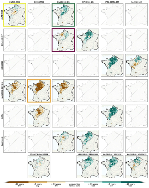
The AquiFR hydrogeological platform, forced by 36 climate projections, simulates future groundwater levels across France. Results reveal significant variability between climate and representative concentration pathways used as socio-economic scenarios, with a dominant signal of rising groundwater levels over most of the study area. Four storylines, representing worst-case scenarios, are selected to inform decision-makers and support the adoption of sustainable groundwater management policies.
Malak Sadki, Gaëtan Noual, Simon Munier, Vanessa Pedinotti, Kaushlendra Verma, Clément Albergel, Sylvain Biancamaria, and Alice Andral
Hydrol. Earth Syst. Sci., 30, 6159–6187, https://doi.org/10.5194/hess-30-6159-2026, https://doi.org/10.5194/hess-30-6159-2026, 2026
Short summary
Short summary
his study explores how 20 years of European Space Agency Climate Change Initiative discharge products improve large-scale hydrological simulations through data assimilation. Tests in two contrasting models across Niger and Congo basins show that temporally dense discharge data reduces bias and improves internal variability. Although product quality, sampling, and basin processes control gain reliability, the findings support these datasets' value in refining models for climate studies.
Julien Lefebve, Sylvain Biancamaria, Alejandro Blazquez, Simon Munier, Laetitia Gal, Rômulo Augusto Jucá Oliveira, and Jordi Etchanchu
EGUsphere, https://doi.org/10.5194/egusphere-2026-4569, https://doi.org/10.5194/egusphere-2026-4569, 2026
Short summary
Short summary
Approaching the water budget closure of a basin gives confidence in our understanding of its water cycle. By analysing 82 major basins worldwide with the most up‑to‑date data, we demonstrate that the large spread in precipitation (44 %), evapotranspiration (33 %) and runoff (36 %) can produce compensations and lead to erroneous conclusions about water budget closure. In the absence of gauge records, calculating discharge from satellite observations rather than from models reduces these errors.
Adrien Manlay, Jean-Pierre Vergnes, Simon Munier, and Florence Habets
EGUsphere, https://doi.org/10.5194/egusphere-2026-1504, https://doi.org/10.5194/egusphere-2026-1504, 2026
Short summary
Short summary
Groundwater is a key resource for human activities, predicting its evolution months in advance poses a significant challenge. Forecasts can be erroneous due to model uncertainties. In this study, we developed a method that integrates observed groundwater levels into a numerical model to improve seasonal forecasts. By continuously updating the model with observations, we achieved more accurate water level simulations and predictions up to six months ahead.
Eric Sauquet, Guillaume Evin, Sonia Siauve, Ryma Aissat, Patrick Arnaud, Maud Bérel, Jérémie Bonneau, Flora Branger, Yvan Caballero, François Colléoni, Agnès Ducharne, Joël Gailhard, Florence Habets, Frédéric Hendrickx, Louis Héraut, Benoît Hingray, Peng Huang, Tristan Jaouen, Alexis Jeantet, Sandra Lanini, Matthieu Le Lay, Claire Magand, Louise Mimeau, Céline Monteil, Simon Munier, Charles Perrin, Olivier Robelin, Fabienne Rousset, Jean-Michel Soubeyroux, Laurent Strohmenger, Guillaume Thirel, Flore Tocquer, Yves Tramblay, Jean-Pierre Vergnes, and Jean-Philippe Vidal
Hydrol. Earth Syst. Sci., 30, 2277–2300, https://doi.org/10.5194/hess-30-2277-2026, https://doi.org/10.5194/hess-30-2277-2026, 2026
Short summary
Short summary
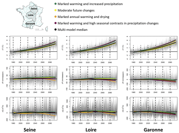
The Explore2 project has provided an unprecedented set of hydrological projections in terms of the number of hydrological models used and the spatial and temporal resolution. The results have been made available through various media. Under the high-emission scenario, the hydrological models mostly agree on the decrease in seasonal flows in the south of France, confirming its hotspot status, and on the decrease in summer flows throughout France, with the exception of the northern part of France.
Guillaume Evin, Benoit Hingray, Guillaume Thirel, Agnès Ducharne, Laurent Strohmenger, Lola Corre, Yves Tramblay, Jean-Philippe Vidal, Jérémie Bonneau, François Colleoni, Joël Gailhard, Florence Habets, Frédéric Hendrickx, Louis Héraut, Peng Huang, Matthieu Le Lay, Claire Magand, Paola Marson, Céline Monteil, Simon Munier, Alix Reverdy, Jean-Michel Soubeyroux, Yoann Robin, Jean-Pierre Vergnes, Mathieu Vrac, and Eric Sauquet
Hydrol. Earth Syst. Sci., 30, 1023–1051, https://doi.org/10.5194/hess-30-1023-2026, https://doi.org/10.5194/hess-30-1023-2026, 2026
Short summary
Short summary
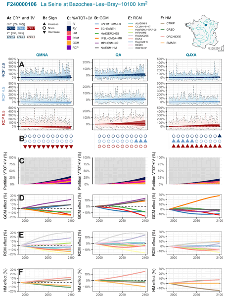
Explore2 provides hydrological projections for 1,735 French catchments. Using QUALYPSO (Quasi-Ergodic Analysis of Climate Projections Using Data Augmentation), this study assesses uncertainties, including internal variability. By the end of the century, low flows are projected to decline in southern France under high emissions, while other indicators remain uncertain. Emission scenarios and regional climate models are key uncertainty sources. Internal variability is often as large as climate-driven changes.
Julia Pfeffer, Anny Cazenave, Alejandro Blazquez, Bertrand Decharme, Simon Munier, and Anne Barnoud
Hydrol. Earth Syst. Sci., 27, 3743–3768, https://doi.org/10.5194/hess-27-3743-2023, https://doi.org/10.5194/hess-27-3743-2023, 2023
Short summary
Short summary
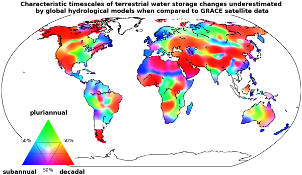
The GRACE (Gravity Recovery And Climate Experiment) satellite mission enabled the quantification of water mass redistributions from 2002 to 2017. The analysis of GRACE satellite data shows here that slow changes in terrestrial water storage occurring over a few years to a decade are severely underestimated by global hydrological models. Several sources of errors may explain such biases, likely including the inaccurate representation of groundwater storage changes.
Laurent Strohmenger, Eric Sauquet, Claire Bernard, Jérémie Bonneau, Flora Branger, Amélie Bresson, Pierre Brigode, Rémy Buzier, Olivier Delaigue, Alexandre Devers, Guillaume Evin, Maïté Fournier, Shu-Chen Hsu, Sandra Lanini, Alban de Lavenne, Thibault Lemaitre-Basset, Claire Magand, Guilherme Mendoza Guimarães, Max Mentha, Simon Munier, Charles Perrin, Tristan Podechard, Léo Rouchy, Malak Sadki, Myriam Soutif-Bellenger, François Tilmant, Yves Tramblay, Anne-Lise Véron, Jean-Philippe Vidal, and Guillaume Thirel
Hydrol. Earth Syst. Sci., 27, 3375–3391, https://doi.org/10.5194/hess-27-3375-2023, https://doi.org/10.5194/hess-27-3375-2023, 2023
Short summary
Short summary
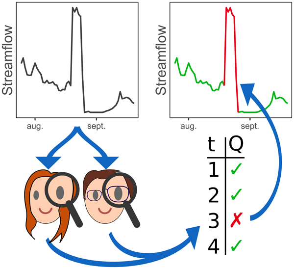
We present the results of a large visual inspection campaign of 674 streamflow time series in France. The objective was to detect non-natural records resulting from instrument failure or anthropogenic influences, such as hydroelectric power generation or reservoir management. We conclude that the identification of flaws in flow time series is highly dependent on the objectives and skills of individual evaluators, and we raise the need for better practices for data cleaning.

Malak Sadki, Simon Munier, Aaron Boone, and Sophie Ricci
Geosci. Model Dev., 16, 427–448, https://doi.org/10.5194/gmd-16-427-2023, https://doi.org/10.5194/gmd-16-427-2023, 2023
Short summary
Short summary
Predicting water resource evolution is a key challenge for the coming century.
Anthropogenic impacts on water resources, and particularly the effects of dams and reservoirs on river flows, are still poorly known and generally neglected in global hydrological studies. A parameterized reservoir model is reproduced to compute monthly releases in Spanish anthropized river basins. For global application, an exhaustive sensitivity analysis of the model parameters is performed on flows and volumes.
Arsène Druel, Simon Munier, Anthony Mucia, Clément Albergel, and Jean-Christophe Calvet
Geosci. Model Dev., 15, 8453–8471, https://doi.org/10.5194/gmd-15-8453-2022, https://doi.org/10.5194/gmd-15-8453-2022, 2022
Short summary
Short summary
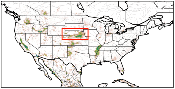
Crop phenology and irrigation is implemented into a land surface model able to work at a global scale. A case study is presented over Nebraska (USA). Simulations with and without the new scheme are compared to different satellite-based observations. The model is able to produce a realistic yearly irrigation water amount. The irrigation scheme improves the simulated leaf area index, gross primary productivity, evapotransipiration, and land surface temperature.

Simon Munier and Bertrand Decharme
Earth Syst. Sci. Data, 14, 2239–2258, https://doi.org/10.5194/essd-14-2239-2022, https://doi.org/10.5194/essd-14-2239-2022, 2022
Short summary
Short summary
This paper presents a new global-scale river network at 1/12°, generated automatically and assessed over the 69 largest basins of the world. A set of hydro-geomorphological parameters are derived at the same spatial resolution, including a description of river stretches (length, slope, width, roughness, bankfull depth), floodplains (roughness, sub-grid topography) and aquifers (transmissivity, porosity, sub-grid topography). The dataset may be useful for hydrology modelling or climate studies.
Cited articles
Altenau, E. H., Pavelsky, T. M., Durand, M. T., Yang, X., Frasson, R. P. D. M., and Bendezu, L.: The Surface Water and Ocean Topography (SWOT) Mission River Database (SWORD): A Global River Network for Satellite Data Products, Water Resour. Res., 57, e2021WR030054, https://doi.org/10.1029/2021WR030054, 2021.
Altenau, E. H., Pavelsky, T. M., Durand, M. T., Yang, X., Frasson, R. P. D. M., and Bendezu, L.: SWOT River Database (SWORD) (Version v17b) [Dataset], Zenodo [data set], https://doi.org/10.5281/zenodo.15299138, 2025.
Berkaoui, M. A., Saadi, M., Colleoni, F., Huynh, N. N. T., Akhtari, A., Larnier, K., Roux, H., and Garambois, P.-A.: A Raster–Vector Framework for Multi-Scale Hydrological–Hydraulic Modeling Across Large Domains, EGUsphere [preprint], https://doi.org/10.5194/egusphere-2026-1557, 2026.
Biancamaria, S., Lettenmaier, D. P., and Pavelsky, T. M.: The SWOT Mission and Its Capabilities for Land Hydrology, Surv. Geophys., 37, 307–337, https://doi.org/10.1007/s10712-015-9346-y, 2016.
Decharme, B., Delire, C., Minvielle, M., Colin, J., Vergnes, J.-P., Alias, A., Saint-Martin, D., Séférian, R., Sénési, S., and Voldoire, A.: Recent changes in the ISBA-CTRIP land surface system for use in the CNRM-CM6 climate model and in global off-line hydrological applications, J. Adv. Model. Earth Syst., 11, 1207–1252, https://doi.org/10.1029/2018MS001545, 2019.
Döll, P. and Lehner, B.: Validation of a new global 30 min drainage direction map, J. Hydrol., 258, 214–231, https://doi.org/10.1016/S0022-1694(01)00565-0, 2002.
Durand, M., Gleason, C. J., Garambois, P. A., Bjerklie, D., Smith, L. C., Roux, H., Rodriguez, E., Bates, P. D., Pavelsky, T. M., Monnier, J., Chen, X., Di Baldassarre, G., Fiset, J.-M., Flipo, N., Frasson, R. P. D. M., Fulton, J., Goutal, N., Hossain, F., Humphries, E., Minear, J. T., Mukolwe, M. M., Neal, J. C., Ricci, S., Sanders, B. F., Schumann, G., Schubert, J. E., and Vilmin, L.: An intercomparison of remote sensing river discharge estimation algorithms from measurements of river height, width, and slope, Water Resour. Res., 52, 4527–4549, https://doi.org/10.1002/2015WR018434, 2016.
Fekete, B. M., Vörösmarty, C. J., and Grabs, W.: High-resolution fields of global runoff combining observed river discharge and simulated water balances, Global Biogeochem. Cy., 16, 15-1–15-10, https://doi.org/10.1029/1999GB001254, 2002.
Godet, J., Gaume, E., Javelle, P., Nicolle, P., and Payrastre, O.: Technical note: Comparing three different methods for allocating river points to coarse-resolution hydrological modelling grid cells, Hydrol. Earth Syst. Sci., 28, 1403–1413, https://doi.org/10.5194/hess-28-1403-2024, 2024.
Lohmann, D., Raschke, E., Nijssen, B., and Lettenmaier, D. P.: Regional scale hydrology: I. Formulation of the VIC-2 L model coupled to a routing model, Hydrolog. Sci. J., 43, 131–141, https://doi.org/10.1080/02626669809492107, 1998.
Mizukami, N., Clark, M. P., Sampson, K., Nijssen, B., Mao, Y., McMillan, H., Viger, R. J., Markstrom, S. L., Hay, L. E., Woods, R., Arnold, J. R., and Brekke, L. D.: mizuRoute version 1: a river network routing tool for a continental domain water resources applications, Geosci. Model Dev., 9, 2223–2238, https://doi.org/10.5194/gmd-9-2223-2016, 2016.
Munier, S. and Decharme, B.: River network and hydro-geomorphological parameters at 1
Munier, S. and Decharme, B.: River network and hydro-geomorphological parameters at 1/12° resolution for global hydrological and climate studies (Version 1.1.3) [Dataset], Zenodo [data set], https://doi.org/10.5281/zenodo.6482906, 2022b.
O'Callaghan, J. F. and Mark, D. M.: The extraction of drainage networks from digital elevation data, Comput. Vision Graph., 28, 323–344, https://doi.org/10.1016/S0734-189X(84)80011-0, 1984.
Shrestha, P. K., Samaniego, L., Rakovec, O., Kumar, R., and Thober, S.: A Novel Stream Network Upscaling Scheme for Accurate Local Streamflow Simulations in Gridded Global Hydrological Models, Water Resour. Res., 61, e2024WR038183, https://doi.org/10.1029/2024WR038183, 2025.
Van Der Knijff, J. M., Younis, J., and De Roo, A. P. J.: LISFLOOD: a GIS-based distributed model for river basin scale water balance and flood simulation, Int. J. Geogr. Inf. Sci., 24, 189–212, https://doi.org/10.1080/13658810802549154, 2010.
Verma, K. and Munier, S.: SWORD-CTRIP Mapping (SCM v1.0): A Confidence-Aware Framework for Mapping Satellite-Derived River Reaches to Gridded Routing Networks (Version SCM v1.0) [Software], Zenodo [code], https://doi.org/10.5281/zenodo.18402332, 2026.
Verma, K., Munier, S., Boone, A., and Le Moigne, P.: CTRIP-HyDAS: A Global-Scale Data Assimilation Framework for SWOT-Derived Discharge using Synthetic Observations at High Resolution (
Wade, J., David, C. H., Altenau, E. H., Collins, E. L., Oubanas, H., Coss, S., Cerbelaud, A., Tom, M., Durand, M., and Pavelsky, T. M.: Bidirectional Translations Between Observational and Topography-Based Hydrographic Data Sets: MERIT-Basins and the SWOT River Database (SWORD), Water Resour. Res., 61, e2024WR038633, https://doi.org/10.1029/2024WR038633, 2025.
Yamazaki, D., Kanae, S., Kim, H., and Oki, T.: A physically based description of floodplain inundation dynamics in a global river routing model, Water Resour. Res., 47, https://doi.org/10.1029/2010WR009726, 2011.
Yamazaki, D., Ikeshima, D., Tawatari, R., Yamaguchi, T., O'Loughlin, F., Neal, J. C., Sampson, C. C., Kanae, S., and Bates, P. D.: A high-accuracy map of global terrain elevations, Geophys. Res. Lett., 44, 5844–5853, https://doi.org/10.1002/2017GL072874, 2017.
Yamazaki, D., Ikeshima, D., Sosa, J., Bates, P. D., Allen, G. H., and Pavelsky, T. M.: MERIT Hydro: A High-Resolution Global Hydrography Map Based on Latest Topography Dataset, Water Resour. Res., 55, 5053–5073, https://doi.org/10.1029/2019WR024873, 2019.
Short summary
Satellite provide river observations as vector reaches, while large-scale hydrological models represent rivers on gridded routing networks. This structural mismatch limits direct data assimilation. We present a global, confidence-aware framework that assigns vector river reaches to routing pixels using geometric and hydrological consistency criteria. Results show that most routing pixels can be assigned with high confidence while preserving basin-scale drainage topology into hydrological models.
Satellite provide river observations as vector reaches, while large-scale hydrological models...


Altmetrics
Final-revised paper
Preprint