
Articles | Volume 19, issue 20
https://doi.org/10.5194/gmd-19-10051-2026
© Author(s) 2026. This work is distributed under
the Creative Commons Attribution 4.0 License.
the Creative Commons Attribution 4.0 License.
https://doi.org/10.5194/gmd-19-10051-2026
© Author(s) 2026. This work is distributed under
the Creative Commons Attribution 4.0 License.
the Creative Commons Attribution 4.0 License.
Development and technical paper
| 
21 Oct 2026
Development and technical paper |
| 21 Oct 2026
| 21 Oct 2026
A preliminary study on a synergistic assimilation scheme for multi-band satellite soil moisture data
Xuesong Bai
Collaborative Innovation Center on Forecast and Evaluation of Meteorological Disasters, Nanjing University of Information Science and Technology, Nanjing, 210044, China
International Center for Climate and Environment Sciences, Institute of Atmospheric Physics, Chinese Academy of Sciences, Beijing, 100029, China
State Key Laboratory of Climate System Prediction and Risk Management, Nanjing University of Information Science and Technology, Nanjing, 210044, China

International Center for Climate and Environment Sciences, Institute of Atmospheric Physics, Chinese Academy of Sciences, Beijing, 100029, China
Collaborative Innovation Center on Forecast and Evaluation of Meteorological Disasters, Nanjing University of Information Science and Technology, Nanjing, 210044, China
Zhengkun Qin
Collaborative Innovation Center on Forecast and Evaluation of Meteorological Disasters, Nanjing University of Information Science and Technology, Nanjing, 210044, China
State Key Laboratory of Climate System Prediction and Risk Management, Nanjing University of Information Science and Technology, Nanjing, 210044, China
Juan Li
CMA Earth System Modeling and Prediction Centre, Beijing, 100081, China
State Key Laboratory of Severe Weather, Chinese Academy of Meteorological Sciences, Beijing, 100081, China
Related authors
Xuesong Bai, Zhaohui Lin, Zhengkun Qin, and Juan Li
Geosci. Model Dev., 19, 4977–4997, https://doi.org/10.5194/gmd-19-4977-2026, https://doi.org/10.5194/gmd-19-4977-2026, 2026
Short summary
Short summary
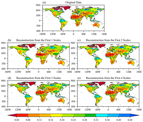
Accurate soil moisture is crucial for weather prediction, but traditional methods often miss correct spatial patterns. We addressed this by treating moisture data as cohesive images rather than isolated points. Using image processing, we optimized both the location and intensity of moisture anomalies. This approach doubled the accuracy of spatial patterns and reduced errors in China and the United States.
Didier Swingedouw, Laura Jackson, Aixue Hu, Anastasia Romanou, Nicole C. Laureanti, Wilbert Weijer, Sina Loriani, Bette Otto-Bliesner, Ayako Abe-Ouchi, Lucas Almeida, Alessio Bellucci, Reyk Börner, Gokhan Danabasoglu, Donovan P. Dennis, Marion Devilliers, Sybren Drijfhout, Jonathan Donges, Friederike Fröb, Thomas L. Frölicher, Guillaume Gastineau, Heiko Goelzer, Chuncheng Guo, Urs Hofmann, Anna Höse, Colin Jones, Torben Koenigk, Ann Kristin Klose, Valerio Lembo, Jose Licon-Salaiz, Ken Mankoff, Virna Meccia, Irina Melnikova, Oliver Mehling, Laurie Menviel, Juliette Mignot, Jon I. Robson, Gavin A. Schmidt, Robin Smith, Yuchen Sun, Irene Trombini, Matteo Willeit, Richard Wood, Fanghua Wu, Lin Zhaohui, and Ricarda Winkelmann
EGUsphere, https://doi.org/10.5194/egusphere-2026-1698, https://doi.org/10.5194/egusphere-2026-1698, 2026
Short summary
Short summary
This study presents a plan for climate model experiments to better understand how changes in freshwater in the North Atlantic affect major ocean currents. We designed coordinated simulations to test their response to warming, added freshwater, and possible recovery after weakening. Comparing results across models and past climate evidence helps improve confidence in projections and assess risks of large ocean circulation changes.
Guangxing Lin, Wei Liao, Zhaohui Lin, He Zhang, Wenbin Kou, Xiaojie Guo, Zhenghui Xie, Qiu Yang, Chenglai Wu, and Minghua Zhang
Geosci. Model Dev., 19, 327–343, https://doi.org/10.5194/gmd-19-327-2026, https://doi.org/10.5194/gmd-19-327-2026, 2026
Short summary
Short summary
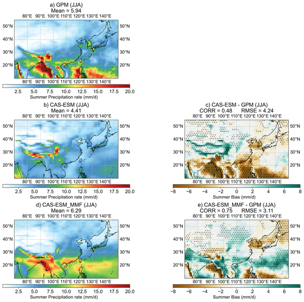
Traditional climate models struggle to accurately represent storm clouds, leading to large rainfall biases over East Asia. To address this, we used a multiscale modeling framework that embeds a high-resolution cloud model into each grid cell of the Chinese Academy of Sciences Earth System Model. This approach greatly improves the simulation of East Asian precipitation.
Minghui Zhang, Yunjie Chen, Fan Yang, and Zhengkun Qin
Geosci. Model Dev., 19, 73–91, https://doi.org/10.5194/gmd-19-73-2026, https://doi.org/10.5194/gmd-19-73-2026, 2026
Short summary
Short summary
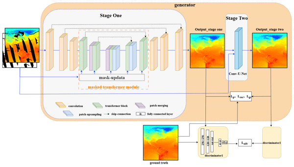
Considering the crucial role of high-resolution surface observation temperature data in the study of surface atmospheric temperature in Marine areas, we propose a new two-stage deep learning model. This model is used to fill in the ocean surface temperature data that is missing in satellite observations due to the orbital gap of polar-orbiting satellites.
Bing Zhang, Mingjian Zeng, Anning Huang, Zhengkun Qin, Couhua Liu, Wenru Shi, Xin Li, Kefeng Zhu, Chunlei Gu, and Jialing Zhou
Geosci. Model Dev., 17, 4579–4601, https://doi.org/10.5194/gmd-17-4579-2024, https://doi.org/10.5194/gmd-17-4579-2024, 2024
Short summary
Short summary
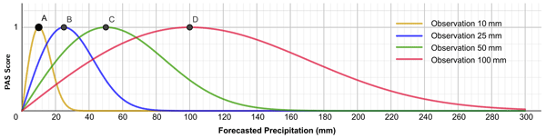
By directly analyzing the proximity of precipitation forecasts and observations, a precipitation accuracy score (PAS) method was constructed. This method does not utilize a traditional contingency-table-based classification verification; however, it can replace the threat score (TS), equitable threat score (ETS), and other skill score methods, and it can be used to calculate the accuracy of numerical models or quantitative precipitation forecasts.
Wangbin Shen, Zhaohui Lin, Zhengkun Qin, and Juan Li
Geosci. Model Dev., 17, 3447–3465, https://doi.org/10.5194/gmd-17-3447-2024, https://doi.org/10.5194/gmd-17-3447-2024, 2024
Short summary
Short summary
In this study, a land surface image assimilation system capable of optimizing the spatial structure of the background field is constructed by introducing the curvelet analysis method and taking the similarity of image structure as a weak constraint. The findings demonstrate that the assimilation of surface soil moisture observation images effectively and reasonably enhances the spatial structure of soil moisture analysis field.
Cited articles
Albergel, C., Munier, S., Leroux, D. J., Dewaele, H., Fairbairn, D., Barbu, A. L., Gelati, E., Dorigo, W., Faroux, S., Meurey, C., Le Moigne, P., Decharme, B., Mahfouf, J.-F., and Calvet, J.-C.: Sequential assimilation of satellite-derived vegetation and soil moisture products using SURFEX_v8.0: LDAS-Monde assessment over the Euro-Mediterranean area, Geosci. Model Dev., 10, 3889–3912, https://doi.org/10.5194/gmd-10-3889-2017, 2017.
Bai, X.: A Preliminary Study on a Synergistic Assimilation Scheme for Multi-band Satellite Soil Moisture Data, Zenodo [data set and code], https://doi.org/10.5281/zenodo.18978246, 2026.
Bai, X., Qin, Z., Li, J., Zhang, S., and Wang, L.: The Impact of Spatial Dynamic Error on the Assimilation of Soil Moisture Retrieval Products, Remote Sens., 17, 239, https://doi.org/10.3390/rs17020239, 2025.
Balsamo, G., Bouyssel, F., and Noilhan, J.: A simplified bi-dimensional variational analysis of soil moisture from screen-level observations in a mesoscale numerical weather-prediction model, Q. J. Roy. Meteor. Soc., 130, 895–915, https://doi.org/10.1256/qj.02.215, 2004.
Bartalis, Z., Wagner, W., Naeimi, V., Hasenauer, S., Scipal, K., Bonekamp, H., Figa, J., and Anderson, C.: Initial soil moisture retrievals from the METOP-A Advanced Scatterometer (ASCAT), Geophys. Res. Lett., 34, https://doi.org/10.1029/2007GL031088, 2007.
Brocca, L., Moramarco, T., Melone, F., Wagner, W., Hasenauer, S., and Hahn, S.: Assimilation of surface- and root-zone ASCAT soil moisture products into rainfall-runoff modeling, IEEE T. Geosci. Remote, 50, 2542–2555, https://doi.org/10.1109/TGRS.2011.2177468, 2012.
Carrera, M. L., Bélair, S., and Bilodeau, B.: Assimilation of passive L-band microwave brightness temperatures in the Canadian Land Data Assimilation System: Impacts on short-range warm season numerical weather prediction, J. Hydrometeorol., 20, 1085–1105, https://doi.org/10.1175/JHM-D-18-0133.1, 2019.
Chambon, P., Mahfouf, J.-F., Audouin, O., Birman, C., Fourrié, N., Loo, C., Martet, M., Moll, P., Payan, C., Pourret, V., and Raspaud, D.: Global Observing System Experiments within the Météo-France 4D-Var Data Assimilation System, Mon. Weather Rev., 151, 127–143, https://doi.org/10.1175/MWR-D-22-0087.1, 2023.
Chaubell, M. J., Yueh, S. H., Dunbar, R. S., Colliander, A., Chen, F., Chan, S. K., Entekhabi, D., Bindlish, R., O'Neill, P. E., Asanuma, J., Berg, A. A., Bosch, D. D., Caldwell, T., Cosh, M. H., Holifield Collins, C., Martínez-Fernández, J., Seyfried, M., Starks, P. J., Su, Z., Thibeault, M., and Walker, J.: Improved SMAP dual-channel algorithm for the retrieval of soil moisture, IEEE T. Geosci. Remote Sens., 58, 3894–3905, https://doi.org/10.1109/TGRS.2019.2959239, 2029.
Chen, F., Crow, W. T., Bindlish, R., Colliander, A., Burgin, M. S., Asanuma, J., and Aida, K.: Global-scale evaluation of SMAP, SMOS and ASCAT soil moisture products using triple collocation, Remote Sens. Environ., 214, 1–13, https://doi.org/10.1016/j.rse.2018.05.008, 2018.
Dai, Y., Zeng, X., Dickinson, R. E., Baker, I., Bonan, G. B., Bosilovich, M. G., Denning, A. S., Dirmeyer, P. A., Houser, P. R., Niu, G., Oleson, K. W., Schlosser, C. A., and Yang, Z.-L.: The Common Land Model, B. Am. Meteorol. Soc., 84, 1013–1024, https://doi.org/10.1175/BAMS-84-8-1013, 2003.
Dash, S. K. and Sinha, R.: A Comprehensive Evaluation of Gridded L-, C-, and X-Band Microwave Soil Moisture Product over the CZO in the Central Ganga Plains, India, Remote Sens., 14, 1629, https://doi.org/10.3390/rs14071629, 2019.
de Rosnay, P., Drusch, M., Vasiljevic, D., Balsamo, G., Albergel, C., and Isaksen, L.: A simplified Extended Kalman Filter for the global operational soil moisture analysis at ECMWF, Q. J. Roy. Meteor. Soc., 139, 1199–1213, https://doi.org/10.1002/qj.2023, 2013.
Dorigo, W., Wagner, W., Albergel, C., Albrecht, F., Balsamo, G., Brocca, L., Chung, D., Ertl, M., Forkel, M., Gruber, A., Haas, E., Hamer, P. D., Hirschi, M., Ikonen, J., de Jeu, R., Kidd, R., Lahoz, W., Liu, Y. Y., Miralles, D., Mistelbauer, T., Nicolai-Shaw, N., Parinussa, R., Pratola, C., Reimer, C., van der Schalie, R., Seneviratne, S. I., Smolander, T., and Lecomte, P.: ESA CCI Soil Moisture for improved Earth system understanding: State-of-the art and future directions, Remote Sens. Environ., 203, 185–215, https://doi.org/10.1016/j.rse.2017.07.001, 2017.
Dorigo, W., Himmelbauer, I., Aberer, D., Schremmer, L., Petrakovic, I., Zappa, L., Preimesberger, W., Xaver, A., Annor, F., Ardö, J., Baldocchi, D., Bitelli, M., Blöschl, G., Bogena, H., Brocca, L., Calvet, J.-C., Camarero, J. J., Capello, G., Choi, M., Cosh, M. C., van de Giesen, N., Hajdu, I., Ikonen, J., Jensen, K. H., Kanniah, K. D., de Kat, I., Kirchengast, G., Kumar Rai, P., Kyrouac, J., Larson, K., Liu, S., Loew, A., Moghaddam, M., Martínez Fernández, J., Mattar Bader, C., Morbidelli, R., Musial, J. P., Osenga, E., Palecki, M. A., Pellarin, T., Petropoulos, G. P., Pfeil, I., Powers, J., Robock, A., Rüdiger, C., Rummel, U., Strobel, M., Su, Z., Sullivan, R., Tagesson, T., Varlagin, A., Vreugdenhil, M., Walker, J., Wen, J., Wenger, F., Wigneron, J. P., Woods, M., Yang, K., Zeng, Y., Zhang, X., Zreda, M., Dietrich, S., Gruber, A., van Oevelen, P., Wagner, W., Scipal, K., Drusch, M., and Sabia, R.: The International Soil Moisture Network: serving Earth system science for over a decade, Hydrol. Earth Syst. Sci., 25, 5749–5804, https://doi.org/10.5194/hess-25-5749-2021, 2021.
Draper, C. and Reichle, R.: The impact of near-surface soil moisture assimilation at subseasonal, seasonal, and inter-annual timescales, Hydrol. Earth Syst. Sci., 19, 4831–4844, https://doi.org/10.5194/hess-19-4831-2015, 2015.
Draper, C. S., Mahfouf, J.-F., and Walker, J. P.: An EKF assimilation of AMSR-E soil moisture into the ISBA land surface scheme, J. Geophys. Res., 114, D20104, https://doi.org/10.1029/2008JD011650, 2009.
Draper, C. S., Reichle, R. H., De Lannoy, G. J. M., and Liu, Q.: Assimilation of passive and active microwave soil moisture retrievals, Geophys. Res. Lett., 39, L04401, https://doi.org/10.1029/2011GL050655, 2012.
Drusch, M., Scipal, K., de Rosnay, P., Balsamo, G., Andersson, E., Bougeault, P., and Viterbo, P.: Towards a Kalman Filter based soil moisture analysis system for the operational ECMWF Integrated Forecast System, Geophys. Res. Lett., 36, L10401, https://doi.org/10.1029/2009GL037716, 2009.
Entekhabi, D., Njoku, E. G., O'Neill, P. E., Kellogg, K. H., Crow, W. T., Edelstein, W. N., Entin, J. K., Goodman, S. D., Jackson, T. J., Johnson, J., Kimball, J., Piepmeier, J. R., Koster, R. D., Martin, N., McDonald, K. C., Moghaddam, M., Moran, S., Reichle, R., Shi, J. C., Spencer, M. W., Thurman, S. W., Tsang, L., and Van Zyl, J.: The Soil Moisture Active Passive (SMAP) Mission, Proc. IEEE, 98, 704–716, https://doi.org/10.1109/JPROC.2010.2043918, 2010.
Gibon, F., Mialon, A., Richaume, P., Rodríguez-Fernández, N., Aberer, D., Boresch, A., Crapolicchio, R., Dorigo, W., Gruber, A., Himmelbauer, I., Preimesberger, W., Sabia, R., Stradiotti, P., Tercjak, M., and Kerr, Y. H.: Estimating the uncertainties of satellite derived soil moisture at global scale, Sci. Remote Sens., 10, 100147, https://doi.org/10.1016/j.srs.2024.100147, 2024.
Girotto, M., Reichle, R. H., Rodell, M., Liu, Q., Mahanama, S., and De Lannoy, G. J.: Multi-sensor assimilation of SMOS brightness temperature and GRACE terrestrial water storage observations for soil moisture and shallow groundwater estimation, Remote Sens. Environ., 227, 12–27, https://doi.org/10.1016/j.rse.2019.03.040, 2019.
Gruber, A., Scanlon, T., van der Schalie, R., Wagner, W., and Dorigo, W.: Evolution of the ESA CCI Soil Moisture climate data records and their underlying merging methodology, Earth Syst. Sci. Data, 11, 717–739, https://doi.org/10.5194/essd-11-717-2019, 2019.
Herbert, C., de Rosnay, P., Weston, P., and Fairbairn, D.: Towards unified land data assimilation at ECMWF: Soil and snow temperature analysis in the SEKF, Q. J. Roy. Meteor. Soc., 150, 4133–4155, https://doi.org/10.1002/qj.4808, 2024.
Hersbach, H., Bell, B., Berrisford, P., Hirahara, S., Horányi, A., Muñoz-Sabater, J., Nicolas, J., Peubey, C., Radu, R., Schepers, D., Simmons, A., Soci, C., Abdalla, S., Abellan, X., Balsamo, G., Bechtold, P., Biavati, G., Bidlot, J., Bonavita, M., De Chiara, G., Dahlgren, P., Dee, D., Diamantakis, M., Dragani, R., Flemming, J., Forbes, R., Fuentes, M., Geer, A., Haimberger, L., Healy, S., Hogan, R. J., Hólm, E., Janisková, M., Keeley, S., Laloyaux, P., Lopez, P., Lupu, C., Radnoti, G., de Rosnay, P., Rozum, I., Vamborg, F., Villaume, S., and Thépaut, J.: The ERA5 global reanalysis, Q. J. Roy. Meteor. Soc., 146, 1999–2049, https://doi.org/10.1002/qj.3803, 2020.
Hess, R.: Assimilation of screen-level observations by variational soil moisture analysis, Meteorol. Atmos. Phys., 77, 145–154, https://doi.org/10.1007/s007030170023, 2001.
Kang, C. S., Zhao, T., Shi, J., Cosh, M. H., Chen, Y., Starks, P. J., Collins, C. H., Wu, S., Sun, R., and Zheng, J.: Global Soil Moisture Retrievals From the Chinese FY-3D Microwave Radiation Imager, IEEE T. Geosci. Remote, 59, 4018–4032, https://doi.org/10.1109/TGRS.2020.3019408, 2020.
Kerr, Y. H., Waldteufel, P., Wigneron, J.-P., Delwart, S., Cabot, F., Boutin, J., Escorihuela, M.-J., Font, J., Reul, N., Gruhier, C., Juglea, S. E., Drinkwater, M. R., Hahne, A., Martín-Neira, M., and Mecklenburg, S.: The SMOS Mission: New Tool for Monitoring Key Elements ofthe Global Water Cycle, Proc. IEEE, 98, 666–687, https://doi.org/10.1109/JPROC.2010.2043032, 2010.
Kerr, Y. H., Waldteufel, P., Richaume, P., Wigneron, J. P., Ferrazzoli, P., Mahmoodi, A., Al Bitar, A., Cabot, F., Gruhier, C., Juglea, S. E., Leroux, D., Mialon, A., and Delwart, S.: The SMOS Soil Moisture Retrieval Algorithm, IEEE T. Geosci. Remote, 50, 1384–1403, https://doi.org/10.1109/TGRS.2012.2184548, 2012.
Khaki, M., Hoteit, I., Kuhn, M., Forootan, E., and Awange, J.: Assessing data assimilation frameworks for using multi-mission satellite products in a hydrological context, Sci. Total Environ., 647, 1031–1043, https://doi.org/10.1016/j.scitotenv.2018.08.032, 2019.
Kim, H., Parinussa, R., Konings, A. G., Wagner, W., Cosh, M. H., Lakshmi, V., Zohaib, M., and Choi, M.: Global-scale assessment and combination of SMAP with ASCAT (active) and AMSR2 (passive) soil moisture products, Remote Sens. Environ., 204, 260–275, https://doi.org/10.1016/j.rse.2017.10.026, 2018.
Kim, H., Crow, W., Li, X., Wagner, W., Hahn, S., and Lakshmi, V.: True global error maps for SMAP, SMOS, and ASCAT soil moisture data based on machine learning and triple collocation analysis, Remote Sens. Environ., 298, 113776, https://doi.org/10.1016/j.rse.2023.113776, 2023.
Kolassa, J., Reichle, R. H., and Draper, C. S.: Merging active and passive microwave observations in soil moisture data assimilation, Remote Sens. Environ., 191, 117–130, https://doi.org/10.1016/j.rse.2017.01.015, 2017.
Koster, R. D., Schubert, S. D., DeAngelis, A. M., Molod, A. M., and Mahanama, S. P.: Using a Simple Water Balance Framework to Quantify the Impact of Soil Moisture Initialization on Subseasonal Evapotranspiration and Air Temperature Forecasts, J. Hydrometeorol., 21, 1705–1722, https://doi.org/10.1175/JHM-D-20-0007.1, 2020.
Kumar, S. V., Peterslidard, C., Tian, Y., Houser, P., Geiger, J., Olden, S., Lighty, L., Eastman, J., Doty, B., and Dirmeyer, P.: Land information system: An interoperable framework for high resolution land surface modeling, Environ. Modell. Softw., 21, 1402–1415, https://doi.org/10.1016/j.envsoft.2005.07.004, 2006.
Kumar, S. V., Reichle, R. H., Koster, R. D., Crow, W. T., and Peters-Lidard, C. D.: Role of Subsurface Physics in the Assimilation of Surface Soil Moisture Observations, J. Hydrometeorol., 10, 1534–1547, https://doi.org/10.1175/2009JHM1134.1, 2009.
Kumar, S. V., Peters-Lidard, C. D., Mocko, D., Reichle, R., Liu, Y., Arsenault, K. R., Xia, Y., Ek, M., Riggs, G., Livneh, B., and Cosh, M.: Assimilation of Remotely Sensed Soil Moisture and Snow Depth Retrievals for Drought Estimation, J. Hydrometeorol., 15, 2446–2469, https://doi.org/10.1175/JHM-D-13-0132.1, 2014.
Lawrence, D. M., Fisher, R. A., Koven, C. D., Oleson, K. W., Swenson, S. C., Bonan, G., Collier, N., Ghimire, B., van Kampenhout, L., Kennedy, D., Kluzek, E., Lawrence, P. J., Li, F., Li, H., Lombardozzi, D., Riley, W. J., Sacks, W. J., Shi, M., Vertenstein, M., Wieder, W. R., Xu, C., Ali, A. A., Badger, A. M., Bisht, G., van den Broeke, M., Brunke, M. A., Burns, S. P., Buzan, J., Clark, M., Craig, A., Dahlin, K., Drewniak, B., Fisher, J. B., Flanner, M., Fox, A. M., Gentine, P., Hoffman, F., Keppel-Aleks, G., Knox, R., Kumar, S., Lenaerts, J., Leung, L. R., Lipscomb, W. H., Lu, Y., Pandey, A., Pelletier, J. D., Perket, J., Randerson, J. T., Ricciuto, D. M., Sanderson, B. M., Slater, A., Subin, Z. M., Tang, J., Thomas, R. Q., Val Martin, M., and Zeng, X.: The Community Land Model Version 5: Description of New Features, Benchmarking, and Impact of Forcing Uncertainty, J. Adv. Model. Earth Sy., 11, 4245–4287, https://doi.org/10.1029/2018MS001583, 2019.
Li, J., Qin, Z., Liu, G., and Huang, J.: Added Benefit of the Early-Morning-Orbit Satellite Fengyun-3E on the Global Microwave Sounding of the Three-Orbit Constellation, Adv. Atmos. Sci., 41, 39–52, https://doi.org/10.1007/s00376-023-2388-z, 2024.
Li, X., Chen, G., Liu, X., Liang, X., Wang, S., Chen, Y., Pei, F., and Xu, X.: A New Global Land-Use and Land-Cover Change Product at a 1-km Resolution for 2010 to 2100 Based on Human–Environment Interactions, Ann. Am. Assoc. Geograph., 107, 1040–1059, https://doi.org/10.1080/24694452.2017.1303357, 2017.
Lievens, H., Reichle, R. H., Liu, Q., De Lannoy, G. J., Dunbar, R. S., Kim, S. B., Das, N. N., Cosh, M., Walker, J. P., and Wagner, W.: Joint Sentinel-1 and SMAP data assimilation to improve soil moisture estimates, Geophys. Res. Lett., 44, 6145–6153, https://doi.org/10.1002/2017GL073904, 2017.
Lin, L., Ebtehaj, A. M., Wang, J., and Bras, R. L.: Soil moisture background error covariance and data assimilation in a coupled land-atmosphere model, Water Resour. Res., 53, 1309–1335, https://doi.org/10.1002/2015WR017548, 2017.
Lin, Z., Liu, H., Xie, Z., Wang, A., and Liu, S.: The Curvelet Transform, Chin. J. Atmos. Sci., 27, 118–133, https://doi.org/10.3878/j.issn.1006-9895.2008.04.19, 2010.
Liu, D. and Mishra, A. K.: Performance of AMSR_E soil moisture data assimilation in CLM4.5 model for monitoring hydrologic fluxes at global scale, J. Hydrol., 547, 67–79, https://doi.org/10.1016/j.jhydrol.2017.01.036, 2017.
Liu, W., Wang, J., Xu, F., Li, C., and Xian, T.: Validation of Four Satellite-Derived Soil Moisture Products Using Ground-Based In Situ Observations over Northern China, Remote Sens., 14, 1419, https://doi.org/10.3390/rs14061419, 2022.
Liu, Y., Peters-Lidard, C. D., Kumar, S., Foster, J. L., Shaw, M., Tian, Y., and Fall, G. M.: Assimilating satellite-based snow depth and snow cover products for improving snow predictions in Alaska, Adv. Water Res., 54, 208–227, https://doi.org/10.1016/j.advwatres.2013.02.005, 2013.
Mousa, B. G. and Shu, H.: Spatial Evaluation and Assimilation of SMAP, SMOS, and ASCAT Satellite Soil Moisture Products Over Africa Using Statistical Techniques, Earth Space Sci., 7, e2019EA000841, https://doi.org/10.1029/2019EA000841, 2020.
Muñoz-Sabater, J.: ERA5-Land hourly data from 1950 to present, Copernicus Climate Change Service (C3S) Climate Data Store (CDS) [data set], https://doi.org/10.24381/cds.e2161bac, 2019.
Njoku, E., Stacey, J., and Barath, F.: The Seasat scanning multichannel microwave radiometer (SMMR): Instrument description and performance, IEEE J. Ocean. Eng., 5, 100–115, https://doi.org/10.1109/JOE.1980.1145458, 1980.
Njoku, E. G., Jackson, T. J., Lakshmi, V., Chan, T. K., and Nghiem, S. V.: Soil moisture retrieval from AMSR-E, IEEE T. Geosci. Remote, 41, 215–229, https://doi.org/10.1109/TGRS.2002.808243, 2003.
O'Neill, P. E., Bindlish, R., Chan, S., Chaubell, J., Colliander, A., Njoku, E., and Jackson, T.: Soil Moisture Active Passive (SMAP) Algorithm Theoretical Basis Document: Level 2 & 3 Soil Moisture (Passive) Data Products, Revision G, Jet Propulsion Laboratory, California Institute of Technology, JPL D-66480, 111 pp., https://nsidc.org/sites/default/files/l2_sm_p_atbd_rev_g_final_oct2021_0.pdf (last access: 24 September 2025), 2021.
O'Neill, P., Chan, S., Njoku, E., Jackson, T., Bindlish, R., Chaubell, J., and Colliander, A.: SMAP enhanced L2 radiometer half-orbit 9 km EASE-grid soil moisture, version 6, NASA National Snow and Ice Data Center Distributed Active Archive Center [data set], https://doi.org/10.5067/BN36FXOMMC4C, 2023.
Paloscia, S., Pettinato, S., Santi, E., Notarnicola, C., Pasolli, L., and Reppucci, A.: Soil moisture mapping using Sentinel-1 images: Algorithm and preliminary validation, Remote Sens. Environ., 134, 234–248, https://doi.org/10.1016/j.rse.2013.02.027, 2013.
Parinussa, R. M., Holmes, T. R. H., Wanders, N., Dorigo, W. A., and de Jeu, R. A. M.: A Preliminary Study toward Consistent Soil Moisture from AMSR2, J. Hydrometeorol., 16, 932–947, https://doi.org/10.1175/JHM-D-13-0200.1, 2015.
Peng, J., Albergel, C., Balenzano, A., Brocca, L., Cartus, O., Cosh, M. H., Crow, W. T., Dabrowska-Zielinska, K., Dadson, S., Davidson, M. W. J., de Rosnay, P., Dorigo, W., Gruber, A., Hagemann, S., Hirschi, M., Kerr, Y. H., Lovergine, F., Mahecha, M. D., Marzahn, P., Mattia, F., Musial, J. P., Preuschmann, S., Reichle, R. H., Satalino, G., Silgram, M., van Bodegom, P. M., Verhoest, N. E. C., Wagner, W., Walker, J. P., Wegmüller, U., and Loew, A.: A roadmap for high-resolution satellite soil moisture applications – confronting product characteristics with user requirements, Remote Sens. Environ., 252, 112162, https://doi.org/10.1016/j.rse.2020.112162, 2021.
Piepmeier, J. R., Focardi, P., Horgan, K. A., Knuble, J., Ehsan, N., Lucey, J., Brambora, C., Brown, P. R., Hoffman, P. J., French, R. T., Mikhaylov, R. L., Kwack, E.-Y., Slimko, E. M., Dawson, D. E., Hudson, D., Peng, J., Mohammed, P. N., De Amici, G., Freedman, A. P., Medeiros, J., Sacks, F., Estep, R., Spencer, M. W., Chen, C. W., Wheeler, K. B., Edelstein, W. N., O'Neill, P. E., and Njoku, E. G.: SMAP L-Band Microwave Radiometer: Instrument Design and First Year on Orbit, IEEE T. Geosci. Remote, 55, 1954–1966, https://doi.org/10.1109/TGRS.2016.2631978, 2017.
Reichle, R. H., Liu, Q., Koster, R. D., Crow, W. T., De Lannoy, G. J. M., Kimball, J. S., Ardizzone, J. V., Bosch, D., Colliander, A., Cosh, M., Kolassa, J., Mahanama, S. P., Prueger, J., Starks, P., and Walker, J. P.: Version 4 of the SMAP Level-4 Soil Moisture Algorithm and Data Product, J. Adv. Model. Earth Sy., 11, 3106–3130, https://doi.org/10.1029/2019MS001729, 2019.
Santanello, J. A., Kumar, S. V., Peters-Lidard, C. D., and Lawston, P. M.: Impact of Soil Moisture Assimilation on Land Surface Model Spinup and Coupled Land–Atmosphere Prediction, J. Hydrometeorol., 17, 517–540, https://doi.org/10.1175/JHM-D-15-0072.1, 2016.
Seneviratne, S. I., Corti, T., Davin, E. L., Hirschi, M., Jaeger, E. B., Lehner, I., Orlowsky, B., and Teuling, A. J.: Investigating soil moisture–climate interactions in a changing climate: A review, Earth Sci. Rev., 99, 125–161, https://doi.org/10.1016/j.earscirev.2010.02.004, 2010.
Seo, E., Lee, M.-I., and Reichle, R. H.: Assimilation of SMAP and ASCAT soil moisture retrievals into the JULES land surface model using the Local Ensemble Transform Kalman Filter, Remote Sens. Environ., 253, 112222, https://doi.org/10.1016/j.rse.2020.112222, 2021.
Shan, X., Steele-Dunne, S., Hahn, S., Wagner, W., Bonan, B., Albergel, C., Calvet, J.-C., and Ku, O.: Assimilating ASCAT normalized backscatter and slope into the land surface model ISBA-A-gs using a Deep Neural Network as the observation operator: Case studies at ISMN stations in western Europe, Remote Sens. Environ., 308, 114167, https://doi.org/10.1016/j.rse.2024.114167, 2024.
Shen, W., Lin, Z., Qin, Z., and Li, J.: Development and preliminary validation of a land surface image assimilation system based on the Common Land Model, Geosci. Model Dev., 17, 3447–3465, https://doi.org/10.5194/gmd-17-3447-2024, 2024.
Stradiotti, P., Gruber, A., Preimesberger, W., and Dorigo, W.: Accounting for seasonal retrieval errors in the merging of multi-sensor satellite soil moisture products, Sci. Remote Sens., 12, 100242, https://doi.org/10.1016/j.srs.2025.100242, 2025.
Taylor, C. M.: Detecting soil moisture impacts on convective initiation in Europe, Geophys. Res. Lett., 42, 4631–4638, https://doi.org/10.1002/2015GL064030, 2015.
Tian, J., Lu, H., Yang, K., Qin, J., Zhao, L., Zhou, J., Jiang, Y., and Ma, X.: Quick estimation of parameters for the land surface data assimilation system and its influence based on the extended Kalman filter and automatic differentiation, Sci. China Earth Sci., 66, 2546–2562, https://doi.org/10.1007/s11430-022-1180-8, 2023.
Wagner, W., Hahn, S., Kidd, R., Melzer, T., Bartalis, Z., Hasenauer, S., Figa-Saldana, J., de Rosnay, P., Jann, A., Schneider, S., Komma, J., Kubu, G., Brugger, K., Aubrecht, C., Züger, J., Gangkofner, U., Kienberger, S., Brocca, L., Wang, Y., Blöschl, G., Eitzinger, J., Steinnocher, K., Zeil, P., and Rubel, F.: The ASCAT soil moisture product: a review of its specifications, validation results, and emerging applications, Meteorol. Z., https://doi.org/10.1127/0941-2948/2013/0399, 2013.
Wanders, N., Karssenberg, D., de Roo, A., de Jong, S. M., and Bierkens, M. F. P.: The suitability of remotely sensed soil moisture for improving operational flood forecasting, Hydrol. Earth Syst. Sci., 18, 2343–2357, https://doi.org/10.5194/hess-18-2343-2014, 2014.
Wanders, N., Karssenberg, D., de Roo, A., de Jong, S. M., Bierkens, M. F. P., Han, C., Brdar, S., and Kollet, S.: Response of Convective Boundary Layer and Shallow Cumulus to Soil Moisture Heterogeneity: A Large-Eddy Simulation Study, J. Adv. Model. Earth Sy., 11, 4305–4322, https://doi.org/10.1029/2019MS001772, 2019.
Yao, P., Lu, H., Zhao, T., Wu, S., Peng, Z., Cosh, M. H., Jia, L., Yang, K., Zhang, P., and Shi, J.: A global daily soil moisture dataset derived from Chinese FengYun Microwave Radiation Imager (MWRI) (2010–2019), Sci. Data, 10, 133, https://doi.org/10.1038/s41597-023-02007-3, 2023.
Yuan, H., Dai, Y., Xiao, Z., Ji, D., and Shangguan, W.: Reprocessing the MODIS Leaf Area Index products for land surface and climate modelling, Remote Sens. Environ., 115, 1171–1187, https://doi.org/10.1016/j.rse.2011.01.001, 2011.
Zafarmomen, N., Alizadeh, H., Bayat, M., Ehtiat, M., and Moradkhani, H.: Assimilation of sentinel-based leaf area index for modeling surface-ground water interactions in irrigation districts, Water Resour. Res., 60, e2023WR036080, https://doi.org/10.1029/2023WR036080, 2024.
Zapotocny, T. H., Jung, J. A., Le Marshall, J. F., and Treadon, R. E.: A Two-Season Impact Study of Satellite and In Situ Data in the NCEP Global Data Assimilation System, Weather Forecast., 22, 887–909, https://doi.org/10.1175/WAF1025.1, 2007.
Zhan, Y. and Lin, Z.: The relationship between June precipitation over mid-lower reaches of the Yangtze River basin and spring soil moisture over the East Asian monsoon region, Acta Meteorol. Sin., 25, 355–363, https://doi.org/10.1007/s13351-011-0310-6, 2011.
Zhan, Y., Lin, Z., Tian, F., Cao, M., and Xu, Y.: The Spatio-Temporal Characteristics of Soil Moisture and Its Memory over Huaihe River Basin, Advances in Meteorological Science and Technology, 10, 87–96, https://doi.org/10.3969/j.issn.2095-1973.2020.05.014, 2020 (in Chinese).
Zhang, Y., Liang, S., Ma, H., He, T., Wang, Q., Li, B., Xu, J., Zhang, G., Liu, X., and Xiong, C.: Generation of global 1 km daily soil moisture product from 2000 to 2020 using ensemble learning, Earth Syst. Sci. Data, 15, 2055–2079, https://doi.org/10.5194/essd-15-2055-2023, 2023.
Zhao, T., Shi, J., Entekhabi, D., Jackson, T. J., Hu, L., Peng, Z., Yao, P., Li, S., and Kang, C. S.: Retrievals of soil moisture and vegetation optical depth using a multi-channel collaborative algorithm, Remote Sens. Environ., 257, 112321, https://doi.org/10.1016/J.RSE.2021.112321, 2021.
Zhou, J., Zuo, Z., Rong, X., Li, K., Zhang, J., Yang, K., and Wu, L.: The Role of Soil Moisture Feedbacks in Future Summer Temperature Change over East Asia, J. Geophys. Res.-Atmos., 124, 12034–12056, https://doi.org/10.1029/2018JD029670, 2019.
Zhou, J., Zuo, Z., and Rong, X.: Comparison of the effects of soil moisture and El Niño on summer precipitation in eastern China, Sci. China Earth Sci., 63, 267–278, https://doi.org/10.1007/s11430-018-9469-6, 2020.
Zhu, Y., Li, X., Pearson, S., Wu, D., Sun, R., Johnson, S., Wheeler, J., and Fang, S.: Evaluation of Fengyun-3C Soil Moisture Products Using In-Situ Data from the Chinese Automatic Soil Moisture Observation Stations: A Case Study in Henan Province, China, Water, 11, 248, https://doi.org/10.3390/w11020248, 2019.
Zribi, M.: Surface soil moisture estimation from the synergistic use of the (multi-incidence and multi-resolution) active microwave ERS Wind Scatterometer and SAR data, Remote Sens. Environ., 86, 30–41, https://doi.org/10.1016/S0034-4257(03)00065-8, 2003.
Short summary
Accurate soil moisture data is essential for predicting weather. This study examined how observations from three satellites can be combined to improve land-surface simulations. While each satellite helps, their value changes with vegetation type. Merging these data sources gives a more reliable estimate of soil wetness, especially in central and western China. This approach strengthens soil-water monitoring and supports more dependable climate forecasting.
Accurate soil moisture data is essential for predicting weather. This study examined how...


